Tag Archives: boulder

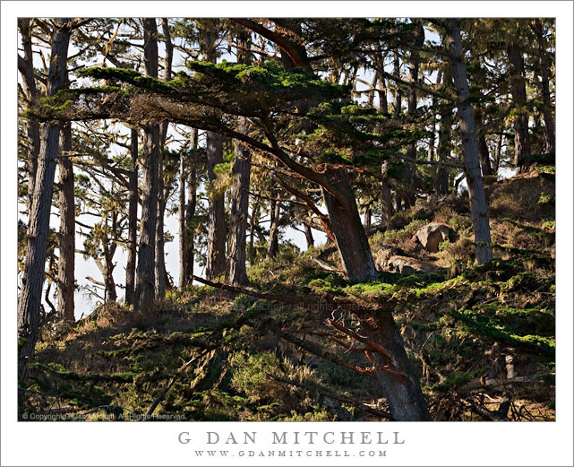
Monterey Cypress Forest, Point Lobos

Monterey Cypress Forest, Point Lobos

Monterey Cypress Forest, Point Lobos. Point Lobos State Reserve, California. January 8, 2011. © Copyright G Dan Mitchell – all rights reserved.

Winter light on the Monterey Pine forest growing on a hillside at Point Lobos State Reserve.

The photograph is the color version of the same scene that I recently posted in a black and white rendition. My initial reaction to the image, and the idea I had in the back of my mind when I photographed it, was that it would be black and white. I wanted to “abstract” the dense shapes and textures of the trees and ground plants and rocks, and I sometimes think that the intrinsically unreal quality of black and white can work for that. However, when I worked up the photograph in color I started to like it, too, though in a different way. At least in the small versions that I looked at on the screen, the color version creates a bit more separation among objects in the scene and seems to have a bit more depth. I guess I won’t know until I make prints!

I have often looked at the straight and upright trees on this rocky prominence as I walked past on a trail that passes by just beyond the left side of the frame. This formation sits between two coves at Point Lobos and rises to a high point (to the right of the photograph) before dropping abruptly to steep rocks and then the sea. From the trail you look up the slope toward the high point and through these trees. But I could never quite see a composition. On this winter day the light was a bit unusual. There was a bit of haze and mist in the air, though not a lot – if I stood with the sun at my back I could not really see it, but if I faced into the sun it was apparent. In any case, even though this was photographed during the harsh light midday time period, the light was softened at least a bit, but still a bit stark from side lighting, the shadows among the trees, and the bright and cloudy sky beyond. It is difficult to find a clear line of sight to this grove that isn’t either very, very far away or else right inside of it. I looked around for a bit and finally found a place not far away along the trail from which I could shoot between tree branches.

This photograph is not in the public domain and may not be used on websites, blogs, or in other media without advance permission from G Dan Mitchell.

G Dan Mitchell Photography
FlickrTwitter (follow me) | Facebook (“Like” my page) | LinkedInEmail

Text, photographs, and other media are © Copyright G Dan Mitchell (or others when indicated) and are not in the public domain and may not be used on websites, blogs, or in other media without advance permission from G Dan Mitchell.
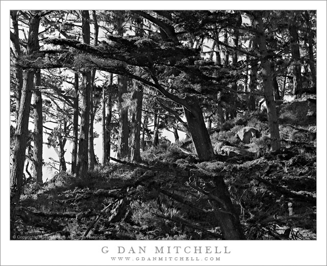

Monterey Cypress Forest, Point Lobos

Monterey Cypress Forest, Point Lobos

Monterey Cypress Forest, Point Lobos. Point Lobos State Reserve, California. January 8, 2011. © Copyright G Dan Mitchell – all rights reserved.

Winter light on the Monterey Cypress forest growing on a hillside at Point Lobos State Reserve.

This is perhaps an absurdly complex photograph – I think it is going to have to end up as a large print at some point. This is a section of Monterey Cypress forest that I’ve walked through many times on the trail along the north shore at Point Lobos State Reserve near Carmel, California. These trees grow along the tops of rocky bluffs above the ocean and in some sheltered places can grow tall and straight.

I made this photograph in what almost amounted to midday sun, though there were a few fog clouds floating around to mute the harshest character of the light a bit. But I knew that the photograph was going to be tricky. The first challenge was finding a location from which to shoot it – most angles are blocked by closer trees or are inaccessible. I finally found a spot along the trail where I could shoot between trees using a longer focal length. Then there was the problem of the light, or more accurately the dynamic range between the clouds and a bit of blue sky and the much darker backlit and shadowed trees in the foreground. Finally, it is just a very complex scene, and making any kind of coherent composition out of it was tricky. I don’t know yet whether it succeeds or not, but the idea was to use the angled division between the darker and very complex lower right side and the lighter upper left side with its vertical tree trunks, and to let the darker foreground tree connect it all together. That was the idea, anyway!

This photograph is not in the public domain and may not be used on websites, blogs, or in other media without advance permission from G Dan Mitchell.

G Dan Mitchell Photography
Flickr | Twitter | Facebook Fan Page | Facebook | Friendfeed | Email

Technical Data:
Canon EOS 5D Mark II (at B&H)
Canon EF 70-200mm f/4 L USM at 94mm (at B&H)
ISO 100, f/16, 1/40 second


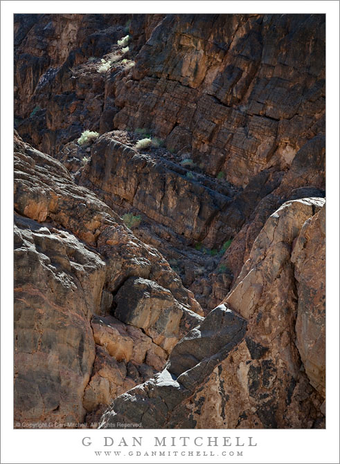
Rugged Terrain, Lower Titus Canyon

Rugged Terrain, Lower Titus Canyon

Rugged Terrain, Lower Titus Canyon. Death Valley National Park, California. March 28, 2010. © Copyright G Dan Mitchell – all rights reserved.

Details of the rugged cliffs and walls rising above lower Titus Canyon in Death Valley National Park.

Titus Canyon Road is one of the marvels of Death Valley National Park. It begins in high desert of Amargosa Valley near the town of Beatty and the ghost town of Rhyolite, winds over the summit of the Grapevine Mountains, drops precipitously into upper Titus Canyon, passes a number of historically interesting sites, passes through a very narrow and deep section in the lower canyon, and then suddenly emerges into the vastness of Death Valley.

In the lower section of the canyon, the wash becomes very narrow, passing through a twisty slot canyon and is, in places, barely wide enough for the one-lane gravel road. Here the walls of the canyon press tightly together and rise steeply for hundreds of feet. Some places are so deep that the sun rarely penetrates to the bottom.

Fortunately for the preservation of the canyon the road is horrible, at least if you are used to more civilized driving. It is a one-way road and the whole thing is gravel. Sections are in decent shape, but it other places the road passes over narrow and twisty sections next to precipitous drop-offs and then dives steeply into deep canyons. At times the route is closed after heavy rains or other conditions that make the route impassable.

Fortunately, the section that is perhaps the most impressive in many ways – the deep slot canyon near the bottom – is easily accessible by foot from Death Valley. After a short drive up to the canyon entrance on a gravel road to a parking area, you can enter the canyon on foot and walk up as far as you want. This photograph was made within the lower mile of the canyon during the late morning, when the light penetrates more deeply into the canyon and creates a glow on the canyon walls.

G Dan Mitchell Photography
About | Flickr | Twitter | Facebook | Google+ | 500px.com | LinkedIn | Email

Text, photographs, and other media are © Copyright G Dan Mitchell (or others when indicated) and are not in the public domain and may not be used on websites, blogs, or in other media without advance permission from G Dan Mitchell.

(Basic EXIF data may be available by “mousing over” large images in posts. Leave a comment if you want to know more.)


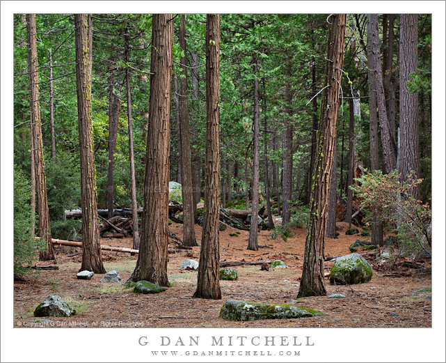
Forest, Upper Yosemite Valley

Forest, Upper Yosemite Valley

Forest, Upper Yosemite Valley. Yosemite National Park, California. October 30, 2010. © Copyright G Dan Mitchell – all rights reserved.

Trees recede into the distance in a quiet forest in the upper section of Yosemite Valley.

Late in the afternoon, after the light rain had mostly ended, I stopped to try to photograph some dogwood trees that were getting their fall colors. I started by looking at some trees very close to the road, but then saw more interesting trees a bit further into the grove so I wandered a bit farther from the road. Soon I saw a couple of trails leading into more open areas near the river, so I kept walking. This led to a trail that headed up the Valley – I followed it and soon crossed the Merced River. Continuing on (and now well beyond the grove that I originally stopped to photograph!) I crossed again on a second bridge and soon noticed an interesting section of more open forest off to one side. As I wandered down into this area I saw that there were quite a few rocks along the otherwise level forest floor here, and after making a couple of initial shots I also saw that nearby the level forest floor began to give way to more hilly and rounded terrain with occasional boulders and small rocky hills. I left the trail and began to walk about slowly, just watching for interesting arrangements of trees, colorful leaves, and places where the light glowed through the forest canopy.

When I stopped to make this photograph (and several other exposures in the same spot) I was attracted by the relatively open forest through which I could see the vertical forms of the trees receding, and by the interesting arrangement of the foreground trees. The soft forest light on this cloudy afternoon also gave the leaves and needles a luminous quality.

This photograph is not in the public domain and may not be used on websites, blogs, or in other media without advance permission from G Dan Mitchell.
G Dan Mitchell Photography
Flickr | Twitter | Facebook Fan Page | Facebook | Friendfeed | Email