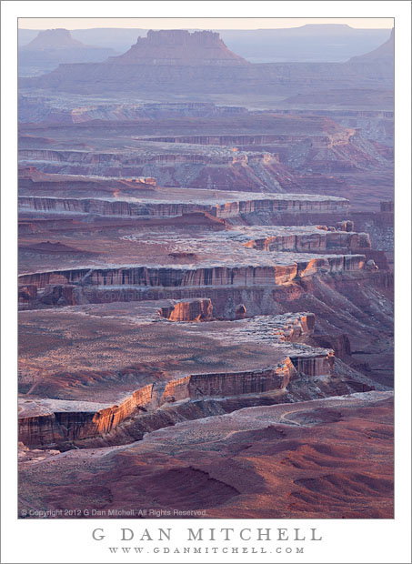
White Rim, Evening. Canyonlands National Park, Utah. April 6, 2012. © Copyright 2012 G Dan Mitchell – all rights reserved.
Evening light on the white rim landscape of the Stillwater Canyon area of the Green River, Canyonlands National Park, Utah.
This was an evening of very special light in the Canyonlands, or so it seemed to me. I love soft, hazy conditions and perhaps prefer them to super clear and sharp conditions in many cases. So I had not been at all disappointed earlier in the day to see that the rugged canyons below the “island in the sky” section of Canyonlands were obscured by dust that had been stirred up by very windy conditions. We visited this spot earlier in the day and I identified it as one of several places I thought I might want to photograph at the end of the day, even though the atmosphere looked almost “murky” during the earlier visit. I knew that the edges of the upper cliffs of canyons, for example along the White Rim, could well be nicely lit in the evening light. So as we wandered around other nearby areas, looking for other shooting prospects, I became more and more certain that this is where I wanted to end up.
When we came back here a bit before actual sunset, it was cold and rather windy. The wind had been an issue though out my photography here and at Arches, and I was getting used to timing my shots for the lulls between gusts. I put on warm clothes and wandered out to the edge of the cliffs, where I found a small number of other photographers as well. Earlier I had not only decided on shooting here, but I had also scoped out a couple of likely compositions. One (which I posted earlier) was a horizontal composition that included the bottom of the canyon that would be out of this picture and to the right – a deep canyon that was carved by the Green River and its tributaries. The other was this vertical composition, that angled across the tops of a row of flat areas along the White Rim where canyons alternated with the flat surfaces above with more distant mesas and more mountains beyond. The atmosphere did something that it can often do when the air is hazy – it gradually changed from having a low contrast and filmy appearance with lots of golden tones and began to become more transparent as the light lowered and came in at a lower and lower angle. Here, very close to when the sun dipped below the horizon, the very low angle light strikes the west-facing cliffs and skims across the tops of the low hills in the foreground and on top of the mesa-like formations beyond.
G Dan Mitchell is a California photographer whose subjects include the Pacific coast, redwood forests, central California oak/grasslands, the Sierra Nevada, California deserts, urban landscapes, night photography, and more.
Blog | About | Flickr | Twitter | Facebook | Google+ | 500px.com | LinkedIn | Email
Text, photographs, and other media are © Copyright G Dan Mitchell (or others when indicated) and are not in the public domain and may not be used on websites, blogs, or in other media without advance permission from G Dan Mitchell.

