Tag Archives: crane

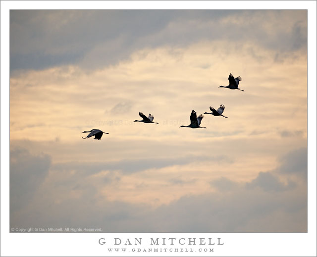
Sandhill Cranes in Flight, Evening

Sandhill Cranes in Flight, Evening

Sandhill Cranes in Flight, Evening. Merced National Wildlife Area, California. February 21, 2011. © Copyright G Dan Mitchell – all rights reserved.

Five sandhill cranes take flight above the Merced National Wildlife Area in evening light.

Migratory birds have always been a subject that I’ve been aware of, but that I haven’t really paid enough attention to. Intellectually I know of their amazing travels between arctic and more temperate regions and I had heard about their appearance in California each winter season. I recall one magical evening a few years back when I began a long drive from the San Francisco Bay Area to Seattle late on a winter day, and as I travelled up the Sacramento Valley at twilight I saw huge flocks of birds and thought that I’d like to try to photograph this scene. I’ve seen and photographed a few interesting birds such as egrets and pelicans. But I somehow managed to mostly remain uninformed about their presence not far from where I live.

This season several things came together, seemingly by chance, to encourage me to actually make the effort to get out into California’s Great Central Valley to see (and hear!) the birds. The first was a chance meeting with one of my colleagues in front of the college espresso stand one morning. We were having a casual conversation and she mentioned that she had been out in the Cosumnes River area looking for birds recently. We talked a bit more and I asked her for more information. Being a librarian, she provided me with lots of information, including details of how to find some interesting places out there. A day or two later I found my way out to that part of the Valley and saw, for the first time close-up, the flocks of winter birds… and I was hooked. Within a few weeks I saw posts on the Chuq 3.0 blog where Chuq wrote about his photography of these birds. Then I saw a couple videos at Michael Frye’s blog that captured the “fly in” and “fly out” phases at the Merced National Wildlife Area. (This place is located out on a road that has to have my all-time favorite Central Valley road name: Sandy Mush Road ;-)

Fast forward a week or two and I was returning from shooting for four days in Death Valley, and driving into the Central Valley near Bakersfield. I looked at my watch and realized that I could probably make a small detour and be at the Merced National Wildlife Area before sunset. So I headed up highway 99 (rather than the more usual route up highway 5), found the turn off to Sandy Mush Road, and arrived at the area an hour or so before sunset on an evening when the clouds from a departing cold front lingered. I basically had no idea where I was going, since I had done literally no prior research other than finding the location via my iPhone. As I arrived in the general area I found a large field filled with what seemed like several hundred sandhill cranes. Slowly and quietly I stopped my car and got out on the side away from the birds and began to watch. I never did get to see the fly-in up close (though I could see a huge cloud of birds landing at a pond north of my position) but some of these cranes did depart from time to time, and I was able to photograph this group of the magnificent birds against the clouds in the western sky.

G Dan Mitchell Photography | Flickr | Twitter | Facebook | Email
Text, photographs, and other media are © Copyright G Dan Mitchell (or others when indicated) and are not in the public domain and may not be used on websites, blogs, or in other media without advance permission from G Dan Mitchell.

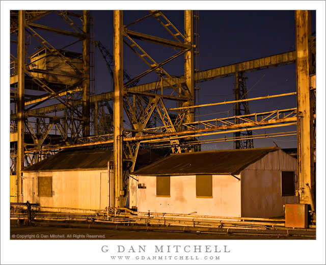
Shacks and Ship Yard Structures

Shacks and Ship Yard Structures

Shacks and Ship Yard Structures. Mare Island Naval Ship Yard, California. February 12, 2011. © Copyright G Dan Mitchell – all rights reserved.

Shacks, trestles, pipes and other shipyard structures against a night sky – Mare Island Naval Ship Yard.

Several years ago I shot more or less this scene and created a black and white photograph from it, and since then I’ve been thinking of trying to work with the scene again. I’ve been back, but ended up not shooting it for a variety of reasons, including a tall fence that now blocks the view a bit. On another occasion I decided not to shoot it since there was no moon… and the original photograph was done in full moon light. (“It wouldn’t look like my other photograph.” What a silly reason to not shoot it!)

This time I wandered over to this area to shoot a different subject, the companion structure that sits just north of this one. (Both support large overhead “tracks” along which some sort of machinery was able to lift and move large things like ship engines from the shop to the waterfront.) With my tripod cranked up to a foot or so above my head, the camera could “see” over the fence, so I decided to go ahead and shoot this subject again.

Technically, there are a few challenges in the shot. The bright light is very close to the first building and it ends up being very bright and the light is a very saturated yellow color – so that limits the maximum exposure. At the same time, there are some deeply shadowed areas in the structure that you can probably spot – come of the areas under parts of the tower for example. In addition, the city of Vallejo lies beyond this facility – you can see a bit of the glow from its lights in the distance – and some of the city lights would be directly visible if I wasn’t careful with camera placement.

I’m intrigued by several things about this subject. As a decommissioned ship yard, it is interesting to think about what it must have been like here in the past when all of this was in use. (Mare Island’s history goes well back into the 1800’s when it was the first west coast naval ship yard.) I also marvel at the “stuff” that I see that I can’t understand at all. I have no idea what many of those pipes were for or even what must have gone on in these little buildings. And the weathered, rusted, decaying character of the structure itself is interesting to me.

G Dan Mitchell Photography | Flickr | Twitter | Facebook | Email
Text, photographs, and other media are © Copyright G Dan Mitchell (or others when indicated) and are not in the public domain and may not be used on websites, blogs, or in other media without advance permission from G Dan Mitchell.
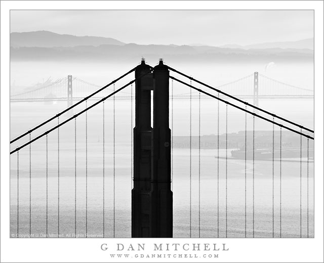
Golden Gate and Bay Bridges, Morning Haze

Golden Gate and Bay Bridges, Morning Haze

Golden Gate and Bay Bridges, Morning Haze. San Francisco Bay, California. February 5, 2011. © Copyright G Dan Mitchell – all rights reserved.

Black and white photograph of Golden Gate Bridge north tower, the San Francisco-Oakland Bay Bridge, and the East Bay Hills in morning haze.

I sometimes enjoy playing the juxtaposition game, going up into the Marin Headlands and using a long lens to juxtapose elements of the Golden Gate Bridge with other elements of the landscape, human and natural, of San Francisco Bay. One of the most iconic examples of such photographs is the one that many have shot (including me!) that centers the tip of the Transamerica building within a frame formed by the north tower of the bridge. But there are many other possibilities that might be at least as interesting, and which may depend more on the changing and often very interesting conditions of atmosphere and light over the bay.

This photograph was made from a point very close to that from which the Transamerica building photograph can be made, but a bit higher on the road up into the headlands. When I arrived just before dawn in the general area there were quite a few other photographers who I presume were there to photograph the dawn scene. (This is a difficult task, as it requires you to shoot essentially directly into the sun if you want San Francisco in your shot.) I was surprised when essentially all of the other photographers packed up and left a few minutes after the sun came up! (In their defense, it was windy up there – so windy that it made shooting with a long lens quite a challenge!) The sunrise wasn’t all that amazing, at least not if you know this area pretty well. But the low haze/fog over the east bay hills and some overhead clouds filtering the light a bit created the potential for some interesting and moody light – at least if I used a long lens to isolate small sections of the scene.

I’m almost a bit embarrassed to admit that I picked my first shooting location not based on the scene but rather on trying to avoid the wind! I went up the road to a spot where I could shoot in the lee of a hill side. After getting that out of my system, I went the other way and entered a very windy area along the road below the parking lot. I eventually found a spot that lined up the two great bridges of San Francisco Bay – the north tower of the Golden Gate Bridge in the foreground and two towers and a central span of the San Francisco-Oakland Bay Bridge in the distance, both backed by that low fog and haze and beyond the East Bay Hills.

G Dan Mitchell Photography | Flickr | Twitter | Facebook | Email
Text, photographs, and other media are © Copyright G Dan Mitchell (or others when indicated) and are not in the public domain and may not be used on websites, blogs, or in other media without advance permission from G Dan Mitchell.
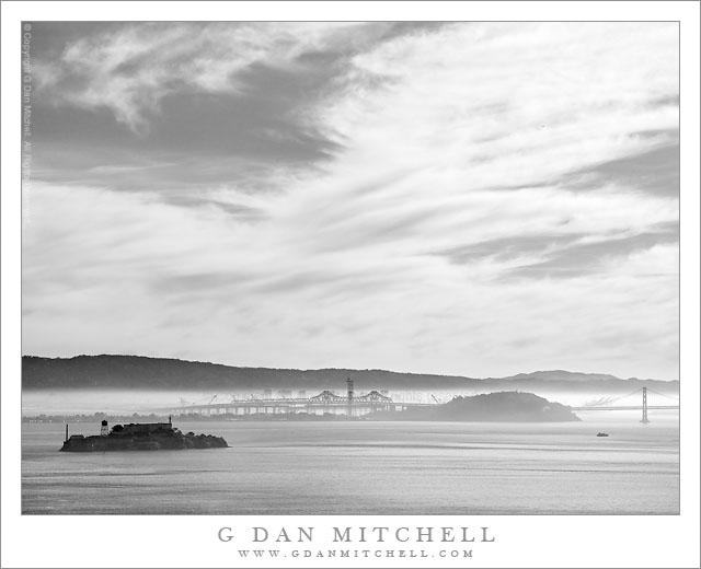
Alcatraz, Treasure Island, East Bay Hills

Alcatraz, Treasure Island, East Bay Hills

Alcatraz, Treasure Island, East Bay Hills. San Francisco Bay, California. February 5, 2011. © Copyright G Dan Mitchell – all rights reserved.

Black and white photograph of San Francisco Bay with Alcatraz, Treasure Island, and the East Bay Hills beneath a morning winter sky.

On this early February day the rough plan was to head up across the Golden Gate Bridge before dawn, shoot a bit from high in the Marin Headlands as the sun rose, and then continue on to most likely shoot at Muir Woods. However, I ended up spending at least two hours shooting from the headlands, and by the time I finished I knew that the tourist hordes would be arriving at Muir Woods, so I only did a bit of additional shooting from the hills before heading back home.

This photograph was made just before I left the Marin Headlands, near the last turn before the road crosses highway 101 near the Golden Gate. It is a familiar location and I’ve photographed from here many times in the past. I don’t always stop, but if something is a bit special or unusual about the conditions I will. That was the case today as someone unusual weather conditions had left the bay mostly clear, but with a thin layer of fog over Oakland and other areas along the east side of the San Francisco Bay – and impressive high clouds were floating above. Alcatraz Island is at the left, Treasure Island and the San Francisco-Oakland Bay Bridge are in the center, and beyond that the tops of buildings in downtown Oakland are visible against the backdrop of the East Bay hills.

G Dan Mitchell Photography | Flickr | Twitter | Facebook | Email
Text, photographs, and other media are © Copyright G Dan Mitchell (or others when indicated) and are not in the public domain and may not be used on websites, blogs, or in other media without advance permission from G Dan Mitchell.