Tag Archives: craters

Aspens, Eastern Sierra, Earth Shadow

Aspens, Eastern Sierra, Earth Shadow
A grove of aspens with early season color, the eastern escarpment of the Sierra Nevada, and the predawn earth shadow in the sky

Aspens, Eastern Sierra, Earth Shadow. © Copyright 2019 G Dan Mitchell – all rights reserved.

A grove of aspens with early season color, the eastern escarpment of the Sierra Nevada, and the predawn earth shadow in the sky.

Long before I understood what I was seeing I had noticed and was intrigued by that band of darker sky just above the horizon during the morning and evening twilight, very close to the time that direct sunlight appears on the highest points. There is something very mysterious about it, and it suggests to me great distances beyond those encompassed by the immediate scene. Eventually I learned what now seems obvious — this is the edge of the shadow of the earth, dropping away in the moments before dawn and rising in the moments following sunset. (To this day, every time I think of this, I recall photographer Gary Crabbe’s “interpretive dance” as he explained this at a talk I attended years ago — one hand extended out and upwards pointing to the shadow, and the other extended at a slight downward angle pointing to the unseen sun. Thanks, Gary!)

I made this photograph from a high point east of the Sierra crest one September. I headed out this way in pre-dawn darkness not sure what I would find. I was pleasantly surprised to find extensive aspen color, even though it was just past mid-September, and then to find an open overlook from which I could take in a large section of the Sierra as dawn arrived.


G Dan Mitchell is a California photographer and visual opportunist. His book, “California’s Fall Color: A Photographer’s Guide to Autumn in the Sierra” is available from Heyday Books and Amazon.

Blog | About | Flickr | FacebookEmail

Links to Articles, Sales and Licensing, my Sierra Nevada Fall Color book, Contact Information.


All media © Copyright G Dan Mitchell and others as indicated. Any use requires advance permission from G Dan Mitchell.

Lee Vining Canyon and Mono Craters, Morning

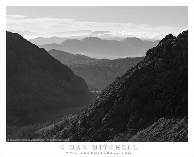
Lee Vining Canyon and Mono Craters, Morning - Morning clouds and haze over Mono Craters, as seen from the upper elevation of Lee Vining Canyon.
Morning clouds and haze over Mono Craters, as seen from the upper elevation of Lee Vining Canyon.

Lee Vining Canyon and Mono Craters, Morning. Eastern Sierra Nevada, California. July 14, 2012. © Copyright 2012 G Dan Mitchell – all rights reserved.

Morning clouds and haze over Mono Craters, as seen from the upper elevation of Lee Vining Canyon.

East of Tioga Pass, highway 120 (a.k.a. “Tioga Pass Road”) descends relatively gently past Tioga Lake and then Ellery Lake before it drop precipitously down the eastern escarpment of the Sierra Nevada through Lee Vining Canyon on its way to the junction with highway 395 just south of the town of Lee Vining. I’ve driven over it for years, going back and forth between my home in the San Francisco Bay Area and the east side of the Sierra, so I should be fairly nonchalant about it by now – but every so often as I pass over the route (most often looking down into the canyon from above) I wonder whatever possessed people to think that it would be a good idea to route a road across the talus fields and across the steep headway of this canyon.

During last week’s photographic trip to the Tuolumne Meadows area of Yosemite National Park I went over the pass twice. The first time was to scout out some possible shooting locations around Mono Lake – OK, and to get an espresso at Latte Da in Lee Vining – and the second was the following morning when I returned to shoot one of these locations. The night before I had moved my camp to Ellery Lake (it is a long story), which put me a bit closer to Mono Lake, so I was up well before dawn and at the lake before sunrise. After photographing my primary subject there right at dawn, I stuck around long enough to photograph the early morning light and haze above the lake, then headed back to break up my camp before heading home. As I crossed that headwall high up above Lee Vining Canyon, I looked east toward the Mono Craters. Looking that way is pretty much a habit, but I rarely find it to present anything that I want to photograph. This morning was different. I quickly found a turn-out and drove back to this spot. A nice haze filled the air (I like atmospheric haze for photography!), a few clouds clustered around ridges just beyond the volcanic Mono Craters, and a high line of clouds from monsoonal flow were in the far distance, with the steep walls of Lee Vining Canyon backlit and almost seen entirely in silhouette.

G Dan Mitchell is a California photographer whose subjects include the Pacific coast, redwood forests, central California oak/grasslands, the Sierra Nevada, California deserts, urban landscapes, night photography, and more.
Blog | About | Flickr | Twitter | FacebookGoogle+ | 500px.com | LinkedIn | Email

Text, photographs, and other media are © Copyright G Dan Mitchell (or others when indicated) and are not in the public domain and may not be used on websites, blogs, or in other media without advance permission from G Dan Mitchell.
Mono Lake, Thunderstorm

Mono Lake, Thunderstorm

Mono Lake, Thunderstorm. Mono Lake, California. July 23, 2007.© Copyright 2007 G Dan Mitchell – all rights reserved.

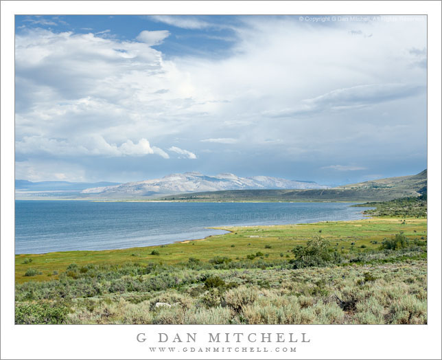
Eastern Sierra Nevada thunderstorms build over Mono Lake, Mono Craters, and Lee Vining, California.

Mono Lake can be an unforgiving place in which to try to make photographs during the day, but sometimes one gets lucky! It is a wonderful place, but if you only know it from photographs – which, of course, tend to be made at the most appealing times – you might not know that it is often hot and hazy and dry during the day. These are among the reasons that it is a place often photographed at dawn or at sunset on days when the clouds are interesting. (The latter poses its own set of problems, since the Sierra Nevada range begins to block the light well before actual sunset.)

But I did get lucky on this late July afternoon. It was thunderstorm weather, so there were some very impressive clouds floating around. However, the clouds did not completely fill the sky, so patches of light were moving across the landscape – in this photograph one illuminates the green area at far right along the shore and, more importantly, the Mono Craters beyond the far shore of the lake. And the vegetation around the lake was still green, or at least green enough to look alive in this light.

G Dan Mitchell Photography
About | Flickr | Twitter | FacebookGoogle+ | 500px.com | LinkedIn | Email

Text, photographs, and other media are © Copyright G Dan Mitchell (or others when indicated) and are not in the public domain and may not be used on websites, blogs, or in other media without advance permission from G Dan Mitchell.

(Basic EXIF data may be available by “mousing over” large images in posts when this page is viewed on the web. Leave a comment if you want to know more.)

Volcanic Ridge, First Light

Volcanic Ridge, First Light

Volcanic Ridge, First Light. Mono County, California. © Copyright G Dan Mitchell – all rights reserved.

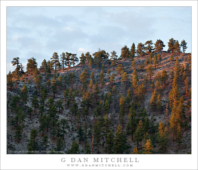
Dawn light illuminates the Jeffrey pine covered ridge of a volcanic dome in the Mono Craters complex, California.

I have a favorite personal spot where I often stop on my way to photograph at South Tufa at Mono Lake. It is spot that you would likely pass right by since, save for a bit of a panoramic view, there is nothing immediately impressive about it, and because you would probably be on your way to someplace else, namely the formations at South Tufa.

On this late June morning I took a break from photographing in the Tuolumne/Tioga Pass area to shoot a bit around Mono Lake, where I had it in mind to shoot certain high desert subjects that I’ve worked on in the past. As I shot those other subjects I’ve often looked up at this particular ridge, been impressed by it, and wondered how to make a photograph of it. When I pulled up at this spot I first intended to shoot a scene that appears to the west, but it turned out to not be quite what I imagined it might be on this morning. Ah, well – that happens! So I turned my camera in a different direction and photographed a somewhat different subject as dawn approached with some very interesting clouds in the sky to the east. As I worked on this I kept glancing up at this volcanic ridge, thinking that the clouds behind it might silhouette the trees along the skyline… but still finding the light too flat and boring. I actually made a photo or two, but wasn’t enthusiastic about it. I turned back to the other subject. A few minutes later I looked back up at this ridge and saw that the first light of early morning sun was glancing across the ridge and lighting up the Jeffrey pines that grow on its slopes. I quickly pivoted around and made a few exposures of the scene in the “good light.”

This photograph is not in the public domain and may not be used on websites, blogs, or in other media without advance permission from G Dan Mitchell.
G Dan Mitchell Photography | Twitter | Friendfeed | Facebook | Facebook Fan Page | Email

Technical Data:
Canon EOS 5D Mark II
Canon EF 70-200mm f/4 L USM at 168mm
ISO 100, f/8, 1/15 second

keywords: jeffrey, pine, forest, mono, county, craters, northwest, coullee, upper, dome, ridge, skyline, dawn, light, morning, early, sky, clouds, cinder, pumice, rhyolite, scree, rock, volcanic, geology, landscape, scenic, travel, california, usa, north america, mountain, hill, stock