Tag Archives: peaks

Peak and Tarn, Sunrise

Peak and Tarn, Sunrise, Sequoia National Park
“Peak and Tarn, Sunrise” — The first dawn light touches Sierra Nevada peaks and is reflected in a rock-studded sub-alpine tarn

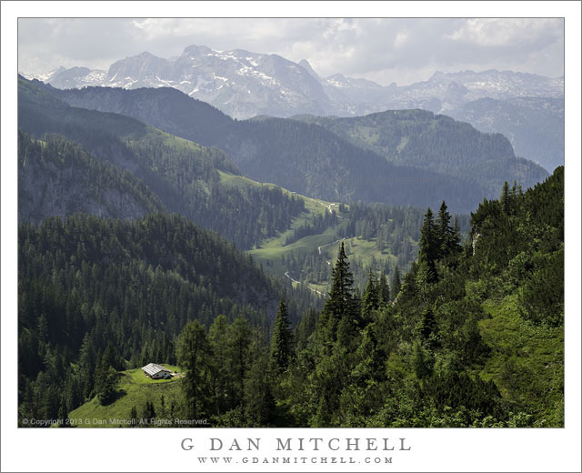
This month a group of us spent nine days in the Sierra Nevada back-country in Kings Canyon National Park, remaining in a single location for six nights. For a photographer, this is a special opportunity to really begin to “get inside” a small area, with time to wander thoughtfully among the features of the landscape at all hours of the day and in a range of conditions, returning more than once to revisit subjects in varying conditions. Up each morning before dawn, we would wander off in different directions to pursue whatever interested us and to find whatever we could find, return to camp during midday hours, and then wander off again in the late afternoon, usually not returning until dark. So often when we visit such places we either look from a distance or hurry through trying “not to miss anything” – but on this visit we had time to get to know individual lakes, rocks, trees, ledges, you name it.

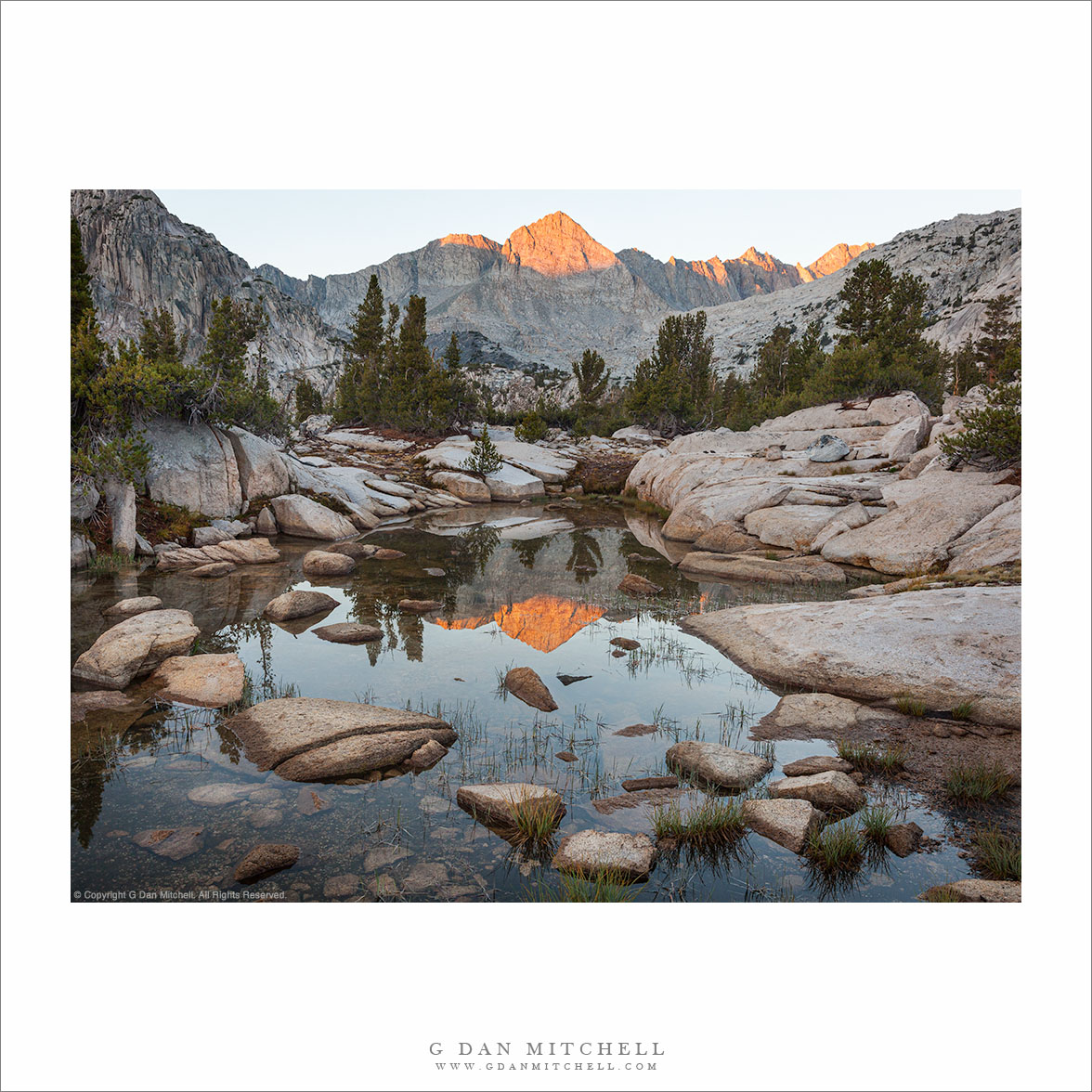
Perhaps 10 minutes away from our camp was a broad valley filled with lakes and tarns and rocky meadows. I think I visited here at least four times, morning and evening. I had already explored the area a bit on an earlier evening when I arrived on this morning before the first light hit the peaks on the divide between the 60 Lakes Basin and Gardiner Basin, so I knew that there were many opportunities to juxtapose the waters of the quiet, cold, rock-filled tarns with the high peaks and first light.

G Dan Mitchell is a California photographer and visual opportunist. His book, “California’s Fall Color: A Photographer’s Guide to Autumn in the Sierra” from Heyday Books, is available directly from G Dan Mitchell.

Blog | Bluesky | Mastodon | Substack Notes | Flickr | Email
Articles | Sales | Sierra Nevada Fall Color | Contact Info

All media © Copyright G Dan Mitchell and others as indicated. Any use requires advance permission from G Dan Mitchell.

Alpine Valley, Bavaria

Alpine Valley, Bavaria

Alpine Valley, Bavaria. Near Königssee, Germany. July 18, 2013. © Copyright 2013 G Dan Mitchell – all rights reserved.

Sun dappled alpine scenery in the Bavarian Alps above Königssee, Germany

We have been traveling. After a week in London, we spent two weeks in Germany, one of which was in the Königssee area of Bavaria, Germany, where we stayed in an old farm-house. I’ll have more to say about this trip as I post more photographs over the coming days and weeks, both landscape and distinctly urban photographs. But for now, something from the Bavarian Alps.

As some of you know, I’m a long-time “Sierra Nevada guy,” who is very accustomed to hiking long distances in somewhat undeveloped areas in order to do photography. The landscape here is no less spectacular, but the experience is in many ways quite different. Take this day’s hike for example… It began with a ride on the Jennerbahn (ski lift) up to a point high up in the mountains, with scenery that reminded me in some ways of parts of “my” Sierra, but even more of some places I have visited in the Pacific Northwest. From there we hiked downhill for a kilometers, first across the top of a high ridge and then dropping down into a beautiful alpine Valley – complete with the Mahlerian sound of a chorus of cowbells. Halfway down we stopped for (fellow Sierrans, eat your heart out!) a lunch of bier und käsebrot before continuing on down to where we began at the base of the lift. The light in this part of Bavaria, at least during our visit, was very different from the clarity that I often seen in the Sierra – here the atmosphere was often thick with moisture, creating a soft quality. On this day, this was enhanced to a gradual build-up of thunderclouds that led to a spectacular evening lightning show, which we enjoyed outdoors at a picnic table back at our lodgings.

G Dan Mitchell is a California photographer and visual opportunist whose subjects include the Pacific coast, redwood forests, central California oak/grasslands, the Sierra Nevada, California deserts, urban landscapes, night photography, and more.
Blog | About | Flickr | Twitter | FacebookGoogle+ | 500px.com | LinkedIn | Email

Text, photographs, and other media are © Copyright G Dan Mitchell (or others when indicated) and are not in the public domain and may not be used on websites, blogs, or in other media without advance permission from G Dan Mitchell.

Melting Ice and Sunrise Reflection, Tioga Lake

Melting Ice and Sunrise Reflection, Tioga Lake

Melting Ice and Sunrise Reflection, Tioga Lake. Tioga Pass, California. June 19, 2011. © Copyright G Dan Mitchell – all rights reserved.

Dawn light on the peaks of Kuna Crest is reflected in a meltwater channel in the frozen surface of Tioga Lake at Tioga Pass.

On the weekend that Tioga Pass opened this year, I spent the “opening day” photographing along highway 120 in the park. That night I stayed in Aspen Camp in Lee Vining Canyon, a standby for me at almost all times of year when I photograph in the area and Tuolumne Meadows campground is not open. (That NPS campground typically opens a few weeks after the pass opens and then closes in late September.) The next morning I was up fairly early, planning to photograph more or less in the Tenaya Lake area a bit after sunrise. I drove up toward the pass and soon came to Tioga Lake, which lies next to the road just below the pass.

I had noticed the striking veined patterns formed by the melting ice the previous day but had not photographed them. When I saw them in the morning I spontaneously decided to stop and see what I could do with the subject, especially since it looked like the ice was starting to pick up a bit of color from the pre-dawn light. I quickly got out and set up and found a way to line up the melted channel in the icy surface with the peaks of the distant Kuna Crest inside the park. As the light began to strike this ridge its color reflected on the frozen lake and I made a few photographs before moving on.

G Dan Mitchell Photography | Flickr | Twitter (follow me) | Facebook (“Like” my page) | LinkedIn | Email
Text, photographs, and other media are © Copyright G Dan Mitchell (or others when indicated) and are not in the public domain and may not be used on websites, blogs, or in other media without advance permission from G Dan Mitchell.

From the Panamints to the Sierra, Evening

From the Panamints to the Sierra, Evening

From the Panamints to the Sierra, Evening. Death Valley National Park, California. March 30, 2011. © Copyright G Dan Mitchell – all rights reserved.

The Sierra Nevada in evening light as seen from Aguereberry Point in Death Valley National Park’s Panamint Range.

I made this photograph from Aguereberry Point shortly before sunset. Aguereberry Point is a lonely prominence over 6000′ above Death Valley, high in the Panamint Mountain range, a place of astonishing panoramic views – and often some significant winds. As I drove the gravel road to the point late in the afternoon I saw three or four other vehicles heading the other direction, but when I arrived at the point a bit more than an hour before sunset no one else was there.

Having photographed here a few times previously, I am becoming more familiar with the challenges and the opportunities of shooting here. One of the challenges – as is the case in many spots in Death Valley – is that certain subjects seem to be “photographable” at very specific times and only for short intervals. One of the most interesting views from Aguereberry is southeast down into Trail Canyon and on to the lower slopes of Wildrose Peak beyond. This is wild, rugged, austere terrain. However, because it lies on the east side of this range the light changes quickly from a washed out blast of daytime sun to sudden deep shadows as the sun drops behind the higher ridges of the Panamints. (Trail Canyon is not seen in this photograph.)

Another challenge is that, impressive and overwhelming as the scale of this grand scene is, it can be difficult to pull interesting compositions out of it. I tend to work with longer lenses here, both to isolate smaller areas out of the huge landscape and to compress distance. In this photograph, the silhouetted crest of the highest part of the Sierra Nevada range is on the horizon, with the intervening ridges of the Panamint Range and others probably including the Inyo Mountains and the ridge just west of Panamint Valley.

And, since I tend towards those large and long lenses… wind is an issue! And on top of Aguereberry Point there is nothing to stop the often strong winds of Death Valley. On this evening the winds were howling, so I found a spot below some rocks where it was a bit less windy and then spent a lot time waiting for momentary lulls in the wind when I could make photographs.

G Dan Mitchell Photography | Flickr | Twitter | Facebook | Email
Text, photographs, and other media are © Copyright G Dan Mitchell (or others when indicated) and are not in the public domain and may not be used on websites, blogs, or in other media without advance permission from G Dan Mitchell.