
Tag Archives: usa

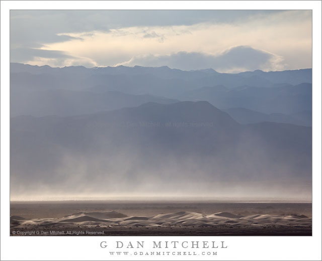
Dunes, Cottonwood Mountains, and Dust Storm

Dunes, Cottonwood Mountains, and Dust Storm

Dunes, Cottonwood Mountains, and Dust Storm. Death Valley National Park, California. February 19, 2011. © Copyright G Dan Mitchell – all rights reserved.

Afternoon winds whip up a dust storm over Death Valley between sand dunes and the high ridges of the Cottonwood Mountains.

Following my typical routine of “get up ridiculously early and shoot until I can’t stand it any longer, hang out during the middle of the day, and then head out for late afternoon and evening shooting,” I had been watching some interesting clouds developing far to the north of Stovepipe Wells during the day and decided that I might head up that way in the evening if they continued to hold promise. After crossing the Valley to the Scotty’s Castle road junction I could see a curtain of virga falling from those clouds to the north, so I decided to head that way.

The wind had been picking up from the south during the afternoon as another weather front approached. As I headed up along the edge of the main valley I could see that this wind was starting to pick up dust and sand from the Mesquite Dunes area near Stovepipe and from areas just north of that. I’m more familiar with the dust being carried south by winds out of the north, so this was a bit of a different site as sand/dust were being picked up from the dunes rather than being deposited there.

The dunes at the bottom of this photograph are not the familiar “main” dunes near Stovepipe, but are instead smaller dunes running north/south up the Valley. While a larger version of the photograph shows some blowing dust on these foreground dunes, the main cloud is coming from further south down the Valley. Beyond the dust and across the Valley are the hills of the Cottonwood range ascending to a ridge that still holds a bit of snow from storms over the previous couple of days, with building clouds above that would bring another dusting on this evening.

G Dan Mitchell Photography | Flickr | Twitter | Facebook | Email
Text, photographs, and other media are © Copyright G Dan Mitchell (or others when indicated) and are not in the public domain and may not be used on websites, blogs, or in other media without advance permission from G Dan Mitchell.
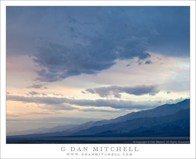
Winter Evening Sky, Panamint Range, Death Valley

Winter Evening Sky, Panamint Range, Death Valley

Winter Evening Sky, Panamint Range, Death Valley. Death Valley National Park, California. February 18, 2011. © Copyright G Dan Mitchell – all rights reserved.

Winter clouds fill the evening sky above the eastern slopes of the Panamint Range in Death Valley National Park.

After the long drive from the San Francisco Bay Area I arrived at Stovepipe Wells in Death Valley and set up my camp in the mid afternoon and hung out a bit, thinking about the prospects of late afternoon and evening shooting. Because a weather front was coming in (the forecast called for a chance of rain in the Valley and pretty much certain light snow over the passes) the clouds were increasing, in many directions heading past the point of “picturesque” and more towards “socked in.” I was hoping for some evening light – or early rain? – but it seemed less promising as evening approached. In circumstances like these I may come up with a few possible shooting alternatives ahead of time, watch as conditions develop, and make a last-minute decision about where to go based on observations and hunches.

So, late in the afternoon I stopped near Death Valley Dunes and worked to line up some long shots that filled the background of the dunes with the rugged shapes of the Grapevine Mountains, and then headed towards the junction with the road to Scotty’s Castle to try to figure out if the light held more promise to the north or the south. It didn’t look totally promising in either direction, but I thought that I might be able to make something out of the haze to the south as the ridges on both sides of the Valley receded, especially if a bit of glow in the sky turned up right at sunset. So, south it was.

I drove just a little ways in that direction to a point where the road curves a bit towards the east to travel around the northernmost area of salt flats in what I think of as the lower valley – this is the area a bit south of the Salt Creek cutoff. From here there is a fairly open view all the way down to the end of the Valley, and it looked like the clouds were going to evolve in some interesting ways. It didn’t look like I would see a gaudy, brilliantly colorful sunset, but something more subtle and quiet looked like it might happen. As the light began to fade I made a series of photographs whose subject was largely the sky and the atmospheric recession along the Panamint Range (shown here) on the west side of the Valley and the mountains just beyond Furnace Creek.

G Dan Mitchell Photography | Flickr | Twitter | Facebook | Email
Text, photographs, and other media are © Copyright G Dan Mitchell (or others when indicated) and are not in the public domain and may not be used on websites, blogs, or in other media without advance permission from G Dan Mitchell.
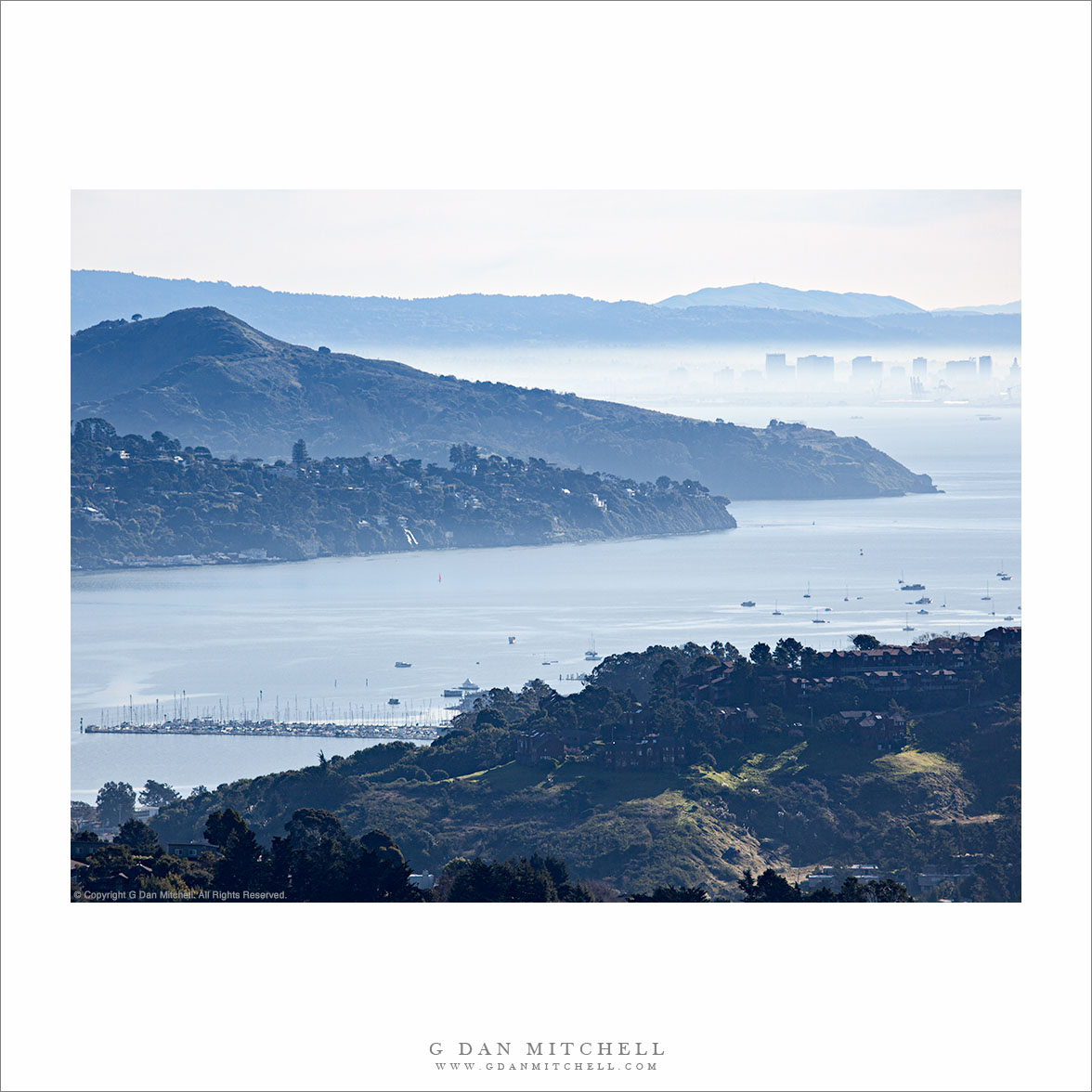
Richardson Bay, Morning

Richardson Bay, Morning
“Richardson Bay, Morning” — Photograph of Richardson Bay from Marin hills, showing Tiburon Peninsula, Angel Island, downtown Oakland, East Bay Hills, and Mount Diablo in the distance.

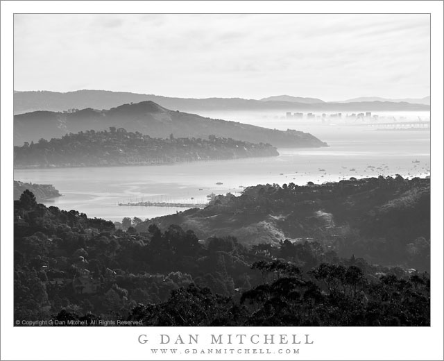
This photograph was shot from essentially the same position as the previous one, a black and white photo of the same vista, though with shorter focal length. I used a longer focal length here to try to enlarge to closer elements and leave out some of the stuff along the edges, and to minimize the amount of sky to some extent. I liked the color version of this – it was hard for me to think about giving up the nice overall blue haze, but even more to give up the was of light on some of the green grassy areas at the bottom of the frame.

There is quite a bit of stuff in this image, so let me describe what you see. At the bottom of the frame are hills above Marin City. Beyond the foreground hills you see Richardson Bay, which is an arm of San Francisco Bay near the entrance to Golden Gate. Across the bay we see the hills of the Tiburon Peninsula and beyond that looms the peak of Angel Island. In the distance and across San Francisco the buildings of downtown Oakland are visible through the low level backlit morning haze. Beyond are the East Bay Hills and the furthest peak is Mount Diablo, all the way out past Concord.


Leave a comment or question using the form. (Click the title to see the full article and to comment if you are viewing it on the home page.)

G Dan Mitchell is a California photographer and visual opportunist. His book, “California’s Fall Color: A Photographer’s Guide to Autumn in the Sierra” (Heyday Books) is available directly from him. Blog | Bluesky | Mastodon | Substack Notes | Flickr | Email

All media © Copyright G Dan Mitchell and others.

Richardson Bay and Tiburon, San Francisco Bay Morning Haze

Richardson Bay and Tiburon, San Francisco Bay Morning Haze

Richardson Bay and Tiburon, San Francisco Bay Morning Haze. Marin, California. February 12, 2011. © Copyright G Dan Mitchell – all rights reserved.

The San Francisco Bay and the haze covered East Bay beyond the waters of Richardson Bay.

When I headed over the Golden Gate on this early February winter morning I intended to end up photographing redwoods or along the coast north of San Francisco in the morning before heading south to go back home by midday. I ended up getting distracted by very interesting shooting conditions in the Marin Headlands of the Golden Gate National Recreation Area and by the time I finished there I didn’t have enough remaining time to carry through on my original plans. But I did have a little time left, so I headed up to this spot along a ridge above Marin City where I know of a great view out over Richardson Bay, the Tiburon Peninsula, Angel Island, the Bay, past fog-shrouded Oakland, and on to the East Bay Hills.

This is a long lens landscape shot, for several reasons. First, the somewhat longer lens – though 159mm isn’t all that long – compresses distance a bit, both bringing Oakland’s downtown buildings a bit “closer” and foreshortening the very large distances a bit. It also lets me “edit” out some potentially distracting elements close to my shooting position and limit the scope of the image to just those elements that I wanted to include.

G Dan Mitchell Photography | Flickr | Twitter | Facebook | Email
Text, photographs, and other media are © Copyright G Dan Mitchell (or others when indicated) and are not in the public domain and may not be used on websites, blogs, or in other media without advance permission from G Dan Mitchell.