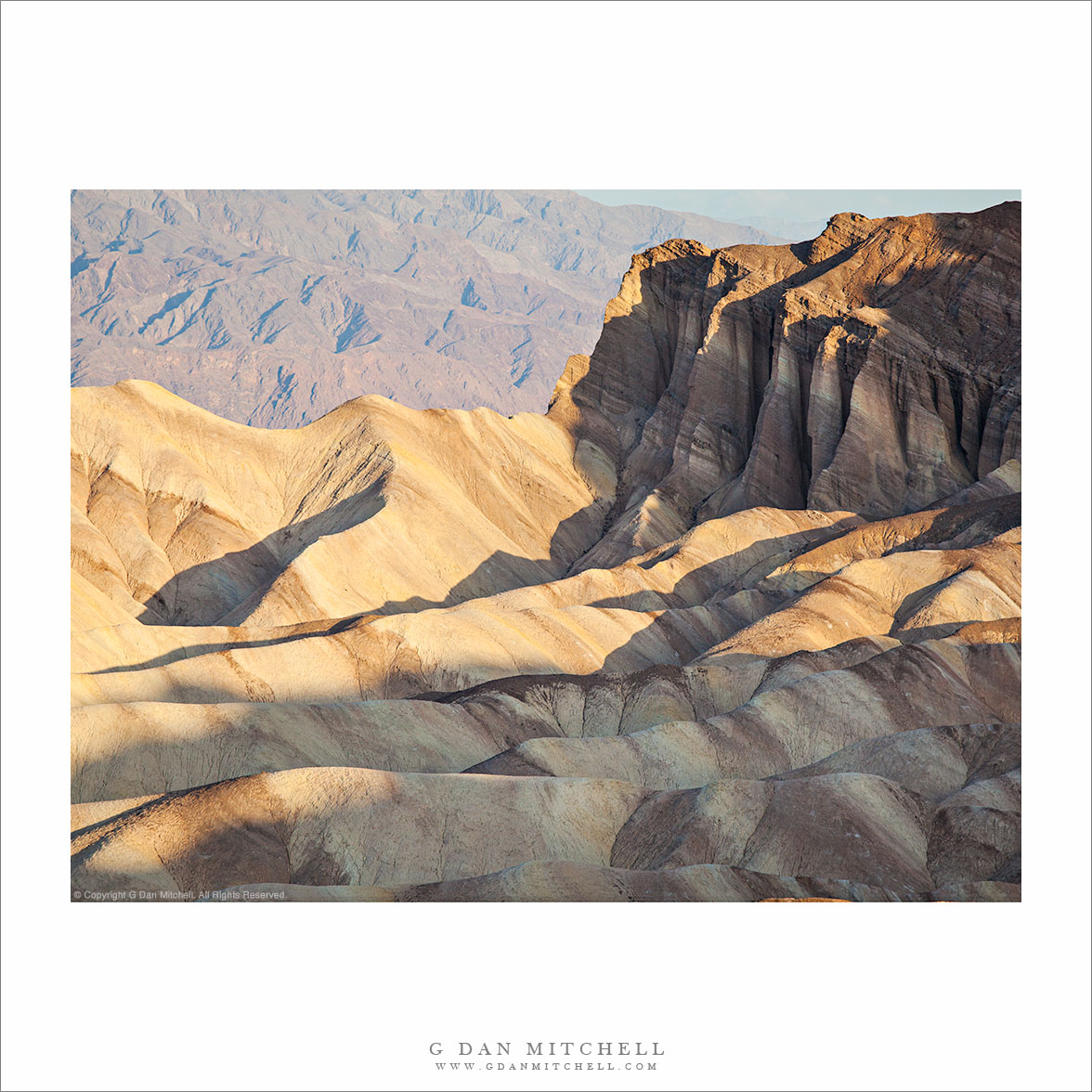
Tag Archives: arid

Red Cathedral, Zabriskie Point

Red Cathedral, Zabriskie Point
“Red Cathedral, Zabriskie Point” — Early morning light on the Red Cathedral and eroded terrain at Zabriskie Point, Death Valley National Park.

This photograph was made at what may be the most famous location in Death Valley, the overlook area at Zabriskie Point. The photograph does not include the famous view of the spire of Manley Beacon, which is just out of the frame to the left in this image. Instead, the photograph focuses on the “Red Cathedral,” a ridge to the right of Zabriskie that rises above the rest of the surrounding eroded hills, is a darker and reddish color, and presents a deeply eroded face.

It is not an easy subject to photograph, and I still have some additional ideas on how else I might approach the feature as a subject. Exposure is a challenge when shooting the Red Cathedral. At first, as light comes to other nearby areas, this feature remains dark. When the sun does finally arrive here – as it is in this photograph – it rakes across the foreground gullies, brightly illuminates the light-colored ridge to the right, and picks off a few small areas of the Red Cathedral while leaving others in deep shade. To add insult to injury, there is a good chance that a photographer will be set up in a position that eventually gives very flat front lighting to the ridge. I may this exposure very shortly after the sun hit Manley Beacon and just as it was starting to light up the foreground gullies and small hills.


Leave a comment or question using the form. (If you are reading this on the home page, click the article title to see the full article and the comment form.

G Dan Mitchell is a California photographer and visual opportunist. His book, “California’s Fall Color: A Photographer’s Guide to Autumn in the Sierra” (Heyday Books) is available directly from him. Blog | Bluesky | Mastodon | Substack Notes | Flickr | Email

All media © Copyright G Dan Mitchell and others.

Playa Surface, Panamint Valley

Playa Surface, Panamint Valley

Playa Surface, Panamint Valley. Death Valley National Park, California. March 31, 2011. © Copyright G Dan Mitchell – all rights reserved.

Cracked and dry surface of the playa in Panament Valley, Death Valley National Park.

This micro-scene could be found in many locations in Death Valley and, for that matter, in many places in the USA and around the rest of the planet. But my little rectangle of the patterns of drying and cracked mud comes from the surface of the Playa (sometimes called “Panamint Lake?”) in upper Panamint Valley in Death Valley National Park. I wrote previously that it was the last day of my late-March photographic visit to Death Valley – I had finished my photography in the main Valley and had started the long drive back to the Bay Area. After crossing Towne Pass the road descends into Panamint Valley to a junction where I most often go south towards Trona and Ridgecrest and beyond.

Just before this junction the road crosses the playa, an extraordinarily flat surface formed when silt washed down from the surrounding mountains occasionally pools and gradually dries, forming what may be the flattest surfaces on the planet. As the moisture evaporates the mud cracks and splits into these interesting semi-geometrical patterns.

For no particular reason other than that this is a spot where I often make one final stop before leaving the park, I pulled over and wandered out onto the playa. I enjoy walking on these often-immense flat surfaces, but there is something very odd about the experience, too. Perhaps it is the slightly odd feeling of walking on such a large floor-flat surface in the natural world, or it might be the deep silence and stillness. In any case, as I wandered around not too far from the road I started looking a bit more closely at the patterns of cracks and soon decided that my photography was not quite finished yet – so I went back to the car to get my camera and made a small series of hand-held photographs with the camera pointing straight down. (The “straight down” shooting raises a question: How should the photograph be oriented? The horizontal orientation shown here is what I saw as I made the photograph… but I also wonder about rotating it 90″ clockwise.)

G Dan Mitchell Photography | Flickr | Twitter (follow me) | Facebook (“Like” my page) | LinkedIn | Email
Text, photographs, and other media are © Copyright G Dan Mitchell (or others when indicated) and are not in the public domain and may not be used on websites, blogs, or in other media without advance permission from G Dan Mitchell.

Red Rock Gully

Red Rock Gully
Red Rock Gully

Red Rock Gully. Death Valley National Park, California. March 29, 2011. © Copyright G Dan Mitchell – all rights reserved.

A red rock gully and wash in the Panamint Range of Death Valley National Park.

I have driven past this area along the road from Death Valley up to Wildrose Canyon quite a few times, and as I do I always am impressed by the many convoluted little canyons and odd and interesting rock formations. Most often I have been on my way to some other place or the light wasn’t quite right, but I always take a look and make a mental list of little spots to keep an eye on. This particular little canyon is one you might not even notice unless you were looking carefully as you passed it. It is in a narrow section of the lower canyon where it is one of many such little landscapes. On this morning I was coming back down from shooting up higher in the Panamints and I was watching carefully as I drove, frequently pulling over to stop and check things out more carefully. At first I almost drove past this spot, but it looked like the light might be interesting this time so I quickly stopped and backed up and made a series of photographs including this one.

The question of how to frame this scene was an interesting one. As is often the case I cover more than one base and shoot the subject in several ways. Initially I worked with a vertical orientation that includes a bit more of the rough terrain a bit higher in the canyon. That image may still see the light of day! But as I shot the scene I also realized that I could use a horizontal orientation too, more tightly frame the entrance to the small canyon, and give up some of the upper canyon formations.

With many subjects I would prefer softer light, and I would probably try to shoot much earlier in the day or come back in the evening. But this canyon, I think, works well in the light of a bit later in the morning when the sun has topped the ridge and direct light hits the top of the rocks and reflects into the recesses a bit more.

G Dan Mitchell Photography | Flickr | Twitter | Facebook | Email
Text, photographs, and other media are © Copyright G Dan Mitchell (or others when indicated) and are not in the public domain and may not be used on websites, blogs, or in other media without advance permission from G Dan Mitchell.

Morning Clouds Above the Manifold, Zabriskie Point

Morning Clouds Above the Manifold, Zabriskie Point

Morning Clouds Above the Manifold, Zabriskie Point. Death Valley National Park, California. April 2, 2007. © Copyright G Dan Mitchell – all rights reserved.

Morning clouds fill the sky above the Manifold at Zabriskie Point, Death Valley National Park.

I posted a monochrome version of this photograph yesterday, so there is perhaps a bit less to say about it in this post. To recap briefly, this is a photograph I made over three years ago during a spring visit to Death Valley NPS. This was a bit of a different morning for photographing at Zabriskie Point, if I recall correctly. Usually, photographing here is pretty straightforward – and once you’ve shot it a couple times in “normal” conditions, there is a basic pattern to the progression of light that becomes fairly (though perhaps not totally) clear. Normal conditions here basically mean perfectly clear skies with the sun coming up to the left from the perspective of this photograph or behind in some of the other familiar shots that include Manley Beacon – and light that sequentially illuminates subjects beginning with the highest peaks of the Panamint Range across the Valley and gradually working down into the Valley and finally to the rugged shapes at Zabriskie Point itself.

But clouds can change everything. If I am going to shoot at Zabriskie, I watch for conditions that will bring them. I will generally not stop there if it is “another beautiful clear sunrise” at Zabriskie. (If you haven’t been there before, you should stop and take in this stunning scene, but I’m often looking for something a bit different.) While the results in clear conditions are relatively predictable, they are not at all as predictable when there are clouds. You can end up with something very special… or with a drab, flat, and gray scene. But that’s the thing about special conditions – they wouldn’t be special if they were predictable and frequent!

Thinking back to this morning, my recollection is that it may have been one of those when I arrived to think, “Oh, boy, clouds!” – only to think a bit later, “I wish those clouds would move and give me some light!” I recall some bits of dawn light that were mostly blocked by the clouds. But the very clouds that blocked the hoped-for first dawn light thoughtfully assembled themselves into these impressive forms just a bit later, at right about the time that the warm side-light was getting down into the rugged folds of the Manifold and Gower Wash.

This photograph is not in the public domain and may not be used on websites, blogs, or in other media without advance permission from G Dan Mitchell.

G Dan Mitchell Photography
Flickr | Twitter | Facebook Fan Page | Facebook | Friendfeed | Email