Tag Archives: bank

Flooded Meadow Near Greenstone Lake

Flooded Meadow Near Greenstone Lake

Flooded Meadow Near Greenstone Lake. Sierra Nevada, California. August 11, 2011. © Copyright 2011 G Dan Mitchell – all rights reserved.

Late-season snow fields are reflected in the pond of a flooded alpine meadow near Greenstone Lake, Sierra Nevada.

During this year of heavy and late winter snowfall, there is still a surprising amount of snow in the Sierra Nevada high country. In the upper portion of this image you can see large snow fields (with much larger ones higher on the slope and out of the frame) at that base of this talus slope at around 10,000+ feet of elevation. During a more typical year, there would still be a few scattered snow fields, but nothing like we see this year. And because there is still so much snow, the plants that would normally be well-developed by now are still just emerging, and the creeks and ponds are overflowing, the meadows are flooded… and the mosquitos are having a field day!

This little pond among the boulder-filled meadows near Greenstone Lake at the far end of Saddlebag Lake was still overflowing with snowmelt water that reflected the extensive snow fields still on the talus field beyond. To get to this spot – in mid-August! – I had to cross a number of still frozen snow fields, follow trails that were flooded in places, and pick my way carefully across waterlogged meadows. It is going to be a short summer season in the high Sierra, but as a compensatory bonus we may still see wildflowers all the way into September.

G Dan Mitchell Photography
About | Flickr | Twitter | FacebookGoogle+ | 500px.com | LinkedIn | Email

Text, photographs, and other media are © Copyright G Dan Mitchell (or others when indicated) and are not in the public domain and may not be used on websites, blogs, or in other media without advance permission from G Dan Mitchell.

(Basic EXIF data may be available by “mousing over” large images in posts. Leave a comment if you want to know more.)

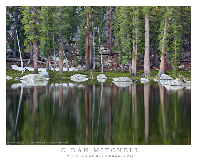
Morning Reflections, Unnamed Lake

Morning Reflections, Unnamed Lake

Morning Reflections, Unnamed Lake. Yosemite National Park, California. July 29, 2011. © Copyright 2011 G Dan Mitchell – all rights reserved.

The still early morning surface of an unnamed subalpine lake reflects the boulders and trees along its rocky shoreline, Yosemite National Park.

This is yet another of those little places in Yosemite that is both surprisingly accessible and surprisingly neglected. Since keeping it that way may be a good thing, I’ll refrain from locating it more specifically than to say that it is along the Tioga Pass Road through the park.

I have photographed here before, and I am intrigued by the good-sized granite boulders along the shoreline and out into the water of this shallow lake surrounded by forest. Because of the surrounding terrain, morning light does not reach down to th lake right away, so I was able to shoot in this soft and indirect light and include both some details in the shadows of the forest and their beautifully blurred reflections in the still surface of the water.

The photograph includes one indication of what an unusual year this has been in the high country. The horizontal white area beyond the shoreline trees at the left side of the frame is a melting snow bank. Normally that might not be a big deal, but this photograph was made near the very end of July. It is a very unusual year when we can still find snow at this elevation near the beginning of August!

G Dan Mitchell Photography
About | Flickr | Twitter | FacebookGoogle+ | 500px.com | LinkedIn | Email

Text, photographs, and other media are © Copyright G Dan Mitchell (or others when indicated) and are not in the public domain and may not be used on websites, blogs, or in other media without advance permission from G Dan Mitchell.

(Basic EXIF data may be available by “mousing over” large images in posts. Leave a comment if you want to know more.)
Offshore Fog Bank, Marin Headlands

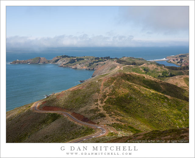
Offshore Fog Bank, Marin Headlands

Offshore Fog Bank, Marin Headlands. Golden Gate National Recreation Area, California. July 14, 2011. © Copyright 2011 G Dan Mitchell – all rights reserved.

Offshore fog lies beyond Point Bonita and Rodeo Beach and the Marin Headlands of the Golden Gate National Recreation Area.

I was surprised to find a clear view like this during my mid-July visit to the Marin Headlands of the Golden Gate National Recreation Area (GGNRA) across the Bay from San Francisco. I had almost decided to stay home or go elsewhere based on weather reports that had the coast completely socked in my dense fog for most of the day. Indeed, it was foggy as I passed through San Francisco and drove across the Golden Gate Bridge. The fog was high, and I could see some distance beneath it, but it was still a rather gray day.

Since the lower section of Conzelman Road, the normal quick and scenic route up into the headlands, was closed for construction, I took that alternate route that passes through a tunnel to come out near Rodeo Beach. I turned left up the hill to reach the upper section of the road. After photographing near Battery 129 for a while, the sun began to break through the fog, and I was surprised to find a fairly clear patch just outside the Golden Gate.

The photograph shows the last section of the headlands as the hills drop towards the historic fort and batteries near the Point Bonito light house, which is barely visible at the end of the peninsula on the left. The line of surf at the upper right is Rodeo Beach, a popular spot with Bay Area folks.

G Dan Mitchell Photography
About | Flickr | Twitter | FacebookGoogle+ | 500px.com | LinkedIn | Email

Text, photographs, and other media are © Copyright G Dan Mitchell (or others when indicated) and are not in the public domain and may not be used on websites, blogs, or in other media without advance permission from G Dan Mitchell.

(Basic EXIF data may be available by “mousing over” large images in posts. Leave a comment if you want to know more.)
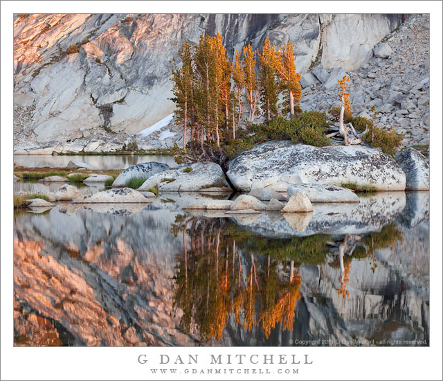
Alpenglow, Trees, and Granite – Upper Young Lake

Alpenglow, Trees, and Granite - Upper Young Lake

Alpenglow, Trees, and Granite – Upper Young Lake. Yosemite National Park, California. September 14, 2010. © Copyright 2010 G Dan Mitchell – all rights reserved.

Alpenglow light on trees growing among granite boulders below glacially carved cliffs at Upper Young Lake.

This is one of my favorite locations in the Yosemite back-country and, in fact, in the entire Sierra Nevada range. This beautiful sub-alpine basis contains three lovely lakes and is surrounded by varied terrain that includes distant views, peaks and ridges towering above, lodgepole pine forests, meadows small and large, and an open view to the west that often provides stunning light late in the day.

As is usually the case, I was camped at the lower Young Lake – this time for several days of photography – and I had headed to the upper lake late in the day to do some evening photography. I have photographed there quite a few times, but I still haven’t come close to exhausting the photographic potential of the place. On this evening I knew that I wanted to be ready to photograph the golden hour light, but I was also interested in the smaller groups of trees that grow among the granite boulders and I wanted to see what might develop as alpenglow struck the glacial slopes above the lake.

There is a small, fun twist to the story of this visit to Upper Young Lake. I took a semi-cross-country route to the upper lake from my camp at the lower lake, and because I knew that I’d be returning alone in deep twilight or even after dark, on the hike up I was concentrating intensely on fixing a series of landmarks in my mind for the return hike. I was so single-minded about this that I made it all the way to the lake and my first intended subject (a small shoreline tree) without looking around much. It was only a moment after arriving that I got out of focus-on-the-route mode and looked around. I had walked right past the campsite of a couple of photographers without even seeing them, much less saying “hi.” Turns out that the photographers were John Sexton and Anne Larsen. After exchanging greetings and conversation, I went about my business of shooting along the edge of the lake. (If I recall correctly, John was shooting nearby as I made this exposure.)

G Dan Mitchell Photography
About | Flickr | Twitter | FacebookGoogle+ | 500px.com | LinkedIn | Email

Text, photographs, and other media are © Copyright G Dan Mitchell (or others when indicated) and are not in the public domain and may not be used on websites, blogs, or in other media without advance permission from G Dan Mitchell.

(Basic EXIF data may be available by “mousing over” large images in posts. Leave a comment if you want to know more.)