Tag Archives: crest

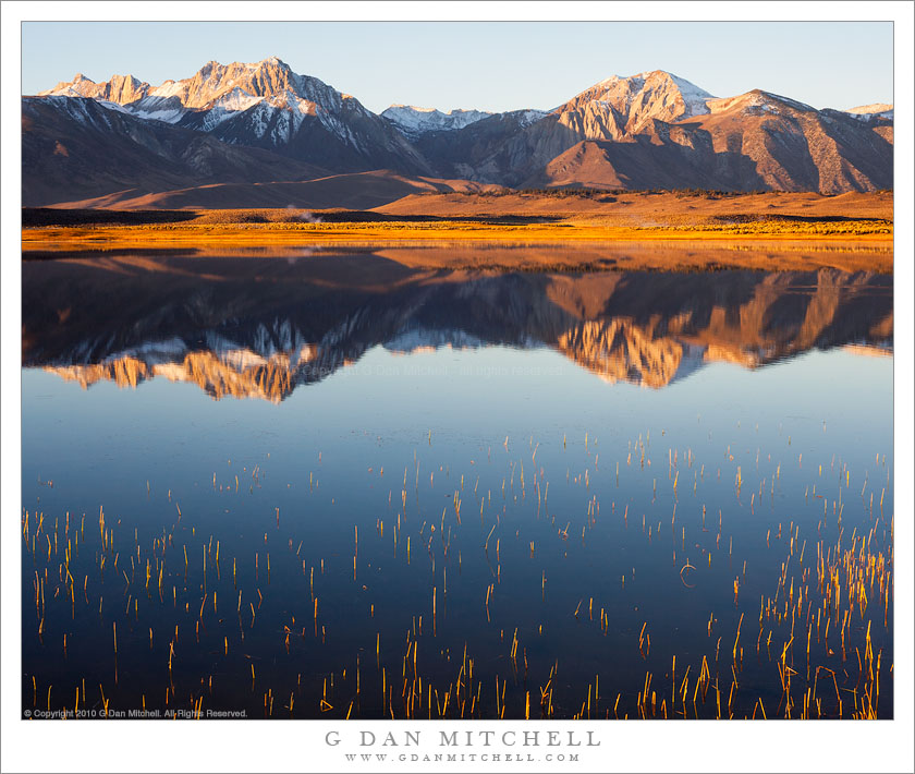
From the Panamints to the Sierra, Evening

From the Panamints to the Sierra, Evening

From the Panamints to the Sierra, Evening. Death Valley National Park, California. March 30, 2011. © Copyright G Dan Mitchell – all rights reserved.

The Sierra Nevada in evening light as seen from Aguereberry Point in Death Valley National Park’s Panamint Range.

I made this photograph from Aguereberry Point shortly before sunset. Aguereberry Point is a lonely prominence over 6000′ above Death Valley, high in the Panamint Mountain range, a place of astonishing panoramic views – and often some significant winds. As I drove the gravel road to the point late in the afternoon I saw three or four other vehicles heading the other direction, but when I arrived at the point a bit more than an hour before sunset no one else was there.

Having photographed here a few times previously, I am becoming more familiar with the challenges and the opportunities of shooting here. One of the challenges – as is the case in many spots in Death Valley – is that certain subjects seem to be “photographable” at very specific times and only for short intervals. One of the most interesting views from Aguereberry is southeast down into Trail Canyon and on to the lower slopes of Wildrose Peak beyond. This is wild, rugged, austere terrain. However, because it lies on the east side of this range the light changes quickly from a washed out blast of daytime sun to sudden deep shadows as the sun drops behind the higher ridges of the Panamints. (Trail Canyon is not seen in this photograph.)

Another challenge is that, impressive and overwhelming as the scale of this grand scene is, it can be difficult to pull interesting compositions out of it. I tend to work with longer lenses here, both to isolate smaller areas out of the huge landscape and to compress distance. In this photograph, the silhouetted crest of the highest part of the Sierra Nevada range is on the horizon, with the intervening ridges of the Panamint Range and others probably including the Inyo Mountains and the ridge just west of Panamint Valley.

And, since I tend towards those large and long lenses… wind is an issue! And on top of Aguereberry Point there is nothing to stop the often strong winds of Death Valley. On this evening the winds were howling, so I found a spot below some rocks where it was a bit less windy and then spent a lot time waiting for momentary lulls in the wind when I could make photographs.

G Dan Mitchell Photography | Flickr | Twitter | Facebook | Email
Text, photographs, and other media are © Copyright G Dan Mitchell (or others when indicated) and are not in the public domain and may not be used on websites, blogs, or in other media without advance permission from G Dan Mitchell.

Tioga Lake, Late Spring

Tioga Lake, Late Spring

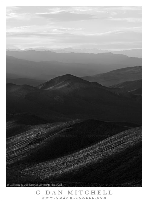
Tioga Lake, Late Spring. Near Yosemite National Park, California. June 5, 2010. © Copyright G Dan Mitchell – all rights reserved.

Late spring at icebound Tioga Lake below Tioga Pass with Mammoth Peak and the Kuna Crest beyond in afternoon light.

I made and shared a slightly different photograph of this scene last summer, but when I did my annual end-of-year traverse of the year’s raw files I returned to the original set of images and wondered how I missed this one. In a lot of ways it is similar to the one I selected earlier, though the foreground light and shadow patterns are a bit different and, more importantly, I like the position of the clouds in this one more than what I had in the original. So, there are now two versions of this scene floating around…

After several fairly dry years in California, the winter of 2009-10 produced much more precipitation, as rain in the lowlands and as snowpack in the Sierra. Because of the heavier snow, Tioga Pass opened just a bit later than average, and when it opened there was still a lot of snow in the high country. Since this afforded a rare chance to cross the Yosemite Sierra in conditions not usually seen by drivers I made it a point to get up there as soon as the road opened.

On the drive there was snow along almost the entire length of Tioga Pass Road, and in many places it looked more like winter than like spring. At the same time, it was spring, and the melting of the snowpack was fully underway. While lakes like Tioga Lake, as seen in this photograph, were still ice-covered… the ice was thinning quickly, and everywhere the melting snow was creating creeks and cascades. The high country, especially at the elevation of the road, was filling with water – water in ponds, water in overflowing lakes, water in rivers, water in cascades and waterfalls. I was waterfalls along the road in places where I had not even suspected that there were creeks!

This photograph shows Tioga Lake, just east of and below Tioga Pass, the eastern entrance to Yosemite. The pass itself is in the low saddle just above the meadow ascending the hill at the end of the lake. Beyond, and inside the park, is massive Kuna Crest with white, snow-capped Mammoth Peak in full sun at the right end of the ridge.

G Dan Mitchell Photography | Flickr | Twitter | Facebook | Email
Text, photographs, and other media are © Copyright G Dan Mitchell (or others when indicated) and are not in the public domain and may not be used on websites, blogs, or in other media without advance permission from G Dan Mitchell.
Mount Morrison and Desert Hills, Morning

Mount Morrison and Desert Hills, Morning

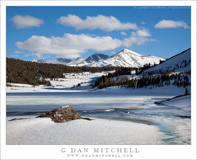
Mount Morrison and Desert Hills, Morning. Owens Valley, California. October 10, 2010. © Copyright G Dan Mitchell – all rights reserved.

Early morning light on sagebrush covered Owens Valley hills and the Sierra crest near Mount Morrison.

I was out in this section of Owens Valley early on this October morning, initially to photograph at a small lake further out in the valley. However, knowing parts of this area pretty well from past visits, I wanted to try a photograph that included the foreground tree-covered ridge in morning light with the Sierra peaks in the background – so I headed back on a gravel road that travels a bit north of the paved road I had taken earlier in the morning. I found this scene with the early light illuminating the crest of the Sierra and the sagebrush-covered foreground hills, but with morning shadows still lying across the lower eastern face of the Sierra just south of Convict Lake.

The dusting of early season snow was left over from a week of early autumn storms. Mt. Morrison is the huge and impressive summit at the right end of the ridge. Mt. Baldwin is the small but very high summit near the left end. In between is a vertical rock face that appears to be split by a crack – I think it is called “the Great White Fang.”

This photograph is not in the public domain and may not be used on websites, blogs, or in other media without advance permission from G Dan Mitchell.
G Dan Mitchell Photography
Flickr | Twitter | Facebook Fan Page | Facebook | Friendfeed | Email

Dawn, Alkali Lake, Eastern Sierra

Dawn, Alkali Lake, Eastern Sierra
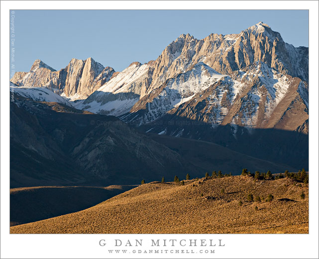
Dawn light on Alkali Lake and the peaks of the eastern Sierra Nevada near Convict Lake.

Dawn, Alkali Lake, Eastern Sierra. Owens Valley, California. October 10, 2010. © Copyright G Dan Mitchell – all rights reserved.

Dawn light on Alkali Lake and the peaks of the eastern Sierra Nevada near Convict Lake.

I posted a photograph very much like this one a month or so ago, but I like this place and the morning light so much that I’m posting this similar photograph. The location is on the shore of a small alkali lake out in Owens Valley/Long Valley, in an area that is full of hot springs. On this very cold early October morning, steam was rising from the many hot springs in the area as the sun rose, lighting the eastern face of the Sierra Nevada near Convict Lake, the sagebrush-covered hills below the Sierra, and finally the surface of the small lake.

For many years after I started visiting the east side of the Sierra Nevada I mostly ignored the high desert terrain such as the area around this lake. As time went on and I looked further east I began to venture out here, and I discovered a beautiful landscape that is affected by proximity to the Sierra but which is not really “Sierra Nevada” itself. The bulk of the eastern escarpment is a constant presence here, but the character of this place is more that of the basin and range country — dry, full of sagebrush, with playas and rocky outcroppings.


G Dan Mitchell is a California photographer and visual opportunist. His book, “California’s Fall Color: A Photographer’s Guide to Autumn in the Sierra” is available from Heyday Books and Amazon.

Blog | About | Flickr | FacebookEmail

Links to Articles, Sales and Licensing, my Sierra Nevada Fall Color book, Contact Information.


All media © Copyright G Dan Mitchell and others as indicated. Any use requires advance permission from G Dan Mitchell.