
Tag Archives: mountains

Skidoo Mill

Skidoo Mill
Skidoo Mill

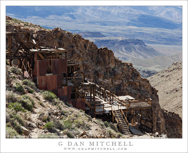
Skidoo Mill. Death Valley National Park, California. April 2, 2014. © Copyright 2014 G Dan Mitchell – all rights reserved.

The abandoned Skidoo Mill, high in the Panamint Mountains of Death Valley National Park

I have been out to the site of the old ghost town of Skidoo a few times. Oddly perhaps, snow has played a part in more than half of my visits—not what you might expect for a desert region like Death Valley. The first time I went there I really did not know much about the place at all, and I drove the nine mile gravel road more or less on a whim, arriving at the broad valley where the main town was, finding little there, poking around a bit, and leaving, a bit disappointed. (I did have a chance to investigate some other historical sites in the area on the same trip, so in the end I didn’t feel cheated.) More recently I visited last winter, during a very cold trip to the park when I encountered sub-freezing temperature down in Death Valley itself and colder temperature well down into the teens up here. Parts of the road were covered by shallow snow, and it was a quiet and lonely experience to be out there alone in the snow. This time I poked around a bit more, exploring some side trails and nearby ridges, until I decided that it was best not to push too far with the snow on the ground.

This past April we were there again, on a day full of interesting experiences and adventures. I often spend at least a day up in the Panamint Range when I visit the park, and I always find new and interesting things, but I don’t think I’ve ever encountered such a range of conditions and subjects in a single day before. We started before dawn and had a brief moment of sunrise light before the clouds of an incoming storm turned out the lights. Very soon we began to see snow flurries along the Panamint ridge and other summits, and soon after visiting one historic site it began to snow in earnest. We headed toward a higher location and finally had to back down as the snow continued to fall. Surprisingly, in these cold conditions and snow we found… abundant wildflowers! We stopped several times to photograph the unexpected display, and then decided to make the side trip to Skidoo as the storm passed and the sun came out. Once there we pushed out past the town site to the location of the old mill, where ore from the mines was processed. The mill, long abandoned and deteriorating now, is an astonishing thing. Its location is unexpected and stunning. It sits right below the crest of a steep ridge and the structure stretches down toward a deep valley below—and the entire site overlooks a vast and arid desert landscape, a bit of which is visible in this photograph. Even more amazing, this mill was powered by water, not at all what you would expect in such a dry and desolate place. But the miners ran a pipeline over 20 miles from a spring elsewhere in the high Panamints to get water to supply power and for the domestic use of the town’s residents.

G Dan Mitchell is a California photographer and visual opportunist whose subjects include the Pacific coast, redwood forests, central California oak/grasslands, the Sierra Nevada, California deserts, urban landscapes, night photography, and more.
Blog | About | Flickr | Twitter | Facebook | Google+ | 500px.com | LinkedIn | Email

Text, photographs, and other media are © Copyright G Dan Mitchell (or others when indicated) and are not in the public domain and may not be used on websites, blogs, or in other media without advance permission from G Dan Mitchell.
Evening Clouds, Tuolumne Meadows

Evening Clouds, Tuolumne Meadows

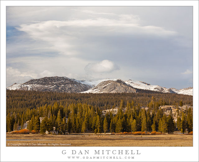
Evening Clouds, Tuolumne Meadows. Yosemite National Park, California. May 4, 2014. © Copyright 2014 G Dan Mitchell – all rights reserved.

Early season evening clouds above Tuolumne Meadows and snow-capped peaks, Yosemite National Park

Another orbit around the sun; another cycle of summer, autumn, winter, and spring; another Sierra Nevada high country summer season begins to come into view. This year’s seems to come early and leaves me with an uneasy feeling—it never really did feel like we had a winter, aside from a few stray storms here and there. But every season is different and who knows what this one will bring. Regardless, Tioga Pass Road through the Yosemite high country opened this past weekend and the high country once again became accessible, as did the eastern slopes of the Sierra. Every year when that happens, the mountains call and I must go. Sometimes, especially when the pass opens later in the season, I may have a few days and I can stay up there and explore a bit more. Other years, like the one, I have to squeeze in a quick visit between other responsibilities. But I virtually always go during the first weekend when the pass opens, and this event marks the beginning of another season that will likely stretch at least into October, when the snows fall again and the aspens change color.

The pass opened on Friday, but I had other plans and responsibilities. I had other things to do on Saturday, too, so that left Sunday. One of those Saturday activities had me returning home at about midnight, and I managed to get to bed at about 12:30… leaving just enough time for three hours of sleep before my 3:30 alarm went off. I was up, stumbling around the house in the dark to dress and make coffee, and in a half hour or so I was on the road to the Sierra. The sun rose as I entered the foothills, where I stopped to photograph some spring oak trees and green grasses, and while it was probably 7:30 or earlier when I reached the park entrance it already seemed like the day was quite far along. I turned east onto the very familiar highway 120, and eagerly watched for special places I know, looking to see how they were developing this year. Was there water in that pond? Early signs of corn lilies? Water flowing in that creek? The Sierra certainly does look dry, but this was masked a bit by the remains of a snow storm from past week, which covered the ridges with white. Eventually I made it across the range and dropped down to Mono Lake and then drove up a quiet east side canyon to sit and listen to the wind for a while before starting back. I made this photograph during the last hour of daylight in Tuolumne Meadows, as the color of the light changed and the clouds of a passing weather front assembled above the crest.

G Dan Mitchell is a California photographer and visual opportunist whose subjects include the Pacific coast, redwood forests, central California oak/grasslands, the Sierra Nevada, California deserts, urban landscapes, night photography, and more.
Blog | About | Flickr | Twitter | Facebook | Google+ | 500px.com | LinkedIn | Email

Text, photographs, and other media are © Copyright G Dan Mitchell (or others when indicated) and are not in the public domain and may not be used on websites, blogs, or in other media without advance permission from G Dan Mitchell.
Desert Morning, Light and Shadow

Desert Morning, Light and Shadow

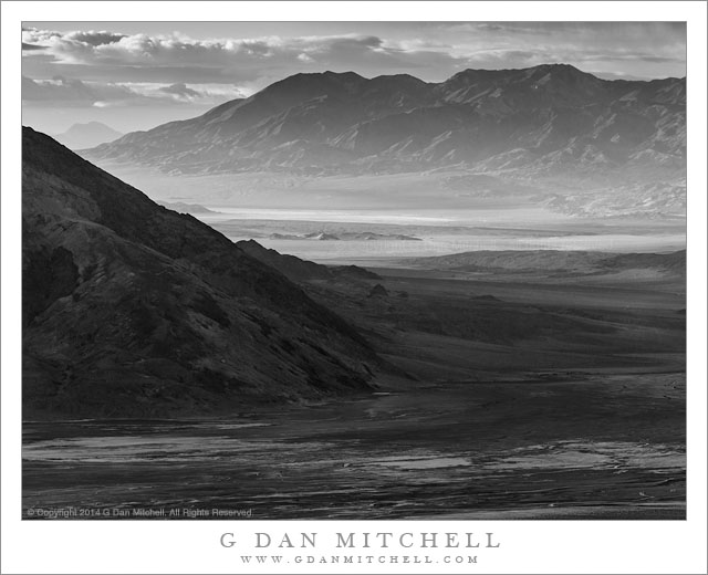
Desert Morning, Light and Shadow. Death Valley National Park, California. April 2, 2014. © Copyright 2014 G Dan Mitchell – all rights reserved.

Morning light and shadows play across the immense landscape of southern Death Valley as storm clouds build.

This photograph reminds me of the immense scale of the Death Valley landscape. Photographed from high in the Panamint Range very early on a morning when a storm was building—it would later snow in our location—the contrast between the cloud-shadowed foreground and the early morning light in the distant valley emphasizes the vast distances in the scene. The light began closing down essentially right at dawn as the clouds of a Pacific weather front came in from the west behind us. (As I made this photograph light snow was falling on the ridge above and behind my position.) The dark clouds building over our position along the crest of the Panamint Range were beginning to extend out over the Valley and build over each of the ranges extending into the distance.

As I made this photograph the main portion of Death Valley, below us to the left and extending into the lower part of the frame here, had fallen into shadow, along with the range of mountains running along its eastern edge. The clouds had not yet worked their way to the south, and where the Valley turns toward the east there was early morning sunlight still spilling into the lower section of the Valley and lighting distant mountains and arid salt flats and atmospheric haze. Even further in the distance some thickening clouds are visible above a single very distant peak.

G Dan Mitchell is a California photographer and visual opportunist whose subjects include the Pacific coast, redwood forests, central California oak/grasslands, the Sierra Nevada, California deserts, urban landscapes, night photography, and more.
Blog | About | Flickr | Twitter | Facebook | Google+ | 500px.com | LinkedIn | Email

Text, photographs, and other media are © Copyright G Dan Mitchell (or others when indicated) and are not in the public domain and may not be used on websites, blogs, or in other media without advance permission from G Dan Mitchell.

Upper Titus Canyon

Upper Titus Canyon
Upper Titus Canyon

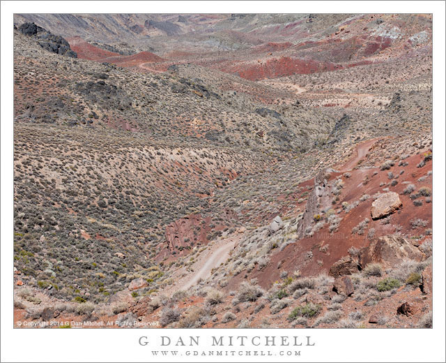
Upper Titus Canyon. Death Valley National Park, California. April 1, 2014. © Copyright 2014 G Dan Mitchell – all rights reserved.

Titus Canyon road descends into the upper canyon from Red Pass, Death Valley National Park

At first glance this landscape lacks a central focus and the colors are relatively unsaturated. The contrasts within the terrain are subdued, without the striking divisions between light and shadow that we might see in places like the alpine zones of the Sierra. In the past I have often not bothered to photograph such places, since they appear to lack the dramatic qualities that we often search out in a place like Death Valley. And there is no questioning the appeal of those subjects that possess starker lines, brighter colors, greater contrast, and perhaps towering geological forms. Yet, it occurred to me a year or two ago that the places like this are part of the true experience of the desert and of Death Valley, and that their character is a big part of what forms my sense of this terrain. To ignore them seems both a bit unfair and a bit dishonest. So I decided to try to see if I could find ways to photograph them, a project I’m still working on but also one on which I’m confident that I’m making some progress—and, in the process, learning to see the place more fully.

This photograph was made at Red Pass, the high point of the Titus Canyon road between the Amargosa Valley and Death Valley. (The source of the the name of this pass is probably obvious from one look at the color of the rocks.) The narrow, twisty, one-way gravel road is perhaps best known for traveling through very narrow slot canyon terrain near its lower end, but the whole thing is part of the experience. After a steep climb out of the upper reaches of Titanothere Canyon, the road tops the narrow ridge of the pass before descending steeply into the upper reaches of Titus Canyon. The view from the pass down into upper Titus Canyon is remarkable. The canyon drops away and the road is visible twisting and turning its way down the initial descent and then crossing flatter areas beyond. Barely visible in the upper left area of the image is the location of the historic ghost town of Leadville, a town built on the false promises of mineral wealth that great and then died in the space of about a year—in a place that could hardly be more remote or less hospitable.

G Dan Mitchell is a California photographer and visual opportunist whose subjects include the Pacific coast, redwood forests, central California oak/grasslands, the Sierra Nevada, California deserts, urban landscapes, night photography, and more.
Blog | About | Flickr | Twitter | Facebook | Google+ | 500px.com | LinkedIn | Email

Text, photographs, and other media are © Copyright G Dan Mitchell (or others when indicated) and are not in the public domain and may not be used on websites, blogs, or in other media without advance permission from G Dan Mitchell.