Tag Archives: road

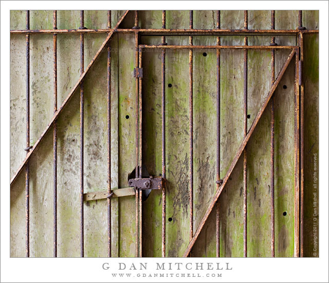
Rusted Gate and Concrete Wall, Battery 129

Rusted Gate and Concrete Wall, Battery 129

Rusted Gate and Concrete Wall, Battery 129. Golden Gate National Recreation Area, California. July 14, 2011. © Copyright 2011 G Dan Mitchell – all rights reserved.

Rusted gate against a weathered concrete wall at the entrance to a tunnel at Battery 129, Golden Gate National Recreation Area.

At the north end of the Golden Gate Bridge, Conzelman Road leads up into the Marin Headlands along the San Francisco Bay side of the ridge. This road is a favorite place for overlooking the Golden Gate and its famous bridge along with a large expanse of San Francisco and its Bay and points east. In mid-July the road was not accessible from the usual spot near the end of the bridge, so I detoured around towards the “back entrance” via the road to Rodeo Beach. From this road I turned up into the hills and joined Conzelman near its summit. I made a few foggy photographs of the Bay, but my main interest was in trying to find photographs in the old batteries and other abandoned military facilities along the ridge running out toward Point Bonita.

At the summit of the hill, before the road becomes very narrow and many people turn back, is “Battery 129.” There are several tunnels into this facility from alongside the road and a separate route leads up the hill to the old structures on the summit. I took one of the two tunnels under the hill and as I entered the second section I saw this old metal gate against a weathered concrete wall, illuminated by light leaking in from the end of the tunnel.

G Dan Mitchell Photography
About | Flickr | Twitter | FacebookGoogle+ | 500px.com | LinkedIn | Email

Text, photographs, and other media are © Copyright G Dan Mitchell (or others when indicated) and are not in the public domain and may not be used on websites, blogs, or in other media without advance permission from G Dan Mitchell.

(Basic EXIF data may be available by “mousing over” large images in posts. Leave a comment if you want to know more.)

Offshore Fog Bank, Marin Headlands

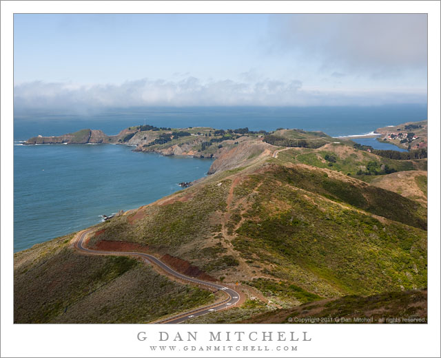
Offshore Fog Bank, Marin Headlands

Offshore Fog Bank, Marin Headlands. Golden Gate National Recreation Area, California. July 14, 2011. © Copyright 2011 G Dan Mitchell – all rights reserved.

Offshore fog lies beyond Point Bonita and Rodeo Beach and the Marin Headlands of the Golden Gate National Recreation Area.

I was surprised to find a clear view like this during my mid-July visit to the Marin Headlands of the Golden Gate National Recreation Area (GGNRA) across the Bay from San Francisco. I had almost decided to stay home or go elsewhere based on weather reports that had the coast completely socked in my dense fog for most of the day. Indeed, it was foggy as I passed through San Francisco and drove across the Golden Gate Bridge. The fog was high, and I could see some distance beneath it, but it was still a rather gray day.

Since the lower section of Conzelman Road, the normal quick and scenic route up into the headlands, was closed for construction, I took that alternate route that passes through a tunnel to come out near Rodeo Beach. I turned left up the hill to reach the upper section of the road. After photographing near Battery 129 for a while, the sun began to break through the fog, and I was surprised to find a fairly clear patch just outside the Golden Gate.

The photograph shows the last section of the headlands as the hills drop towards the historic fort and batteries near the Point Bonito light house, which is barely visible at the end of the peninsula on the left. The line of surf at the upper right is Rodeo Beach, a popular spot with Bay Area folks.

G Dan Mitchell Photography
About | Flickr | Twitter | FacebookGoogle+ | 500px.com | LinkedIn | Email

Text, photographs, and other media are © Copyright G Dan Mitchell (or others when indicated) and are not in the public domain and may not be used on websites, blogs, or in other media without advance permission from G Dan Mitchell.

(Basic EXIF data may be available by “mousing over” large images in posts. Leave a comment if you want to know more.)
Forest, Gazos Creek

Forest, Gazos Creek
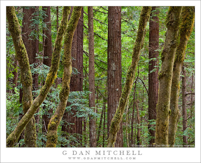
Forest, Gazos Creek

Forest, Gazos Creek. Gazos Creek Road, California. July 12, 2011. © Copyright 2011 G Dan Mitchell – all rights reserved.

A dense mixed redwood and big leaf maple forest along Gazos Creek, California.

Today I used the excuse of driving my son over the hill to UC-Santa Cruz for his summer school class to get in a short trip up the coast north of Santa Cruz. We are in the midst of the “June gloom” period along the coast of northern California, and the fog doesn’t clear until later in the day, and never does clear completely in some areas. As I left Santa Cruz the fog bank was visible but well off-shore, but as I travelled north I eventually encountered it right around Año Nuevo State Reserve.

I had a vague plan to check out Gazos Creek Road, having heard from some other photographers that there are interesting redwood trees and other subjects in that area. Since I still had some time, I turned up the road and it quickly narrowed as it followed the creek and the bottom of the canyon into the Santa Cruz Mountains. Since this was more or less a scouting trip, I drove all the way to the end of the road without stopping much, but on the way back down I decided to stop and make some photographs of this grove of new-grown coast redwoods mixed with the curving trunks of big leaf maple trees.

G Dan Mitchell Photography
About | Flickr | Twitter | FacebookGoogle+ | 500px.com | LinkedIn | Email

Text, photographs, and other media are © Copyright G Dan Mitchell (or others when indicated) and are not in the public domain and may not be used on websites, blogs, or in other media without advance permission from G Dan Mitchell.

(Basic EXIF data may be available by “mousing over” large images in posts. Leave a comment if you want to know more.)
Late Afternoon, Tenaya Lake

Late Afternoon, Tenaya Lake

Late Afternoon, Tenaya Lake. Yosemite National Park, California. June 18, 2011. © Copyright G Dan Mitchell – all rights reserved.

Ice covers the surface of Tenaya Lake on the day of the mid-June opening of Tioga Pass Road as afternoon clouds cluster around the summit of Mount Conness, Yosemite National Park.

After the wild sunset-illuminated versions of this scene that I’ve posted recently, I thought it might be a relief to post something more subtle! This photograph was also made on the evening of June 18, the day that Tioga Pass Road opened for the 2011 season. A bit earlier I had photographed along the shoreline of Tenaya Lake – the ice-covered area in the lower portion of this image – where I had juxtaposed melting ice, deep blue water, and interesting clouds. When I finished there I had a decision to make – whether to head back up toward the pass, continue to photograph around the lake, or try to get a shot of Mount Conness from Olmsted Point. Since I had been in contact with a client concerning Mount Conness photographs just a few days earlier, I decided to try that third choice.

When I arrived at Olmsted, conditions were a bit unpromising. Clouds had come up over the Sierra crest and Conness was completely obscured. In addition, a certain type of gloomy haze and cloudiness was taking much of the energy out of the scene. Clouds to the west were washing out the light, too. Many times I don’t give up immediately in situations like this, at least not until I’ve spent a bit of time trying to get a sense of where things might be headed. (Ultimately on this evening that turned out to be a good decision, as near sunset one of the most intense displays of Sierra evening color occurred… but that it a story I’ve already told in earlier posts.) As I watched, the clouds around Conness began to move a bit and every so often a bit of the tip of the mountain would poke through. During one of these moments, a bit of light filtered through the high clouds from the west and glanced across the slopes of Polly Dome and struck the upper reaches of Medlicott Dome.

G Dan Mitchell Photography
Flickr | Twitter (follow me) | Facebook (“Like” my page) | 500px.com | LinkedIn | Email

Text, photographs, and other media are © Copyright G Dan Mitchell (or others when indicated) and are not in the public domain and may not be used on websites, blogs, or in other media without advance permission from G Dan Mitchell.