Tag Archives: tioga

Runoff Pool, Evening – Tuolumne Meadows

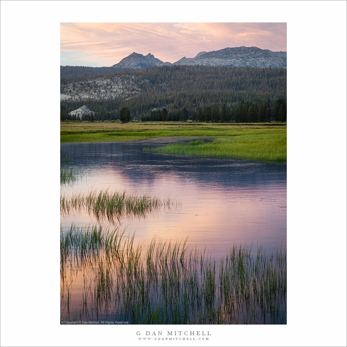
Runoff Pool, Evening
“Runoff Pool, Evening ” — Grass bordered early summer runoff pool in Toulumne Meadows.

I made this photograph on a very early-season visit to the Tuolumne Meadows area in early July of this year. Since this was a below-normal precipitation year, the road to the pass cleared a bit on the early side and by early July almost all of the snow was gone at road level – but there was still a good amount of run-off water in Tuolumne Meadows. (Though nothing like in the big precipitation years, when portions of the meadow become more lake than solid ground.)

There were some interesting clouds this evening so I wandered out into one of my favorite areas in the lower end of the meadow as the day ended and photographed the new grasses and pools of water that reflected sky, clouds, and surrounding peaks. In the distance the summit of Ragged Peak marks the location of Young Lakes.


COMMENT OR QUESTION? Scroll down to the comment form.

G Dan Mitchell is a California photographer and visual opportunist. His book, “California’s Fall Color: A Photographer’s Guide to Autumn in the Sierra” (Heyday Books) is available directly from him. Blog | Bluesky | Mastodon | Substack Notes | Flickr | Email

All media © Copyright G Dan Mitchell and others.

Fall Foliage and Rock Face, Tioga Road

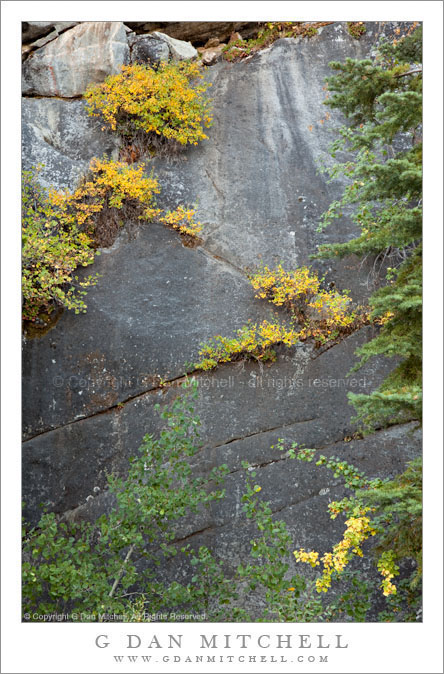
Fall Foliage and Rock Face, Tioga Road

Fall Foliage and Rock Face, Tioga Road. Yosemite National Park, California. September 26, 2009. © Copyright G Dan Mitchell – all rights reserved.

Fall colors come to plants growing in cracks in a rock face alongside Tioga Road, Yosemite National Park, California.

As I drove across the Sierra via Tioga Pass Road in late September I was watching for early fall color, which often just gets going at about this time. Most of the good color is east of the crest, but there is one area near where the road crosses Yosemite Creek where I sometimes spot some yellow leaves – and, sure enough, as I passed this spot I saw some interesting color along the rock walls beside the road.

This photograph is not in the public domain and may not be used on websites, blogs, or in other media without advance permission from G Dan Mitchell.

G Dan Mitchell Photography | Twitter | Friendfeed | Facebook | Facebook Fan Page | Email

keywords: yellow, green, gold, leaf, plant, branch, bush, tree, aspen, rock, face, cliff, crack, gray, boulder, broken, angle, season, fall, autumn, texture, tioga, pass, road, 120, highway, yosemite, national, park, california, usa, high, sierra, nevada, mountain, range, trans, creek, nature, travel, scenic, needle, stock

Tioga Pass and Alternatives as Winter Approaches

Lots of us northern and central California photographers make trips to the eastern Sierra in the summer and fall – I know that many of you have been there in the past month to photograph aspens and other fall color. For many of us the standard route to the “east side” is through Yosemite National Park and over Tioga Pass on State Highway 120 to Lee Vining and the area near Mono Lake. From here it is a short drive south to Mammoth (about a half hour) and Bishop (an hour) and points south, including Big Pine, Independence, and Lone Pine.

As the fall season arrives and winter weather approaches, Tioga Pass becomes a less reliable route and eventually closes for the season. The seasonal closure typically occurs sometime in late October or in November, though the historical records show that it has happened as late as January 1!

Continue reading Tioga Pass and Alternatives as Winter Approaches

Winter arrives in the Sierra?

A few years ago I did what was a traditional end-of-season backpack trip out of Tuolumne Meadows on the last weekend during which the NPS permits overnight parking on Tioga Pass road – this is typically on or just before October 15. It was a beautiful weekend with – as I always hope for in October – pleasant, sunny conditions and beautiful light.

The following weekend a backpacking buddy who had been unable to make that trip tried his own end-of-seasons visit, hoping to wander up into the Twenty Lakes Basin area just east of Tioga Pass. He arrived late and rolled out his bivy sack at the small campground by the lake right below Tioga Pass… and woke up the next morning with more than a half foot of snow on top of him and more on the way. He scrambled out of his bag, got into his car, and managed to get out just before the road was blocked. He liked to say that he was there for the switch from fall to winter… literally.

It sounds like something similar may happen over the next 24 hours. From all reports, one of the biggest October storms that we’ve seen in California in decades may be sweeping through tonight and tomorrow, bringing heavy winds, a lot of rain, and the potential for some significant snow at the higher elevations.

The folks at the Dweeb Report (interesting source of Sierra weather info) include an ominous sentence in their most recent update: “WINDS WITH THIS SYSTEM OVER THE CREST COULD REACH BETWEEN 120MPH AND 140MPH OVER THE CENTRAL SIERRA.”

Of course, you knew this was leading to a comment on aspens, right? Given the rather strange conditions for aspen color this fall, somehow it doesn’t seem at all surprising that the storm might bring down a good portion of the remaining leaves!


G Dan Mitchell is a California photographer and visual opportunist. His book, “California’s Fall Color: A Photographer’s Guide to Autumn in the Sierra” (Heyday Books) is available directly from him.

G Dan Mitchell: Blog | Bluesky | Mastodon | Substack Notes | Flickr | Email


All media © Copyright G Dan Mitchell and others as indicated. Any use requires advance permission from G Dan Mitchell.