Category Archives: Photographs: Owens Valley

Owens Valley Sky

Owens Valley Sky
Owens Valley Sky

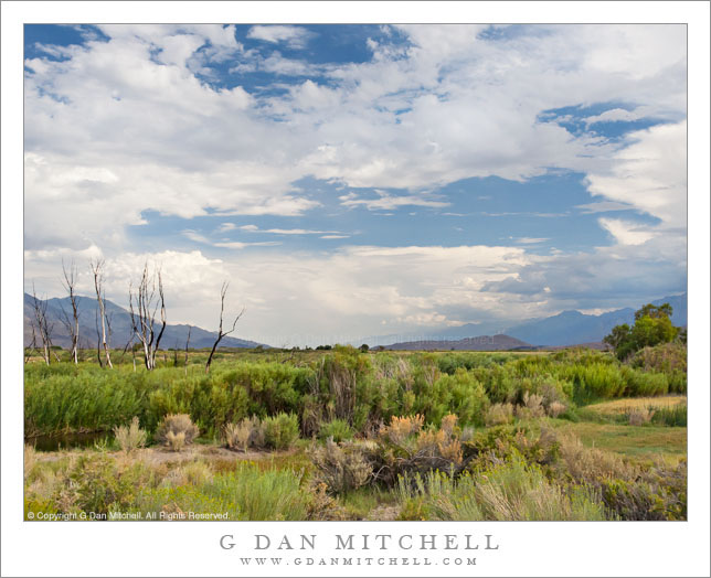
Owens Valley Sky. Owens Valley, California. August 6, 2005. © Copyright 2011 G Dan Mitchell – all rights reserved.

Dramatic thunderstorms begin to build above Owens Valley, flanked by the White Mountains and the eastern Sierra Nevada range.

If there is any good news about starting to run out of space on my hard drive, it might be that it encourages me to begin the process of reviewing my tens of thousands of archived raw image files, and that leads me to look through files that I haven’t revisited in a long time – and during this process I find photographs that I had forgotten about. Not only is it worthwhile to rediscover these photographs that ended up buried in the archive, but it is also a chance to recall some of the trips on which the photographs were made.

This photograph is yet another (of many!) that wouldn’t have happened at all if it were not for a whole unpredictable series of events and circumstances. I’ll make the story as short as I can, but it is still a bit involved. Almost every summer I share a long pack trip with a group of my friends. In 2005 we had come up with a 14-day trip along a good portion of the John Muir Trail between roughly the Ediza Lake area and Bishop Pass, which included one of the very few sections of the JMT that I had not hiked. We started at Agnew Meadow, headed up past Shadow Lake, turned south on the JMT, stopped at Reds Meadow, continued on to the Duck and Purple Lakes area… where I started to feel like I might be coming down with some sort of bug. Discretion being the better part of valor and all that, I decided that the prudent thing was to bail out of the trip and exit to Mammoth Lakes since the idea of getting sick on the fourth day of a 14-day hike with a large group was not appealing.

So I hiked out. Ironically, once I crossed the pass to head down to the Mammoth area, I recovered – but it was now too late to rejoin my group since they would be two days ahead of me on the trail at this point. Since I was back at my car now and feeling just fine I figured that I might as well do something else before heading home, so I decided to drive up into the White Mountains and visit the Bristlecone Pine forest. On the way back down from the Whites I just happened to pull out at this spot where the high desert terrain was extra green around a creek, on an afternoon when monsoon conditions were leading to a buildup of afternoon clouds above the Sierra, the Whites, and Owens Valley between the two ranges.

G Dan Mitchell Photography
About | Flickr | Twitter | FacebookGoogle+ | 500px.com | LinkedIn | Email

Text, photographs, and other media are © Copyright G Dan Mitchell (or others when indicated) and are not in the public domain and may not be used on websites, blogs, or in other media without advance permission from G Dan Mitchell.

(Basic EXIF data may be available by “mousing over” large images in posts. Leave a comment if you want to know more.)

From the Panamints to the Sierra, Evening

From the Panamints to the Sierra, Evening

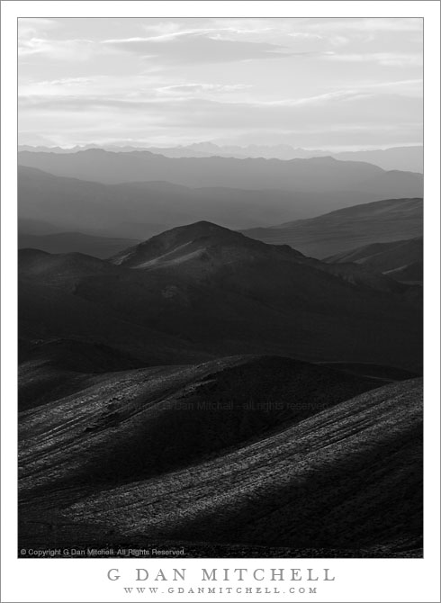
From the Panamints to the Sierra, Evening. Death Valley National Park, California. March 30, 2011. © Copyright G Dan Mitchell – all rights reserved.

The Sierra Nevada in evening light as seen from Aguereberry Point in Death Valley National Park’s Panamint Range.

I made this photograph from Aguereberry Point shortly before sunset. Aguereberry Point is a lonely prominence over 6000′ above Death Valley, high in the Panamint Mountain range, a place of astonishing panoramic views – and often some significant winds. As I drove the gravel road to the point late in the afternoon I saw three or four other vehicles heading the other direction, but when I arrived at the point a bit more than an hour before sunset no one else was there.

Having photographed here a few times previously, I am becoming more familiar with the challenges and the opportunities of shooting here. One of the challenges – as is the case in many spots in Death Valley – is that certain subjects seem to be “photographable” at very specific times and only for short intervals. One of the most interesting views from Aguereberry is southeast down into Trail Canyon and on to the lower slopes of Wildrose Peak beyond. This is wild, rugged, austere terrain. However, because it lies on the east side of this range the light changes quickly from a washed out blast of daytime sun to sudden deep shadows as the sun drops behind the higher ridges of the Panamints. (Trail Canyon is not seen in this photograph.)

Another challenge is that, impressive and overwhelming as the scale of this grand scene is, it can be difficult to pull interesting compositions out of it. I tend to work with longer lenses here, both to isolate smaller areas out of the huge landscape and to compress distance. In this photograph, the silhouetted crest of the highest part of the Sierra Nevada range is on the horizon, with the intervening ridges of the Panamint Range and others probably including the Inyo Mountains and the ridge just west of Panamint Valley.

And, since I tend towards those large and long lenses… wind is an issue! And on top of Aguereberry Point there is nothing to stop the often strong winds of Death Valley. On this evening the winds were howling, so I found a spot below some rocks where it was a bit less windy and then spent a lot time waiting for momentary lulls in the wind when I could make photographs.

G Dan Mitchell Photography | Flickr | Twitter | Facebook | Email
Text, photographs, and other media are © Copyright G Dan Mitchell (or others when indicated) and are not in the public domain and may not be used on websites, blogs, or in other media without advance permission from G Dan Mitchell.

McGee Canyon and Mount Morgan

McGee Canyon and Mount Morgan

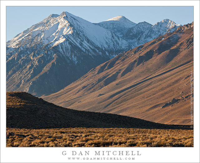
McGee Canyon and Mount Morgan. Owens Valley, California. October 10, 2010. © Copyright G Dan Mitchell – all rights reserved.

Snow crested Mount Morgan rises above McGee Canyon and the sagebrush-covered hills of Owens Valley in the eastern Sierra Nevada.

I’ve been traveling to the Sierra for many years. My first recollection of the range is a faint mental image of a shoreline park at Lake Tahoe when my family moved to California – I was four years old. My next memory is of staying at a small motel in El Portal next to the high water of the Merced River back in the days before the current mega-hotels were erected. One thing that all of my early Sierra experiences had in common is that I always approached the range from the west since I lived (and still live) in the San Francisco Bay Area. For the person whose orientation to the range is from the west, the Sierras are a range that begins almost imperceptibly in the Central Valley. Although you can see distant peaks from the Valley on clear days, it is hard to say where the range begins. As you head east you encounter some very small and rounded hills which gradually get larger. Eventually you are going up more than up and down as you  travel through oak and grass lands. At some point the road rises into forest, but the mountain tops are mostly rounded and forest covered. Keep going and a few rocky prominences begin to appear along the ridges and some distant granite peaks become visible. Only after a lot of driving do you find yourself in the higher reaches of the range, and this only in the few areas where roads cross from west to east. In most places you cannot even see the summit of the range close up from the west without walking a long ways.

It was only many years later that I first went over the summit of the range and saw it from the east side. The Sierra is (are?) completely different when approached this way. Instead of a long, gradual, and relatively gentle rise to high valleys and forests and meadows, the eastern escarpment of the Sierra rises abruptly – one might say violently – and directly, in most places, from the high desert sagebrush country of Owens Valley and similar places. This wall of peaks seems almost inaccessible, and I imagine that many people who only drive past on highway 395 must regard it that way.

This photograph was made from a spot just a mile or two east of highway 395, out an a gravel road that I know. I have photographed this shadowed foreground ridge and the peaks beyond in the past, so I had a fairly good idea of what I would find at this location before I made the photograph on an early October morning when fall storms had dusted the highest peaks with snow. I used a somewhat long lens and tight framing to emphasize the rise from the foreground desert to the very high peaks beyond.

This photograph is not in the public domain and may not be used on websites, blogs, or in other media without advance permission from G Dan Mitchell.

G Dan Mitchell Photography
Flickr | Twitter | Facebook Fan Page | Facebook | Friendfeed | Email

Mount Morrison and Desert Hills, Morning

Mount Morrison and Desert Hills, Morning

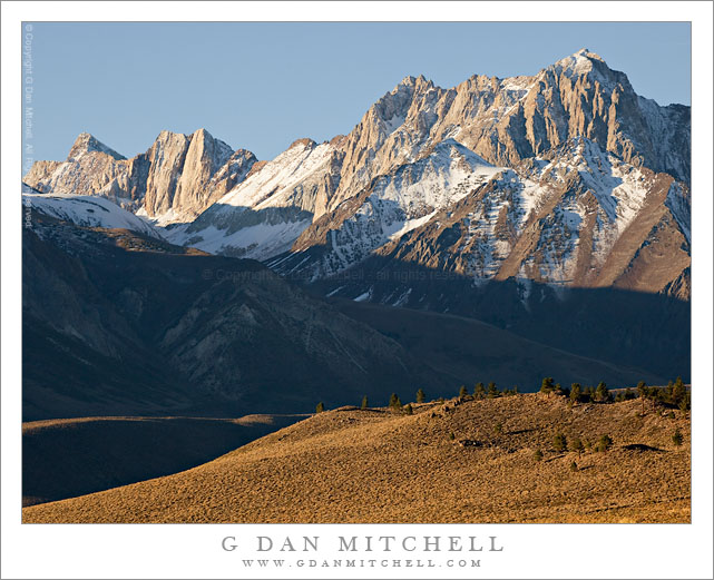
Mount Morrison and Desert Hills, Morning. Owens Valley, California. October 10, 2010. © Copyright G Dan Mitchell – all rights reserved.

Early morning light on sagebrush covered Owens Valley hills and the Sierra crest near Mount Morrison.

I was out in this section of Owens Valley early on this October morning, initially to photograph at a small lake further out in the valley. However, knowing parts of this area pretty well from past visits, I wanted to try a photograph that included the foreground tree-covered ridge in morning light with the Sierra peaks in the background – so I headed back on a gravel road that travels a bit north of the paved road I had taken earlier in the morning. I found this scene with the early light illuminating the crest of the Sierra and the sagebrush-covered foreground hills, but with morning shadows still lying across the lower eastern face of the Sierra just south of Convict Lake.

The dusting of early season snow was left over from a week of early autumn storms. Mt. Morrison is the huge and impressive summit at the right end of the ridge. Mt. Baldwin is the small but very high summit near the left end. In between is a vertical rock face that appears to be split by a crack – I think it is called “the Great White Fang.”

This photograph is not in the public domain and may not be used on websites, blogs, or in other media without advance permission from G Dan Mitchell.

G Dan Mitchell Photography
Flickr | Twitter | Facebook Fan Page | Facebook | Friendfeed | Email