Tag Archives: 395

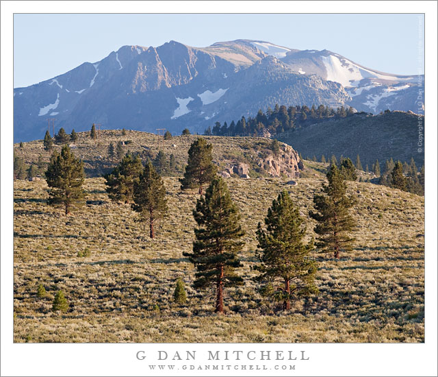
Eastern Sierra Nevada Near June Lake

Eastern Sierra Nevada Near June Lake

Eastern Sierra Nevada Near June Lake. Mono County, California. August 10, 2011. © Copyright 2011 G Dan Mitchell – all rights reserved.

Trees ascend sage-covered hills toward the Sierra Nevada crest near June Lake, California.

Near highway 395 in Mono County, the main north-south route east of the Sierra crest, these open stands of large conifers ascend from the high desert sagebrush country towards the peaks of the Sierra crest, which rise much more abruptly on this side of the range than on the gentle west side. The tall ridge is above the June Lakes resort area between Mammoth Lakes and Lee Vining.

While my primary goal on this trip was to photograph in the Yosemite high country along Tioga Pass Road, smoke from a wildfire near Glacier Point in the park was drifting over the Tuolumne area and creating a lot of very non-photogenic haze. I had a hunch that by dropped over to the east side of the range I might be able to get away from the smoke or at least find areas where it wasn’t so thick. The smoke was still affecting the light near Lee Vining, but I didn’t have to drive too far south to get out of its path, though even here there is a bit of haze increasing the effect of atmospheric recession.

G Dan Mitchell Photography
About | Flickr | Twitter | FacebookGoogle+ | 500px.com | LinkedIn | Email

Text, photographs, and other media are © Copyright G Dan Mitchell (or others when indicated) and are not in the public domain and may not be used on websites, blogs, or in other media without advance permission from G Dan Mitchell.

(Basic EXIF data may be available by “mousing over” large images in posts. Leave a comment if you want to know more.)

Reader Question: Yosemite in October

“Tom” recently sent me a question about visiting Yosemite in October, and I thought I would reply here where others can see the information, too.

I will be in CA in October and was planning on going up to Yosemite for a few days. Any advice you’d care to share would be greatly appreciated. :)

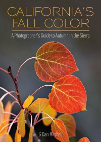
California’s Fall Color: A Photographer’s Guide to Autumn in the SierraBefore I answer your question below, you might be interested in my book, California’s Fall Color: A Photographer’s Guide to Autumn in the Sierra, available from Heyday Books and from Amazon. It shares a lot of what I have learned about locating and photographing Sierra Nevada fall color, along with a large collection of my autumn photography in locations from the eastern Sierra to Yosemite Valley.
October may be my favorite time of the year to be in the Sierra in general and in Yosemite in particular. While some things that draw people to Yosemite (waterfalls, for example) are not likely to be at their best, there are many other wonderful attractions at this time of year. October is a transition month in the Sierra, with early October often having the character of late summer and late October often feeling more like early winter. Conditions can change quickly, and warm and sunny days may be followed by a day of rain or snow.

Autumn Light, Yosemite High Country

I have divided the following description geographically to separately describe Yosemite Valley, the Yosemite high country, and the east side of the Sierra Nevada range.

Yosemite Valley – The busy summer tourism season winds down in September after the Labor Day weekend, and by October the Valley is no longer quite the crowded, urbanized, noisy zoo that it can be on the worst days during the summer. (I generally steer clear of the Valley in June, July, August, and early September.) The meadows will have turned golden brown already, and real autumn colors begin to appear later in the month. While some are subtle, such as the transition of the oak tree leaves, others are quite striking, including brilliant fall colors of maples and dogwood trees. I make a habit of shooting autumn colors in The Valley every fall right around the end of October or beginning of November. (You’ll often find me there on Halloween!) Continue reading Reader Question: Yosemite in October

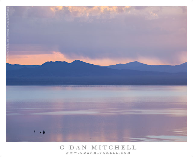
Purple Dawn, Mono Lake

Purple Dawn, Mono Lake

Purple Dawn, Mono Lake. Eastern Sierra Nevada, California. June 29, 2010. © Copyright G Dan Mitchell – all rights reserved.

Pastel shades of purple and blue just before dawn at Mono Lake.

Back at the end of 2010 I wrote that I was going through all of my 2010 raw files to look for images that I had passed over, as I do near the end of every year. Things got busy, I got distracted, and I only got about half way through the year’s files. Recently I have returned to the 2010 photographs to try to complete the task, and this is one of the photographs that I rediscovered as I resumed the search with images taken near the end of June.

This was my first real photographic trip to the Sierra during the summer season of 2010. I had made a brief trip up there, visiting Yosemite Valley and then crossing Tioga Pass, back in early June right about the time that the pass opened. However, on this trip I was able to spend several days in the high country and kicking around near Mono Lake. This can be a great time of the year up there since conditions range from what seems like late winter in the high country to real summer in places like Owens Valley and around Mono Lake.

On this morning I decided that I’d head down to Mono Lake well before dawn and see what I could turn up. I did not go to the iconic South Tufa area on this morning, thinking instead that I’d try for some different and longer views of the lake. (Later in the morning I traveled a good distance south of the lake on the less-used section of highway 120.) There were, obviously, clouds in the morning and they blocked the sunrise. However, the light glowed through and over and under and around them, and even though there was not direct light in very early morning image, the colors were quite something. The group of tufa towers at the lower left are offshore not far from the South Tufa area.

G Dan Mitchell Photography | Flickr | Twitter | Facebook | Email
Text, photographs, and other media are © Copyright G Dan Mitchell (or others when indicated) and are not in the public domain and may not be used on websites, blogs, or in other media without advance permission from G Dan Mitchell.

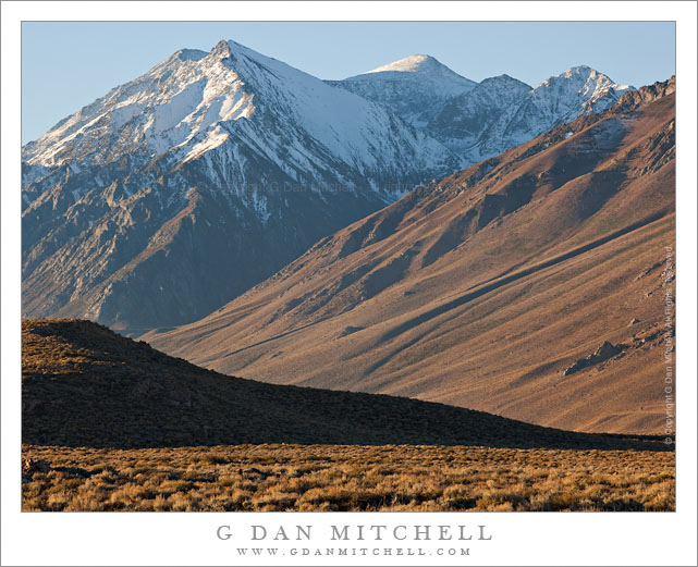
McGee Canyon and Mount Morgan

McGee Canyon and Mount Morgan

McGee Canyon and Mount Morgan. Owens Valley, California. October 10, 2010. © Copyright G Dan Mitchell – all rights reserved.

Snow crested Mount Morgan rises above McGee Canyon and the sagebrush-covered hills of Owens Valley in the eastern Sierra Nevada.

I’ve been traveling to the Sierra for many years. My first recollection of the range is a faint mental image of a shoreline park at Lake Tahoe when my family moved to California – I was four years old. My next memory is of staying at a small motel in El Portal next to the high water of the Merced River back in the days before the current mega-hotels were erected. One thing that all of my early Sierra experiences had in common is that I always approached the range from the west since I lived (and still live) in the San Francisco Bay Area. For the person whose orientation to the range is from the west, the Sierras are a range that begins almost imperceptibly in the Central Valley. Although you can see distant peaks from the Valley on clear days, it is hard to say where the range begins. As you head east you encounter some very small and rounded hills which gradually get larger. Eventually you are going up more than up and down as you  travel through oak and grass lands. At some point the road rises into forest, but the mountain tops are mostly rounded and forest covered. Keep going and a few rocky prominences begin to appear along the ridges and some distant granite peaks become visible. Only after a lot of driving do you find yourself in the higher reaches of the range, and this only in the few areas where roads cross from west to east. In most places you cannot even see the summit of the range close up from the west without walking a long ways.

It was only many years later that I first went over the summit of the range and saw it from the east side. The Sierra is (are?) completely different when approached this way. Instead of a long, gradual, and relatively gentle rise to high valleys and forests and meadows, the eastern escarpment of the Sierra rises abruptly – one might say violently – and directly, in most places, from the high desert sagebrush country of Owens Valley and similar places. This wall of peaks seems almost inaccessible, and I imagine that many people who only drive past on highway 395 must regard it that way.

This photograph was made from a spot just a mile or two east of highway 395, out an a gravel road that I know. I have photographed this shadowed foreground ridge and the peaks beyond in the past, so I had a fairly good idea of what I would find at this location before I made the photograph on an early October morning when fall storms had dusted the highest peaks with snow. I used a somewhat long lens and tight framing to emphasize the rise from the foreground desert to the very high peaks beyond.

This photograph is not in the public domain and may not be used on websites, blogs, or in other media without advance permission from G Dan Mitchell.

G Dan Mitchell Photography
Flickr | Twitter | Facebook Fan Page | Facebook | Friendfeed | Email