
Tag Archives: green

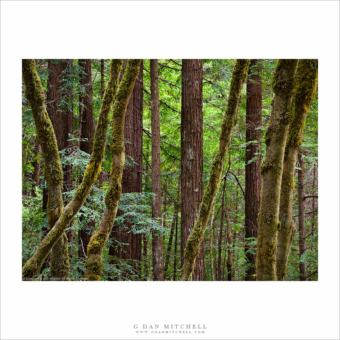
Forest, Gazos Creek

“Forest, Gazos Creek” — A dense mixed redwood and maple forest along Gazos Creek, California.

Today I used the excuse of driving my son over the hill to UC-Santa Cruz for his summer school class to get in a short trip up the coast north of Santa Cruz. We are in the midst of the “June gloom” period along the coast of northern California, and the fog doesn’t clear until later in the day, and never does clear completely in some areas. As I left Santa Cruz the fog bank was visible but well off-shore, but as I travelled north I eventually encountered it right around Año Nuevo State Reserve.

I had a vague plan to check out Gazos Creek Road, having heard from some other photographers that there are interesting redwood trees and other subjects in that area. Since I still had some time, I turned up the road and it quickly narrowed as it followed the creek and the bottom of the canyon into the Santa Cruz Mountains. Since this was more or less a scouting trip, I drove all the way to the end of the road without stopping much, but on the way back down I decided to stop and make some photographs of this grove of new-grown coast redwoods mixed with the curving trunks of big leaf maple trees.


G Dan Mitchell is a California photographer and visual opportunist. His book, “California’s Fall Color: A Photographer’s Guide to Autumn in the Sierra” (Heyday Books) is available directly from him.

G Dan Mitchell: Blog | Bluesky | Mastodon | Substack Notes | Flickr | Email


All media © Copyright G Dan Mitchell and others as indicated. Any use requires advance permission from G Dan Mitchell.
Spring Cascade, Tioga Pass Road

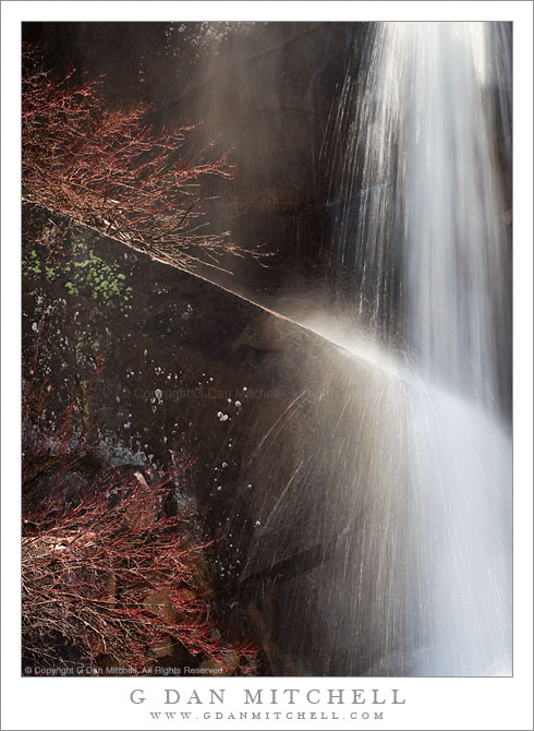
Spring Cascade, Tioga Pass Road

Spring Cascade, Tioga Pass Road. Yosemite National Park, California. June 18, 2011. © Copyright G Dan Mitchell – all rights reserved.

A seasonal stream cascades over a granite ledge along Tioga Pass Road, Yosemite National Park.

This small cascade is one of hundreds seen along Tioga Pass Road on June 18 this year, the day the park service opened the road for the season. The opening date was later than usual due to the heavy snowpack, and there was water everywhere as the snow melt accelerated in the late spring weather. It was almost embarrassingly easy to find and photograph these subjects – this one was right next to the roadway.

This is part of a larger cascade, out of view to the right, that flows off the top of a granite area and drops quickly across granite cliffs. Here the water strikes a slanting ledge and bits of spray explode almost like Fourth of July fireworks. Obviously, the somewhat unusually long shutter speed was selected with this effect in mind. The reddish plants to the left, just beginning to come back to life after the long winter, hint at the early date in the season.

G Dan Mitchell Photography | Flickr | Twitter (follow me) | Facebook (“Like” my page) | LinkedIn | Email
Text, photographs, and other media are © Copyright G Dan Mitchell (or others when indicated) and are not in the public domain and may not be used on websites, blogs, or in other media without advance permission from G Dan Mitchell.
Young Trees and Meadow, Tioga Pass

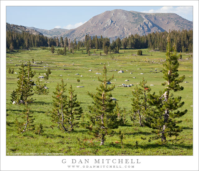
Young Trees and Meadow, Tioga Pass

Young Trees and Meadow, Tioga Pass. Yosemite National Park, California. July 22, 2010. © Copyright G Dan Mitchell – all rights reserved.

Young trees grow along the edge of subalpine meadows at Tioga Pass, Yosemite National Park.

This meadow, right below Tioga Pass – which is among the trees in the saddle in the upper part of the photograph – is something of a magical spot in the Sierra. It is, of course, the highest point that you can drive to in the park, and it sits right on top of the crest of the Sierra Nevada. At just slightly less than 10,000′ of elevation it is verging on the true alpine zone. Because of elevation and location, it is only open for a few months each year between roughly the end of spring and generally some time in November. (For those of us who think of this as it looks in summer, it is sobering to remember that during the majority of the year it is a cold and snow-covered place.) Once you pass over Tioga you begin to descend into the very different world of the high deserts east of the crest. Yes, it still feels like the high country for a while, but within miles you are in hot dry places that are not at all like this alpine terrain.

Oddly, while a thin band of trees crosses the saddle at the pass, much of the area on either side is meadow. This section is on the “Yosemite side,” and is an extension of the many meadows along the Dana Fork of the Tuolumne River which drains this area around Mount Dana. As if to reinforce the idea that this is not as gentle a place as it may appear in the summer, parts of the meadow are filled with the bleached remains of trees struck down by avalanches from the ridge that is out of this photograph to the left. The trail to the summit Mt. Dana, of the second-highest peak of Yosemite (being a few feet shorter than Mt. Lyell), begins by crossing this meadow.

Although I drive over this pass with some frequency, I virtually always stop and get out of the car and look around for at least a moment. On this late-July visit I stayed more than a moment, spending a good portion of an afternoon wandering about the meadow and photographing these young trees, small streams and ponds, fallen trees, some of the more distant mountains, and much else.

G Dan Mitchell Photography | Flickr | Twitter (follow me) | Facebook (“Like” my page) | LinkedIn | Email
Text, photographs, and other media are © Copyright G Dan Mitchell (or others when indicated) and are not in the public domain and may not be used on websites, blogs, or in other media without advance permission from G Dan Mitchell.
Bull Tule Elk, Point Reyes

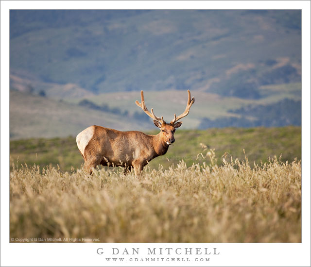
Bull Tule Elk, Point Reyes

Bull Tule Elk, Point Reyes. Point Reyes National Seashore, California. May 30, 2011. © Copyright G Dan Mitchell – all rights reserved.

A bull tule elk grazes among the grassy hills near Drakes Bay, Point Reyes National Seashore.

The group of bull tule elk that I encountered at Point Reyes National Seashore on Memorial Day was large and tended to stick together very closely. Most of the photographs that I shot include multiple animals. However, this fellow paused for a moment as the others moved to the right and I had a chance to make a few photographs containing only a single elk. He was even thoughtful enough to pose in front of the rolling green hills rising above Tomales Bay in the distance!

The elk were apparently native to Point Reyes – and much of the rest of California – but were decimated in the 1800s as a result of hunting and displacement by cattle. As I understand it, a small group was reintroduced to Point Reyes in the 1970s or thereabouts. Eventually they were so successful that the herd began to expand to other areas of the park, and the area has now reached it normal carrying capacity for these animals. This specimen and the group it was part of were along the top of the rolling hills above Drakes Bay.

G Dan Mitchell Photography | Flickr | Twitter (follow me) | Facebook (“Like” my page) | LinkedIn | Email
Text, photographs, and other media are © Copyright G Dan Mitchell (or others when indicated) and are not in the public domain and may not be used on websites, blogs, or in other media without advance permission from G Dan Mitchell.