Tag Archives: mount

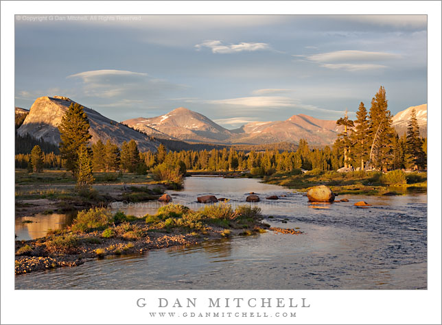
Twilight, Tuolumne River and Tuolumne Meadows, Sierra Crest

Twilight, Tuolumne River and Tuolumne Meadows, Sierra Crest
Light from lenticular cloud-filled twilight sky illuminates Tuolumne Meadows and the Tuolumne River with Lembert Dome, Mount Dana, and Mount Gibbs beyond, Yosemite National Park, California

Twilight, Tuolumne River and Tuolumne Meadows, Sierra Crest. Yosemite National Park, California. July 10, 2009. © Copyright G DanMitchell – all rights reserved.

Light from lenticular cloud-filled twilight sky illuminates Tuolumne Meadows and the Tuolumne River with Lembert Dome, Mount Dana, and Mount Gibbs beyond, Yosemite National Park, California.

Yes, one more in the series – perhaps the final one, but we’ll see. I suppose it could be titled, “It ain’t over until it’s over.”

After the astonishing colors of the brightest moments of the sunset fade, one might think that the show is over – but often it isn’t quite done. I remember the time I first learned the value of sticking around until it is too dark to photograph any more. This “lesson” happened a bit further west in Tuolumne Meadows some years ago. I was photographing in the evening, shooting across a transitory early-season lake. Another nearby photographer was photographing the same beautiful evening, and he pointed out that some of his favorite photographs actually came after the intense light of sunset and during the time when the light almost begins to feel more like night than day.

Two wonderful things can happen at this hour. First, you may witness unexpected “color surprises” even after the show seems to be over. (I learned this a second time a few years later after packing up at the summit of Lembert Dome and heading down – only to be surprised by a wonderful and completely unexpected suffusion of beautiful light, and having to quickly unpack to squeeze off a couple of exposures.) Second, as astonishing as the earlier brilliant colors are, this is the time for some wonderfully deep and subtle colors that you just won’t see at any other time of day.


G Dan Mitchell is a California photographer and visual opportunist. His book, “California’s Fall Color: A Photographer’s Guide to Autumn in the Sierra” is available from Heyday Books and Amazon.

Blog | About | Flickr | FacebookEmail

Links to Articles, Sales and Licensing, my Sierra Nevada Fall Color book, Contact Information.


All media © Copyright G Dan Mitchell and others as indicated. Any use requires advance permission from G Dan Mitchell.

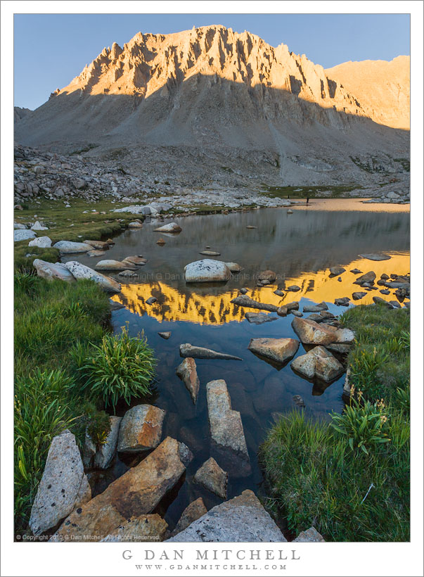
Mount Whitney, Guitar Lake, Evening

Mount Whitney, Guitar Lake, Evening
The west face of Mount Whitney at sunset, viewed from Guitar Lake

West Face of Mount Whitney, Guitar Lake, Evening. Sequoia National Park, California. August 10, 2008. © Copyright 2008 G Dan Mitchell – all rights reserved.

The west face of Mount Whitney at sunset, viewed from Guitar Lake

Near the end of my early August 2008 trans-Sierra pack trip from Crescent Meadow to Whitney Portal we found ourselves at Guitar Lake, the traditional base camp for west side approaches to Mount Whitney. We arrived fairly early to set up camp, and after lazing around and finally getting dinner it was time to do some photography – so I took my equipment and headed to the outlet of the lake where I made this photograph as the last sun hit the peak and was reflected in the lake.


G Dan Mitchell is a California photographer and visual opportunist. His book, “California’s Fall Color: A Photographer’s Guide to Autumn in the Sierra” is available from Heyday Books and Amazon.
Blog | About | Flickr | Twitter | FacebookGoogle+ | LinkedIn | Email


All media © Copyright G Dan Mitchell and others as indicated. Any use requires advance permission from G Dan Mitchell.


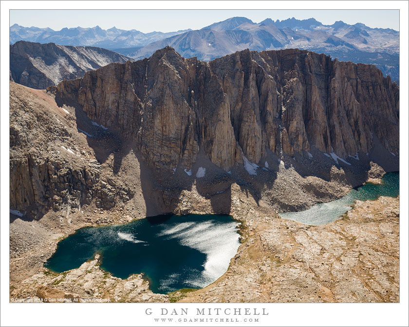
Hitchcock Lakes

High Lakes, Trail Crest
Terrain to the west of Whitney Trail Crest

Hitchcock Lakes from the Mt. Whitney Trail. Sequoia National Park, California. August 11, 2008. © Copyright 2008 G Dan Mitchell – all rights reserved.

Hitchcock Lakes seen from the Mt. Whitney Trail.

I climbed Mount Whitney – again – on August 11, 2008 after crossing the Sierra Nevada from west to east on Sequoia National Park’s High Sierra Trail. I’ve been to the summit a couple times in the past. Last year I swore I would not climb this peak again, mainly because there are so many other beautiful things to see in the Sierra and I didn’t feel a strong need to do this again. But my friends proposed a trip that concluded with the Whitney ascent, and I couldn’t say no.

A traditional starting point for ascents from the west is Guitar Lake, a small – and often somewhat crowded – little lake in a truly alpine setting just above timberline. From here the trail ascends the valley containing these lakes, leading to the junction with the trail from the east side just before reaching the ridge, and then a lateral trail traverses out to the summit of Whitney.

It won’t surprise anyone if I say that there are some wonderful panoramas to be seen from almost any point on this climb. One of my favorite is this view back across the valley from which the trail ascended and towards high elevation Hitchcock Lakes and the ridge between them and the Crabtree Basin beyond.

(Oddly, I often find the summit view to be photographically uninspiring, and I usually end up just making some “record” photos there and a perfunctory pano or two.)


G Dan Mitchell is a California photographer and visual opportunist whose subjects include the Pacific coast, redwood forests, central California oak/grasslands, the Sierra Nevada, California deserts, urban landscapes, night photography, and more.
Blog | About | Flickr | Twitter | FacebookGoogle+ | 500px.com | LinkedIn | Email

Text, photographs, and other media are © Copyright G Dan Mitchell (or others when indicated) and are not in the public domain and may not be used on websites, blogs, or in other media without advance permission from G Dan Mitchell.

Cloud Shadows on North Dome

Cloud Shadows on North Dome
Cloud Shadows on North Dome. Yosemite National Park, California. May 16, 2008. © Copyright G Dan Mitchell – all rights reserved.

Late afternoon cloud shadows race across the top of North Dome with Mount Hoffman beyond and Yosemite Valley below. Photographed from Glacier Point.

Mt. Hoffman is one of the most historic locations in the park. It was from Hoffman’s summit that members of the California Survey Party did much of their early mapping work in the 1800s. Today there is almost a trail to the summit – a steep but not overly difficult route (if you are used to off-trail alpine travel) from May Lake.

keywords: california, national park, Sierra Nevada, Spring, Yosemite, valley, north, dome, basket, mount, hoffman, ridge, mountain, snow, glacier point, forest, rock, outcrop, cliff, boulder, overlook, travel, scenic, landscape, stock