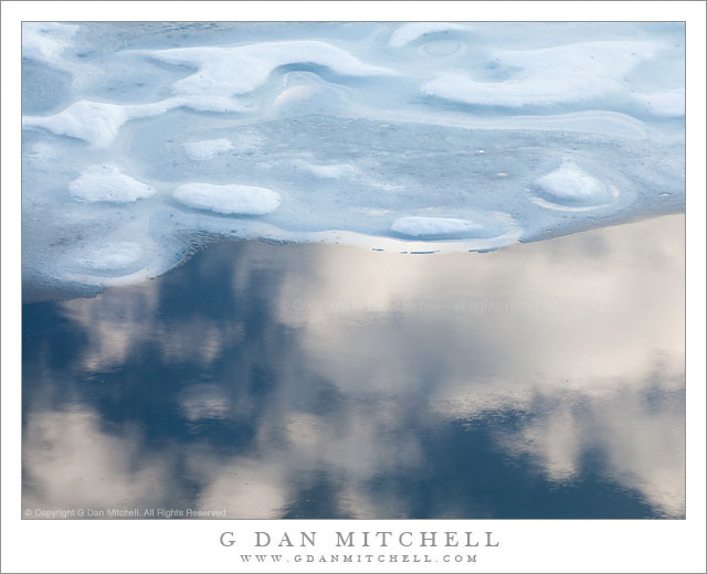
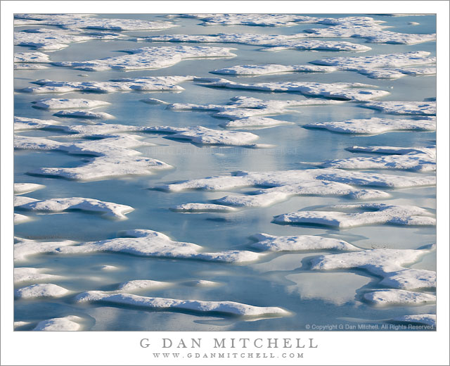
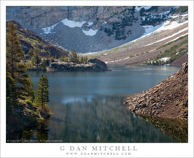
Clouds in blue sky are reflected in the surface of Gaylor Lake next to melting winter ice.
This photograph is very similar to another I made on this late June evening in 2010 when a small group of us hiked over a ridge near Tioga Pass to find a snow covered valley and this lake that was still almost completely covered with ice. The deep blue water near the edge of the melting ice along the shoreline reflected evening clouds passing overhead, and there were quite a few possible compositions combining the clouds, blue sky, curving edge of the ice and the interesting formations where the ice surface was melting. I made quite a few photographs – some up close like this one and others taking in the larger landscape. As I was recently reviewing raw files from 2010, I ended up spending quite a bit of time with this set of images!
Pools of water between sections of melting ice reflect evening clouds above Gaylor Lake, Yosemite National Park.
I continue to mine the vein of photographs from this early summer afternoon and evening visit to a lake not far from the Sierra crest at Tioga pass. In my defense I’ll point out that the conditions were variable and that I shot this subject in a number of different ways – close up views of ice and water, images that focus on the clouds, some that take in the more distant landscape of the surrounding ridges and peaks, others that focus on just the patterns of water and ice, and all shot as the light transitioned toward evening and was occasionally interrupted by clouds.
It is very unusual for me to get to visit a large lake with quite this combination of conditions. Sometimes in the early season I might encounter a lake that is still covered with ice, and later I often pass by lakes that are mostly clear but have snow banks and ice coming down to the shoreline. But in this case the lake was still covered completely in ice, but the ice was melting and creating pools of blue water on top of the remaining ice, and this water reflected the sky and passing clouds. I think the first things that might catch your attention in this photograph are the white areas of ice and the blue areas in between. But if you look a bit closer you see that the blue areas are anything but uniform. The shades of blue vary tremendously, sometimes approaching black in the shadows along the edges of the ice, spanning a range of shades in the open water, and then heading towards white in areas that reflect the clouds floating above the lake.
Early season morning light on Ellery Lake near Tioga Pass.
I made this photograph on the same early-season morning on which I made the vertical format photograph of the same scene that I recently posted. Ellery Lake is alongside highway 120, the “Tioga Pass Road,” just beyond the eastern boundary of the park and the Sierra crest. To be completely forthcoming, I made this photograph from the side of the road! (The many individuals who know this area well, and who have probably stopped to look at the same scene, already knew that…)
To briefly recap, the road here curves around the upper end of the lake above this small bay. Looking across the bay, the rocky edges of the lake are visible along with the steep talus slopes ascending to the peaks around Mt. Dana beyond. The spot has a natural beauty in terms of the forms of the landscape, but I think it is difficult to photograph as a whole – the light is the tricky thing. The earliest morning light is block by high peaks to the east and the late afternoon light goes quickly from sun to shade as the sun drops below ridges behind the camera position, and this light can be fairly flat since it comes from directly behind. This photograph was made in the morning, but not close to sunrise at all – it was two or three hours later. Even here the scene isn’t without technical challenges, especially from the dynamic range that spans from the shadows behind backlit rocks and trees to the very bright snow fields at upper right.
A Sierra Nevada creek, swollen from spring runoff, flows across granite slabs – Yosemite National Park.
The image and sound of spring runoff water rushing over granite slabs are common in the high Sierra. Though the scene is almost a generic one, for me it also brings to mind many very specific places and experiences throughout the range. (Some of my backpacking friends might think of a spot along Tyndall Creek on the John Muir Trail where we have camped more than once.)
The exact location of this little bit of cascading and rushing water is probably not very important – you are never far from a little scene like this if you are near almost any little creek high in the Sierra! Here the water flows mostly across very smooth rock – so smooth that you can see right through the rushing water to the rocks in many places. In this precise spot there is a weakness in the rock and a small ledge has formed, and the result is a bit of white water.
I’ll share a few technical observations about this photograph, too. First, there isn’t a sharp thing in the image! While sharp focus can be important, I don’t think it is here. (Though if you look closely, the patterns of the blurred, fast-moving water are sharp in a fuzzy sort of way. ;-) The rocks beneath the water cannot be sharp because they are blurred by the water; the water cannot be sharp since I intentionally chose a shutter speed that allowed motion blur. Second, I have to admit that I did not originally have a black and white photograph in mind when I made this exposure. I worked on it for a while in color and though I liked the motion of the water I just wasn’t happy with the coloration of the scene. I finally realized that this image wasn’t about the “reality” of the rocks and water but about creating an impression of the rushing water – and that perhaps monochrome might work. Third, this is yet another “landscape” photograph made with a lens that the “common wisdom” (which often turns out to be not so wise) would say is not a landscape lens – a 70-200mm zoom.