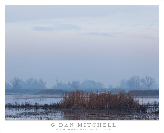
Foggy Marsh, Dawn Light. San Joaquin Valley, California. January 1, 2013. © Copyright 2012 G Dan Mitchell – all rights reserved.
Dawn light begins to illuminate high clouds above the fog over a California Central Valley marsh
Have I mentioned how much I love fog and pre-dawn and post-sunset light? I guess I have… :-) I made this photograph on New Years Day 2013, shortly after arriving at the San Joaquin location in near darkness to meet a group of friends and fellow “wild goose chasers.” I can hardly imagine a better way to greet the new year than to join like-minded friends in such a place!
This was a day of surprises of various sorts. A painter showed up to join our photography-centric little band! We took a midday break to go see a movie. Although they were too far away to see clearly in the early morning haze, huge numbers of cranes arrived just after sunset. A solitary flock of white pelicans surprised us with an unexpected fly-over at one point. And the light and atmosphere were about impossible to predict. It was cold and seemed very clear on the way to our location, but as we arrived I could see hints of fog forming above this wet and cold area. Just before dawn it was quite hazy and gray, providing neither perfectly clear air nor the evocative and mysterious atmosphere of thick tule fog. But as sometimes happened, as the sky became lighter at sunrise, the brighter clouds and sky above the low elevation murk began to reveal itself, much as a hidden theatrical set may become visible behind a scrim. We stopped at the spot where I made this photograph because we could barely see a very large flock of (hundreds or, more likely, thousands) of sandhill cranes across the pond near the levee next to the trees. We stood around waiting for the birds to fly our direction, which they mostly did not do. But as we waited I began to see a bit of color and definition come to the higher clouds far above the low fog.
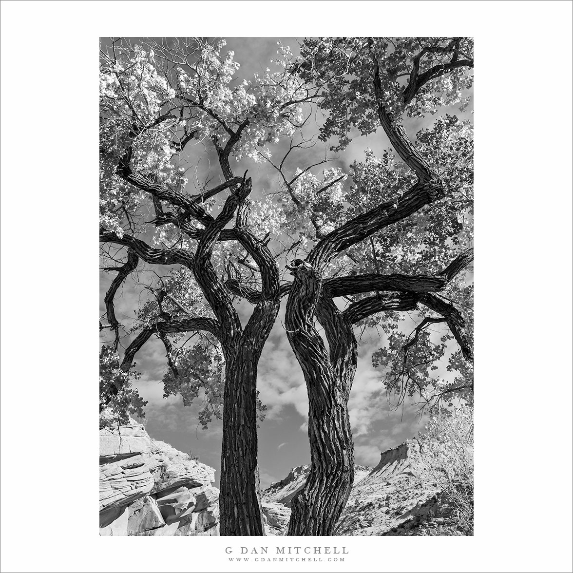
 G Dan Mitchell is a California photographer and visual opportunist whose subjects include the Pacific coast, redwood forests, central California oak/grasslands, the Sierra Nevada, California deserts, urban landscapes, night photography, and more.
Blog | About | Flickr | Twitter | Facebook | Google+ | 500px.com | LinkedIn | Email
Text, photographs, and other media are © Copyright G Dan Mitchell (or others when indicated) and are not in the public domain and may not be used on websites, blogs, or in other media without advance permission from G Dan Mitchell.