Tag Archives: geology

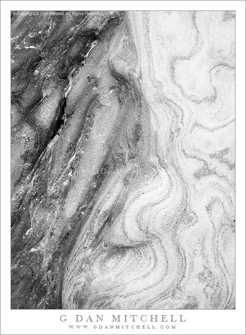
Point Lobos Rock Patterns #1 – July 10, 2010

Point Lobos Rock Patterns #1 – July 10, 2010

Point Lobos Rock Patterns #1 – July 10, 2010. Point Lobos State Reserve, California. © Copyright 2010 G Dan Mitchell – all rights reserved.

Black and white photograph of abstract rock patterns near Weston Beach at Point Lobos State Reserve.

This detail of the Point Lobos shoreline rocks was also photographed in an area just a bit north of Weston Cove where large rocks are lifted up at striking angles and the surf has worn away successive layers of sedimentary rock to reveal wild patterns. Some of the colors in this bit of rock were quite intense – the rock on the left is intensely reddish-brown in the original capture – and seemed to overwhelm the subtle patterns, especially those on the right side of the image.

I don’t know if it is apparent but this is a highly post-processed image. I don’t think it is necessary to spoil the fun by going into all of the gory details, but this image depends quite a bit on work in post.

G Dan Mitchell Photography
About | Flickr | Twitter | Facebook | Google+ | 500px.com | LinkedIn | Email

Text, photographs, and other media are © Copyright G Dan Mitchell (or others when indicated) and are not in the public domain and may not be used on websites, blogs, or in other media without advance permission from G Dan Mitchell.

(Basic EXIF data is available by “mousing over” large images in blog posts. Leave a comment if you want to know more.)

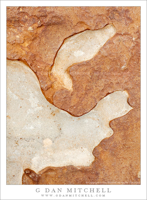
Point Lobos Rock Patterns #2 – July 10, 2010

Point Lobos Rock Patterns #2 - July 10, 2010

Point Lobos Rock Patterns #2 – July 10, 2010. Point Lobos State Reserve, California. © Copyright G Dan Mitchell – all rights reserved.

Detail of patterns in eroded shoreline rocks, Point Lobos State Reserve.

Another photograph of eroded rock patterns near the water not far from Weston Cove at Point Lobos. Here the top layer of reddish rock has worn away in places, leaving a much lighter layer of what I guess is some kind of sandstone below. I’m no geologist, but this section of seashore has fascinating rock formations on the small and large scale where many strata have been exposed by the surf. In some places there a big gobs of conglomerate rock, composed of many smaller rocks “glued” together. In other places very thin layers lie one on top of the other and they have been partially uncovered and worn away by the surf, creating amazing patterns.

This photograph is not in the public domain and may not be used on websites, blogs, or in other media without advance permission from G Dan Mitchell.

G Dan Mitchell Photography | Twitter | Friendfeed | Facebook | Facebook Fan Page | Email

Technical Data:
Canon EOS 5D Mark II
Canon EF 50mm f/1.4 USM
ISO 100, f/16, 1/6 second

keywords: point, lobos, state, reserve, park, california, usa, north america, carmel, big, sur, monterey, peninsula, coast, shore, sea, ocean, pacific, scenic, travel, nature, geology, texture, form, shape, rock, erosion, sand, stone, sedimentary, landscape, detail

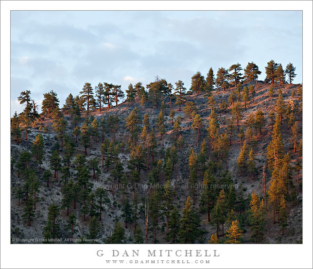
Volcanic Ridge, First Light

Volcanic Ridge, First Light

Volcanic Ridge, First Light. Mono County, California. © Copyright G Dan Mitchell – all rights reserved.

Dawn light illuminates the Jeffrey pine covered ridge of a volcanic dome in the Mono Craters complex, California.

I have a favorite personal spot where I often stop on my way to photograph at South Tufa at Mono Lake. It is spot that you would likely pass right by since, save for a bit of a panoramic view, there is nothing immediately impressive about it, and because you would probably be on your way to someplace else, namely the formations at South Tufa.

On this late June morning I took a break from photographing in the Tuolumne/Tioga Pass area to shoot a bit around Mono Lake, where I had it in mind to shoot certain high desert subjects that I’ve worked on in the past. As I shot those other subjects I’ve often looked up at this particular ridge, been impressed by it, and wondered how to make a photograph of it. When I pulled up at this spot I first intended to shoot a scene that appears to the west, but it turned out to not be quite what I imagined it might be on this morning. Ah, well – that happens! So I turned my camera in a different direction and photographed a somewhat different subject as dawn approached with some very interesting clouds in the sky to the east. As I worked on this I kept glancing up at this volcanic ridge, thinking that the clouds behind it might silhouette the trees along the skyline… but still finding the light too flat and boring. I actually made a photo or two, but wasn’t enthusiastic about it. I turned back to the other subject. A few minutes later I looked back up at this ridge and saw that the first light of early morning sun was glancing across the ridge and lighting up the Jeffrey pines that grow on its slopes. I quickly pivoted around and made a few exposures of the scene in the “good light.”

This photograph is not in the public domain and may not be used on websites, blogs, or in other media without advance permission from G Dan Mitchell.

G Dan Mitchell Photography | Twitter | Friendfeed | Facebook | Facebook Fan Page | Email

Technical Data:
Canon EOS 5D Mark II
Canon EF 70-200mm f/4 L USM at 168mm
ISO 100, f/8, 1/15 second

keywords: jeffrey, pine, forest, mono, county, craters, northwest, coullee, upper, dome, ridge, skyline, dawn, light, morning, early, sky, clouds, cinder, pumice, rhyolite, scree, rock, volcanic, geology, landscape, scenic, travel, california, usa, north america, mountain, hill, stock

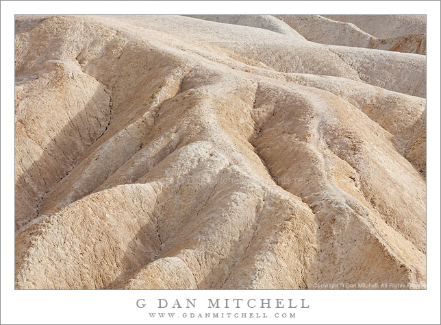
Erosion Patterns in Afternoon Light, Zabriskie Point

Erosion Patterns in Afternoon Light, Zabriskie Point

Erosion Patterns in Afternoon Light, Zabriskie Point. Death Valley National Park, California. March 29, 2010. © Copyright G Dan Mitchell – all rights reserved.

Slightly overcast afternoon light on erosion patterns in the Gower Gulch area of Zabriskie Point, Death Valley National Park, California.

After posting such a long string of close views of the hills at Zabriskie Point… it is starting to become difficult to say much original and new about the photographs in this series! This one was made rather late in the afternoon – about 4:00 p.m. – when the light is usually still too harsh and bright for most photography here. Fortunately, some high and thin clouds diffused the light a bit – but still didn’t take the light too far in the soft direction.

It perhaps goes without saying that this another in my series of long-lens studies of small elements of the large and iconic scene at this location. I’ve photographed this particular bit of folded geology before, and I’m still interested in the combination of soft, almost organic shapes and the crazy patterns of lines and shapes heading every which way. From lower left to upper right the lines shift almost completely.

This photograph is not in the public domain and may not be used on websites, blogs, or in other media without advance permission from G Dan Mitchell.

G Dan Mitchell Photography | Twitter | Friendfeed | Facebook | Facebook Fan Page | Email

Technical Data:
Canon EOS 5D Mark II
Canon EF 100-400mm f/4.5-5.6 L IS USM at 200mm
ISO 100, f/16, 1/60 second

keywords: gower, gulch, zabriskie, point, erosion, gully, ridge, hill, crack, dirt, curve, fold, geology, shadow, light, afternoon, overcast, diffuse, death valley, national, park, california, usa, north america, landscape, nature, scenic, travel, detail, stock