Tag Archives: river

Small Trees and Plants, Granite Slabs

Small Trees and Plants, Granite Slabs

Small Trees and Plants, Granite Slabs. Yosemite National Park, California. September 15, 2011. © Copyright 2011 G Dan Mitchell – all rights reserved.

Small trees and plants grow in a thin crack among stained granite slabs, Yosemite National Park.

Just over a small hill from the campsite on the first nights of my recent Yosemite back-country photography trip, the Tuolumne River cuts down through rocky terrain and past large granite slabs marked by intrusions of red rock. As is often the case in the Sierra, any tiny crack or weakness in the rock is enough for plants to get started. This very think crack supports a “grove” of very small trees, along with some other plants.

The previous week had been a rainy one, including the night before, when I arrived just in time to set up my tent before the rain began. As a result, water had been draining across this granite slope and highlighting the natural seepage lines on the rock and the colors of various deposits from the more colorful rock above and embedded in the granite slabs. I made this photograph in the very soft early morning light before the sun had risen high enough to send direct light down into the canyon.

G Dan Mitchell Photography
About | Flickr | Twitter | FacebookGoogle+ | 500px.com | LinkedIn | Email

Text, photographs, and other media are © Copyright G Dan Mitchell (or others when indicated) and are not in the public domain and may not be used on websites, blogs, or in other media without advance permission from G Dan Mitchell.

(Basic EXIF data may be available by “mousing over” large images in posts when this page is viewed on the web. Leave a comment if you want to know more.)

Forest And Cliffs, Evening

Forest And Cliffs, Evening

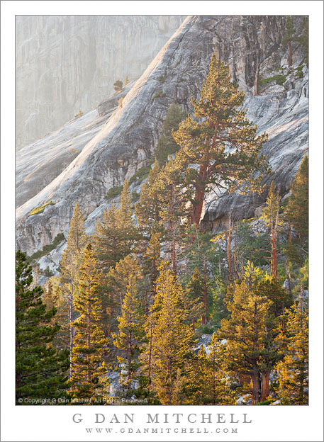
Forest And Cliffs, Evening. Yosemite National Park, California. September 15, 2011. © Copyright 2011 G Dan Mitchell – all rights reserved.

Forest trees, lit by evening light, ascend granite cliffs in the Yosemite National Park back-country.

From September 14 through September 21 I spent eight days on the trail in the back-country of Yosemite National Park, starting and ending at Tuolumne Meadows, taking time to photograph some of the areas I passed through. I was fortunate to be able to join up with a group of five outstanding Yosemite photographers on all but the last day – they were to remain in the high country for several more days after I left.

On the second evening of the trip I walked to a nearby rocky area to photograph, well, rocks – granite slabs, actually, that are marked by reddish deposits and broken up by trees struggling to grow in cracks and small pockets of soil in the rock. I also wanted to photograph a nearby section of the Tuolumne River as it descended through some steep areas of granite as it entered a narrower section of canyon. I started working perhaps an hour and a half or so before sunset, and as actual sunset approached I looked up from these subjects to see the light from the lowering sun beginning to backlight trees high on a cliff above my position and to angle across the edges of the cliffs themselves. I switched gears – and lenses – and began to work on finding compositions in this rocky terrain, seen through a bit of haze and lit by increasingly warm light.

G Dan Mitchell Photography
About | Flickr | Twitter | FacebookGoogle+ | 500px.com | LinkedIn | Email

Text, photographs, and other media are © Copyright G Dan Mitchell (or others when indicated) and are not in the public domain and may not be used on websites, blogs, or in other media without advance permission from G Dan Mitchell.

(Basic EXIF data may be available by “mousing over” large images in posts when this page is viewed on the web. Leave a comment if you want to know more.)
Owens Valley Sky

Owens Valley Sky
Owens Valley Sky

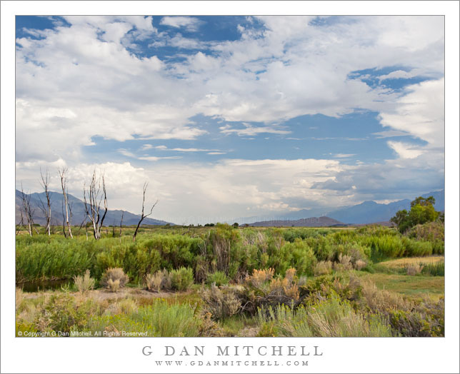
Owens Valley Sky. Owens Valley, California. August 6, 2005. © Copyright 2011 G Dan Mitchell – all rights reserved.

Dramatic thunderstorms begin to build above Owens Valley, flanked by the White Mountains and the eastern Sierra Nevada range.

If there is any good news about starting to run out of space on my hard drive, it might be that it encourages me to begin the process of reviewing my tens of thousands of archived raw image files, and that leads me to look through files that I haven’t revisited in a long time – and during this process I find photographs that I had forgotten about. Not only is it worthwhile to rediscover these photographs that ended up buried in the archive, but it is also a chance to recall some of the trips on which the photographs were made.

This photograph is yet another (of many!) that wouldn’t have happened at all if it were not for a whole unpredictable series of events and circumstances. I’ll make the story as short as I can, but it is still a bit involved. Almost every summer I share a long pack trip with a group of my friends. In 2005 we had come up with a 14-day trip along a good portion of the John Muir Trail between roughly the Ediza Lake area and Bishop Pass, which included one of the very few sections of the JMT that I had not hiked. We started at Agnew Meadow, headed up past Shadow Lake, turned south on the JMT, stopped at Reds Meadow, continued on to the Duck and Purple Lakes area… where I started to feel like I might be coming down with some sort of bug. Discretion being the better part of valor and all that, I decided that the prudent thing was to bail out of the trip and exit to Mammoth Lakes since the idea of getting sick on the fourth day of a 14-day hike with a large group was not appealing.

So I hiked out. Ironically, once I crossed the pass to head down to the Mammoth area, I recovered – but it was now too late to rejoin my group since they would be two days ahead of me on the trail at this point. Since I was back at my car now and feeling just fine I figured that I might as well do something else before heading home, so I decided to drive up into the White Mountains and visit the Bristlecone Pine forest. On the way back down from the Whites I just happened to pull out at this spot where the high desert terrain was extra green around a creek, on an afternoon when monsoon conditions were leading to a buildup of afternoon clouds above the Sierra, the Whites, and Owens Valley between the two ranges.

G Dan Mitchell Photography
About | Flickr | Twitter | FacebookGoogle+ | 500px.com | LinkedIn | Email

Text, photographs, and other media are © Copyright G Dan Mitchell (or others when indicated) and are not in the public domain and may not be used on websites, blogs, or in other media without advance permission from G Dan Mitchell.

(Basic EXIF data may be available by “mousing over” large images in posts. Leave a comment if you want to know more.)
Sunset and Moonrise, Kuna Crest

Sunset and Moonrise, Kuna Crest

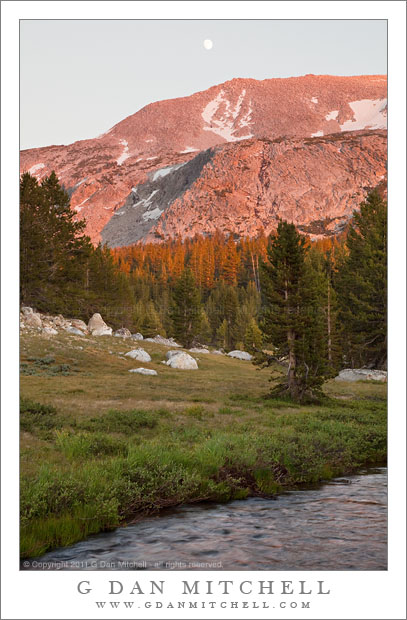
Sunset and Moonrise, Kuna Crest. Yosemite National Park, California. August 10, 2010. © Copyright 2011 G Dan Mitchell – all rights reserved.

The nearly- full moon rises above the sunset light on Kuna Crest, Yosemite National Park.

Kuna Crest runs up Lyell Canyon between the Lyell and Dana forks of the Tuolumne River with the Sierra crest at one end and Mammoth Peak at the other. (Mammoth Peak is the large peak straight in front of you as you top Tioga Pass entering Yosemite National Park.) This ridge can catch great sunset light during the summer, and as I came down from the pass, heading back toward my camp at Porcupine Flat, and saw the almost full moon appearing over the shoulder of the ridge I decided to quickly stop and make a few exposures as the last light was about to leave the forest and soon after the peaks.

If you have tried photographing a scene that includes the moon in the early evening you know that the exposure is a tricky thing. The moon is lit by daylight, so it isn’t too surprising that the “correct” exposure for the moon is close to a normal daytime exposure. But that is not the right exposure for the rest of the scene, which turns out to be quite a bit darker than daylight at this time of day. In this scene things were even more complicates as the very saturated red colors on the ridge were quite “hot,” while the foreground meadow and forest was in shade and both darker and cooler in color. Basically, the dynamic range between the moon and the foreground was too large for a single exposure… so I made several.

At the time of exposure I thought that I might need as many as three component images in the final photograph – they would be one exposed for the bright ridge and sky, one exposed for the rather dark and shadowed foreground, and possibly a third that correctly exposed the moon. To be on the safe side I bracketed four exposures. When I began to work on the image I figured out that in this case I could construct a final “believable” image from two exposures if I was careful and could make some additional adjustments during post.

This is an example of a shot in which the use of a graduated neutral density filter could have been problematic, but where exposure blending could work very well. (“Exposure blending” is one term for the process of manually combining two component exposures using masked layers in Photoshop. No, it is not the same thing as HDR photography.) One of the things that would have been quite tricking using graduated neutral density filters is that the division between the brighter upper half and the darker lower half is not linear. Instead, the roughly follows the curved boundary between the lower meadow and dark trees and the still sunlit trees and the peak and sky.

G Dan Mitchell Photography
About | Flickr | Twitter | FacebookGoogle+ | 500px.com | LinkedIn | Email

Text, photographs, and other media are © Copyright G Dan Mitchell (or others when indicated) and are not in the public domain and may not be used on websites, blogs, or in other media without advance permission from G Dan Mitchell.

(Basic EXIF data may be available by “mousing over” large images in posts. Leave a comment if you want to know more.)