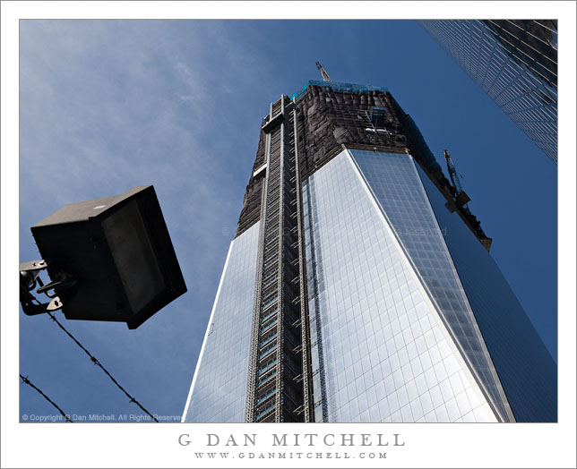
The 1 World Trade Center (1 WTC) building under construction on August 23, 2011, New York City.
“When words become unclear, I shall focus with photographs. When images become inadequate, I shall be content with silence.” – Ansel Adams
G Dan Mitchell is a California photographer and visual opportunist. His book, “California’s Fall Color: A Photographer’s Guide to Autumn in the Sierra” (Heyday Books) is available directly from him.
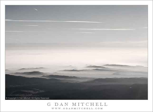
The sky over Northern California, stretching from coastal hills and fog across the tule-fog-filled Central Valley to the Sierra Nevada, New Years Morning.
On New Years Day 2008 I flew to Seattle for a family visit. As we flew out of San Jose and over the hills along the eastern edge of the Bay Area, the winter tule fog was filling the Central Valley and spilling up against the hills, while above and beyond it was a nearly perfectly clear sky. For those who might be unfamiliar with the landscape here, beyond the fog-filled Central Valley, and very far away, the faint dark line of the Sierra Nevada crest is visible, and if you look very closely you may be able to see that the highest peaks are snow-capped.
This photograph has sat in the archive for over three years. I liked the scene but I wasn’t quite sure of what to do with the somewhat odd colors that resulted from shooting though an airplane window and into very bright light. I had considered a straightforward black and white interpretation and, if fact, that is what I was working on when I decided to instead desaturate the image about three-quarters of the way to being monochrome – and for me this seemed like just the right thing and more in line with how I think of the scene now. Another question was whether to clone out the contrail of another plane near the upper left corner. In the end I decided to leave it, for several reasons that I’ll leave to your imagination for now.
G Dan Mitchell is a California photographer and visual opportunist. His book, “California’s Fall Color: A Photographer’s Guide to Autumn in the Sierra” (Heyday Books) is available directly from him.
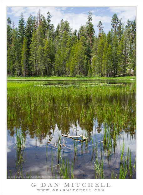
The middle of a summer day at Siesta Lake, Yosemite National Park.
And, surprise!, yet another photograph dredged up from the archives during my summer crawl through the past eight years of raw files.
Siesta Lake is probably well-known to almost anyone who has driven across Tioga Pass Road (highway 120) from west to east through Yosemite National Park. As the road ascends from into the higher elevations, at one point it rounds a turn and there on the right is this pretty and peaceful little lake, right next to the road, surrounded by trees and boulders, and often with water lilies floating on its surface. Few can resist a quick stop, unless they are in a real hurry or have stopped there many times before. I’ve stopped there lots of times, but I still do pull over for at least a quick look.
This photograph of the lake is a bit unusual for me in a couple of ways. For one thing, it was made during the middle of the day, during those hours that are not supposed to be conducive to photography – and, in fact, which can be very challenging. But on this day there was a thin layer of overcast broken by thicker clouds, and this somewhat muted the midday intensity of the light. In addition, I think that I most often work close views of the grasses and, especially, the flowers growing in the lake – but here I stood back a bit and took in everything from the foreground to the trees on the opposite shore. Finally, the vast majority of photographs I’ve made here are in landscape (wide) orientation, with some even going all the way to 2:1 panoramic formats and beyond.
Distorted and colorful reflections on the metal surface of the Frank Gehry-designed EMP Museum in Seattle, Washington.
I made this photograph, and a series of them of this subject, during a visit to Seattle back in 2006. After seeing the exhibits at the EMP Museum, I spent some time wandering around the Frank Gehry designed building and looking for photographs.
Seattle seems like a great place to photograph architecture – you are almost guaranteed soft light! Here I had a mostly cloudy sky with a few spots of blue sky, so the basic light was very nice. In addition, the building itself is, in places, one giant fun house mirror. In this shot the reflective panels are picking up their own coloration, some clouds and blue sky, and some extremely distorted reflections of nearby carnival rides – and all of that stuff is set off against the sky blue curving shapes projecting from the building at the upper right. Some of the colors reflected in the wall panels are so colorful as to almost be over-saturated, and with the strange distortions they create the effect seems almost hallucinogenic! Is there any color that cannot be found somewhere on that wall?