Tag Archives: point

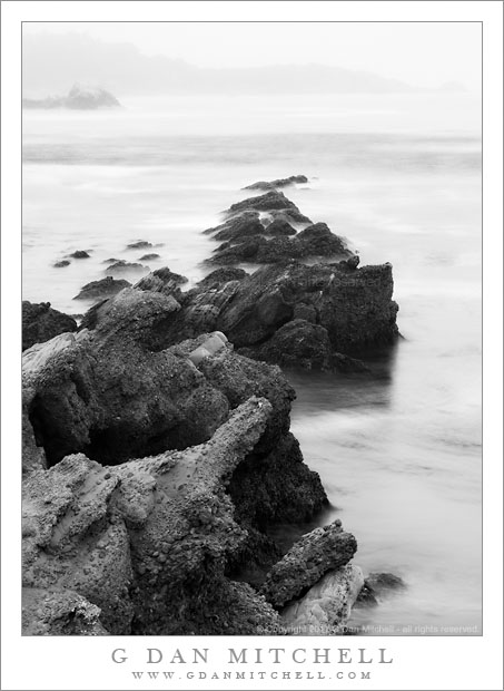
Rocks and Fog, Point Lobos

Rocks and Fog, Point Lobos

Rocks and Fog, Point Lobos. Point Lobos State Reserve, California. July 21, 2011. © Copyright 2011 G Dan Mitchell – all rights reserved.

A rocky peninsula drops into the ocean on a foggy morning at Point Lobos State Reserve.

On this morning it was foggy and drizzling at Point Lobos and there was a surprising amount of surf for a summer morning. When I arrived shortly after the park opened, there were few other people about. With the moving water and the low light conditions, I decided that this was a good time to do some work with long daytime exposures, so I got out my 9-stop neutral density filters and went about looking for compositions.

After shooting down closer to the water in the cove to the left of these rocks, I wandered up a trail along the shoreline that took me to a point that was a bit higher above the water. As I looked back I saw that the rocks that defined the cove that I had been shooting appeared to head straight out into the water towards a distant peninsula and then submerge – a rather different take on this feature.

By using this filter I was able to get an eight-second exposure in this light. Longer would have been better, but the light was beginning to come through the fog a bit and I didn’t have much choice. With an exposure this “short” I had to be a bit careful about timing the shots, trying to get the right amount of water breaking over the rocks.

G Dan Mitchell Photography
About | Flickr | Twitter | FacebookGoogle+ | 500px.com | LinkedIn | Email

Text, photographs, and other media are © Copyright G Dan Mitchell (or others when indicated) and are not in the public domain and may not be used on websites, blogs, or in other media without advance permission from G Dan Mitchell.

(Basic EXIF data may be available by “mousing over” large images in posts. Leave a comment if you want to know more.)

Offshore Fog Bank, Marin Headlands

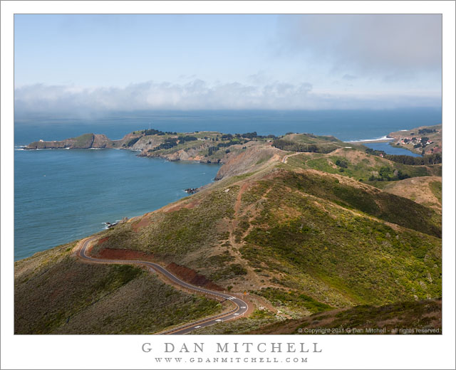
Offshore Fog Bank, Marin Headlands

Offshore Fog Bank, Marin Headlands. Golden Gate National Recreation Area, California. July 14, 2011. © Copyright 2011 G Dan Mitchell – all rights reserved.

Offshore fog lies beyond Point Bonita and Rodeo Beach and the Marin Headlands of the Golden Gate National Recreation Area.

I was surprised to find a clear view like this during my mid-July visit to the Marin Headlands of the Golden Gate National Recreation Area (GGNRA) across the Bay from San Francisco. I had almost decided to stay home or go elsewhere based on weather reports that had the coast completely socked in my dense fog for most of the day. Indeed, it was foggy as I passed through San Francisco and drove across the Golden Gate Bridge. The fog was high, and I could see some distance beneath it, but it was still a rather gray day.

Since the lower section of Conzelman Road, the normal quick and scenic route up into the headlands, was closed for construction, I took that alternate route that passes through a tunnel to come out near Rodeo Beach. I turned left up the hill to reach the upper section of the road. After photographing near Battery 129 for a while, the sun began to break through the fog, and I was surprised to find a fairly clear patch just outside the Golden Gate.

The photograph shows the last section of the headlands as the hills drop towards the historic fort and batteries near the Point Bonito light house, which is barely visible at the end of the peninsula on the left. The line of surf at the upper right is Rodeo Beach, a popular spot with Bay Area folks.

G Dan Mitchell Photography
About | Flickr | Twitter | FacebookGoogle+ | 500px.com | LinkedIn | Email

Text, photographs, and other media are © Copyright G Dan Mitchell (or others when indicated) and are not in the public domain and may not be used on websites, blogs, or in other media without advance permission from G Dan Mitchell.

(Basic EXIF data may be available by “mousing over” large images in posts. Leave a comment if you want to know more.)
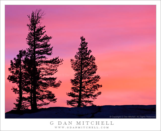
Trees and Sunset Sky, Olmsted Point

Trees and Sunset Sky, Olmsted Point

Trees and Sunset Sky, Olmsted Point. Yosemite National Park, California. June 18, 2011. © Copyright G Dan Mitchell – all rights reserved.

Trees growing on granite silhouetted against a colorful sunset sky at Olmsted Point, Yosemite National Park.

This astonishing, magical light occurred just at and right after sunset on the evening of June 18, the day that Tioga Pass finally opened for the 2011 summer season. I earlier posted a vertical format photograph of much the same scene, though with slightly different light – the other photograph was made about a minute after this one and the conditions were changing very rapidly.

The photograph was made from the popular Olmsted Point overlook along the Tioga Pass Road (highway 120), with its well-known view of subalpine Tenaya Lake. Since I have recounted the story of this light in some detail in an earlier post, I’ll keep this description somewhat short, but here is the genera outline. Earlier in the evening I had come here to try to photograph Mount Conness with a long lens. Initially the light was very unpromising, but I observed some things that suggested the possibility of sunset light so I stuck around. Just before sunset, as the sun dropped near the horizon to the west, the light came from below to illuminate the thin, high clouds and produce an amazing color show.

To make the series of photographs of these trees I simply pivoted my tripod around from the direction it had been pointing, towards Mount Conness. The trees are somewhat sparse here since the granite domes and slabs cannot support many of them. The speed of light and color transition was remarkable. At one or more points, as the clouds picked up the sunset glow, the brightness of the light suddenly increased noticeably. The brightest color moved across the sky from east to west, and here the color was just beginning to diminish ever so slightly overhead as it continues to intensify to the west and closer to the horizon.

G Dan Mitchell Photography
Flickr | Twitter (follow me) | Facebook (“Like” my page) | 500px.com | LinkedIn | Email

Text, photographs, and other media are © Copyright G Dan Mitchell (or others when indicated) and are not in the public domain and may not be used on websites, blogs, or in other media without advance permission from G Dan Mitchell.

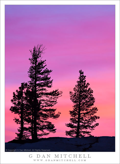
Trees in Silhouette, Olmsted Point, Sunset

Trees in Silhouette, Olmsted Point, Sunset

Trees in Silhouette, Olmsted Point, Sunset. Yosemite National Park, California. June 18, 2011. © Copyright G Dan Mitchell – all rights reserved.

Trees at Olmsted Point are silhouetted against a brilliantly colorful spring sunset sky, Yosemite National Park.

I think everyone should occasionally get to post a just plain gaudy color sunset – and this is mine. While photographing Mount Conness from Olmsted Point was my primary goal on this evening, I also had some opportunities to swing the tripod around and point at other things from time to time. This is about as close as I can come to capturing the nearly hallucinogenic color of the sky as the brightest cloud illumination was centered directly overhead and beginning to move off to the west.

The color saturation was so intense that I had to under expose this by at least a stop in order to avoid blowing out the red channel and in order to retain some differentiation among the various shadings of color as they transitioned from very pink/red through orange and purple and on towards blue.

G Dan Mitchell Photography | Flickr | Twitter (follow me) | Facebook (“Like” my page) | LinkedIn | Email
Text, photographs, and other media are © Copyright G Dan Mitchell (or others when indicated) and are not in the public domain and may not be used on websites, blogs, or in other media without advance permission from G Dan Mitchell.