
Tag Archives: sand

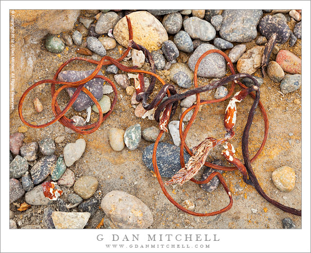
Seaweed and Pebbles, Weston Beach

Seaweed and Pebbles, Weston Beach - Shoreline debris, including pebbles and seaweed, at Weston Beach, Point Lobos State Reserve.
Shoreline debris, including pebbles and seaweed, at Weston Beach, Point Lobos State Reserve.

Seaweed and Pebbles, Weston Beach. Point Lobos State Reserve, California. July 16, 2012. © Copyright 2012 G Dan Mitchell – all rights reserved.

Shoreline debris, including pebbles and seaweed, at Weston Beach, Point Lobos State Reserve.

During virtually every visit to the Point Lobos State Reserve I end up shooting at Weston Beach (named after photographer Edward Weston) at least once. Perhaps the Weston name is part of what attracts me… though the easy parking might have something to do with it, too. ;-) But seriously, this beach is a special place that I have visited for decades, starting when my family went to Point Lobos so that I can my siblings could wander about and inspect the tide pools.

Weston Beach has always seemed to me to barely qualify as what I think of when I hear the word “beach.” That word, to me, suggests a strand of fine sand that runs along the edge of the ocean. But this beach is more of a cove, and the its shore is emphatically not that kind of “sand.” Instead, it is mostly rocky with broken ledges full of channels that run down and into the water. It is separated from the open ocean by another wall of rocks that almost closes it off from the rougher water, though wave spill in through the gap. Instead of fine sand, there is gravel, consisting mostly of smooth rocks that are almost golf ball sized. During much of the year, but especially in winter when Pacific storms bring the highest surf, all sorts of interesting stuff washes up on this beach – shells, drift wood, seaweed – and I love to walk here slowly, looking for seemingly random juxtapositions and forms that might make a photograph.

G Dan Mitchell is a California photographer whose subjects include the Pacific coast, redwood forests, central California oak/grasslands, the Sierra Nevada, California deserts, urban landscapes, night photography, and more.
Blog | About | Flickr | Twitter | Facebook | Google+ | 500px.com | LinkedIn | Email

Text, photographs, and other media are © Copyright G Dan Mitchell (or others when indicated) and are not in the public domain and may not be used on websites, blogs, or in other media without advance permission from G Dan Mitchell.
Sand Tufa, Mono Lake

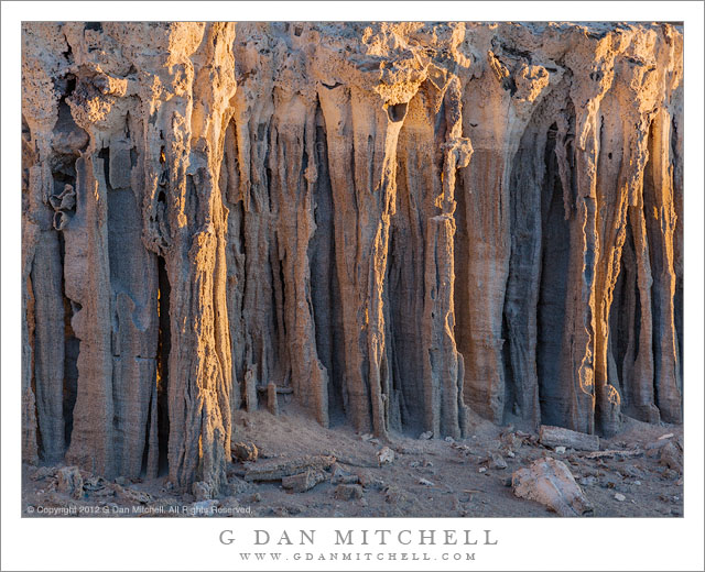
Sand Tufa, Mono Lake - Early morning light on details of sand tufa formations, Mono Lake
Early morning light on details of sand tufa formations.

Sand Tufa. Mono County, California. July 14, 2012. © Copyright 2012 G Dan Mitchell – all rights reserved.

Early morning light on details of sand tufa formations, Mono County.

I have wanted to photograph this subject for some time. The sand tufas are not found in the same location as the better-known “tufa towers” that are so often photographed, and they are smaller and somewhat subtler (if that is the right word) subjects. If you weren’t aware of what you were looking for, it would be very easy to pass right by them and barely notice their presence at all. They also appear to be very fragile, so great care should be taken if you ever happen to come across them. Walk around, not over or through them, and minimize your impact on them to the greatest extent possible. If you come across examples, it is probably best to not blast a lot of specific information to the world. I don’t know all of the details of their formation, but judging by their locations and by the recent history of lower lake levels, I suspect that they may have been underwater before the historically recent extraction of water from the eastern Sierra by Los Angeles.

If you are thinking of looking for an interesting and easy to shoot photographic subject, don’t bother with the sand tufa. You’ll probably have much better luck and more fun shooting the impressive and better known and larger “tower” features at other areas. These small structures do not tower above anything. Some are only inches tall, and the largest are just a few feet tall. Their natural color is a muted and, let’s be honest, boring gray color. Their location does not particularly allow them to be paired with more impressive and distant large-scale landscape features such as the expanse of the lake’s surface or the surrounding mountains and hills, with the possible exception of certain kinds of cloud formations. When I went there I had some pre-conceived ideas about I might photograph them, perhaps including the Sierra’s eastern escarpment in the images, but these ideas did not pan out. However, by shooting in the first few minutes of light and working with a long focal length to crop tightly I found some interesting fluted patterns to work with.

G Dan Mitchell is a California photographer whose subjects include the Pacific coast, redwood forests, central California oak/grasslands, the Sierra Nevada, California deserts, urban landscapes, night photography, and more.
Blog | About | Flickr | Twitter | Facebook | Google+ | 500px.com | LinkedIn | Email

Text, photographs, and other media are © Copyright G Dan Mitchell (or others when indicated) and are not in the public domain and may not be used on websites, blogs, or in other media without advance permission from G Dan Mitchell.
Beach and Rocks, Whalers Cove

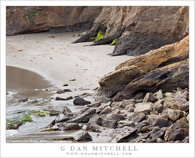
Beach and Rocks, Whalers Cove - Large rocks and a sandy beach below the bluffs at Whalers Cover, Point Lobos State Reserve.
Large rocks and a sandy beach below the bluffs at Whalers Cover, Point Lobos State Reserve.

Beach and Rocks, Whalers Cove. Point Lobos State Reserve, California. March 29, 2012. © Copyright 2012 G Dan Mitchell – all rights reserved.

Large rocks and a sandy beach below the bluffs at Whalers Cover, Point Lobos State Reserve.

For some reason this little vignette caught my attention when I visited Point Lobos one morning in late March. The spot is a section of the curving beach at the inside of Whalers Cove, where a bluff sits above short cliffs at the edge of the sand. This is another of those spots that I have visited for literally decades, yet never photographed. Although I have photographed nearby I don’t think I have any photographs of this little beach area at all, but I’ve been eyeing it during my last few visits.

The cove itself is an appealing spot, somewhat different from many other parts of Point Lobos. Those tend to feature quite rugged seashore, often with cliffs and rocks that run right down into the surging water of the Pacific Ocean. But this cove is doubly protected from the ocean, by being a cove and by having an entrance that does not face straight out toward the ocean. It is filled with kelp beds and is a good place to look for sea lions very close to the shore. (Several were hanging out, wrapped in kelp and lounging around, not more than a few feet from the shore.)

G Dan Mitchell is a California photographer whose subjects include the Pacific coast, redwood forests, central California oak/grasslands, the Sierra Nevada, California deserts, urban landscapes, night photography, and more.
Blog | About | Flickr | Twitter | Facebook | Google+ | 500px.com | LinkedIn | Email

Text, photographs, and other media are © Copyright G Dan Mitchell (or others when indicated) and are not in the public domain and may not be used on websites, blogs, or in other media without advance permission from G Dan Mitchell.

Trees and Cliffs, Red Rock Canyon

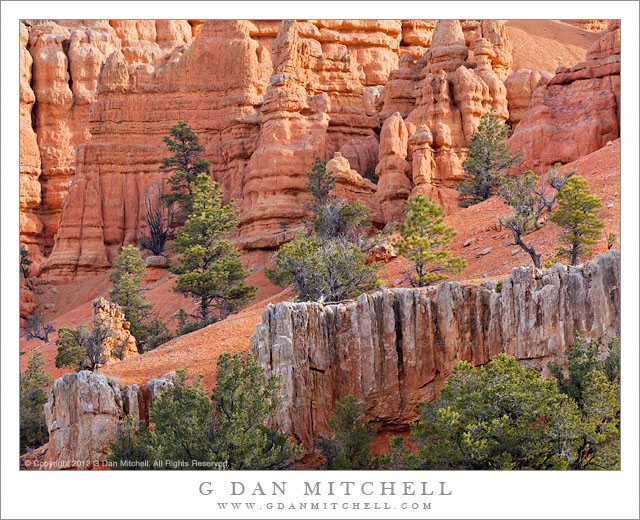
Trees and Cliffs, Red Rock Canyon - Scattered trees below eroded red sandstone cliffs, Red Rock Canyon State Park, Utah.
Scattered trees below eroded red sandstone cliffs, Red Rock Canyon State Park, Utah.

Trees and Cliffs, Red Rock Canyon. Red Canyon, Utah. April 5, 2012. © Copyright 2012 G Dan Mitchell – all rights reserved.

Scattered trees below eroded red sandstone cliffs, Red Rock Canyon State Park, Utah.

During out April Utah visit we drove from Zion National Park to Moab, where we would visit Arches and Canyonlands National Park. We debated whether to take the quick and efficient route or the slow and scenic route from Zion to Moab… and of course the slow and scenic route won out. This took us on a range to sometimes-twisty two-lane highways, starting with the Mt. Carmel road through Zion, then up through the Dixie National Forest, past Red Canyon and then Zion, across the drainage of the Escalante, through part of the Capitol Reef National Park, and finally taking a long, lonely road north to highway 70. There was a lot to see along this route – too much, actually, for the single travel day we had allocated to it.

On a trip filled with surprises – this was my first visit to Utah in a long, long time, and my first time photographing there – this day was filled with more than its share. Among them was the drive up Red Canyon. Being focused on the well-known national parks and monuments I had completely overlooked this place – but it turns out to be a wildly colorful place of brilliant red cliffs and towers, many very close to the highway as it ascends the canyon. I made this photograph very close to the beginning of the red rock country as we arrived from the west.

G Dan Mitchell is a California photographer whose subjects include the Pacific coast, redwood forests, central California oak/grasslands, the Sierra Nevada, California deserts, urban landscapes, night photography, and more.
Blog | About | Flickr | Twitter | Facebook | Google+ | 500px.com | LinkedIn | Email

Text, photographs, and other media are © Copyright G Dan Mitchell (or others when indicated) and are not in the public domain and may not be used on websites, blogs, or in other media without advance permission from G Dan Mitchell.