Tag Archives: sand

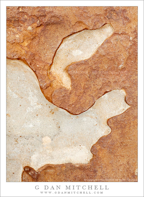
Point Lobos Rock Patterns #2 – July 10, 2010

Point Lobos Rock Patterns #2 - July 10, 2010

Point Lobos Rock Patterns #2 – July 10, 2010. Point Lobos State Reserve, California. © Copyright G Dan Mitchell – all rights reserved.

Detail of patterns in eroded shoreline rocks, Point Lobos State Reserve.

Another photograph of eroded rock patterns near the water not far from Weston Cove at Point Lobos. Here the top layer of reddish rock has worn away in places, leaving a much lighter layer of what I guess is some kind of sandstone below. I’m no geologist, but this section of seashore has fascinating rock formations on the small and large scale where many strata have been exposed by the surf. In some places there a big gobs of conglomerate rock, composed of many smaller rocks “glued” together. In other places very thin layers lie one on top of the other and they have been partially uncovered and worn away by the surf, creating amazing patterns.

This photograph is not in the public domain and may not be used on websites, blogs, or in other media without advance permission from G Dan Mitchell.

G Dan Mitchell Photography | Twitter | Friendfeed | Facebook | Facebook Fan Page | Email

Technical Data:
Canon EOS 5D Mark II
Canon EF 50mm f/1.4 USM
ISO 100, f/16, 1/6 second

keywords: point, lobos, state, reserve, park, california, usa, north america, carmel, big, sur, monterey, peninsula, coast, shore, sea, ocean, pacific, scenic, travel, nature, geology, texture, form, shape, rock, erosion, sand, stone, sedimentary, landscape, detail

Summer Evening, Scott Creek Beach

Summer Evening, Scott Creek Beach

Summer Evening, Scott Creek Beach. Near Davenport, California. June 23, 2010© Copyright G Dan Mitchell – all rights reserved.

Fog rolls in on a summer evening at Scott Creek Beach, on the Pacific Ocean coastline near Davenport, California.

I’m fortunate to live close enough to the California coastline that I can occasionally just decide on the spur of the moment to “drive over the hill” and step out of the world of work to watch the sunset over the Pacific. This is what I decided to do yesterday. I drove over that hill with only a vague plan to see what conditions looked like and then most likely head north from Santa Cruz toward and perhaps beyond Davenport.

I almost never know exactly what I’ll find on the coast until I get there. Yesterday I had suspicions about the possibility of fog, but I also thought that clear sky might linger a while before the fog rolled in. For the most part it turned out that there was fog but that in most places it was a good distance offshore though starting to form in closer. However, it also turned out that there was a good amount of high cloudiness blocking the sunlight. In other words, the prospects were mixed – might be interesting light at the last minute, fog might roll in and cover everything, the clouds might thicken instead of thin. So I continued with no specific images in mind, driving past various familiar locations. As I descended toward Scott Creek Beach I caught a quick glimpse of a panorama across the beach that seemed like it might work as a wide angle shot, so I quickly turned around and returned to the spot. Once I got set up I realized that while it was a beautiful scene it wasn’t going to work as a photograph. But this scene, which required a longer focal length, caught my attention instead.

G Dan Mitchell Photography
About | Flickr | Twitter | Facebook | Google+ | 500px.com | LinkedIn | Email

Text, photographs, and other media are © Copyright G Dan Mitchell (or others when indicated) and are not in the public domain and may not be used on websites, blogs, or in other media without advance permission from G Dan Mitchell.

(Basic EXIF data may be available by “mousing over” large images in posts. Leave a comment if you want to know more.)


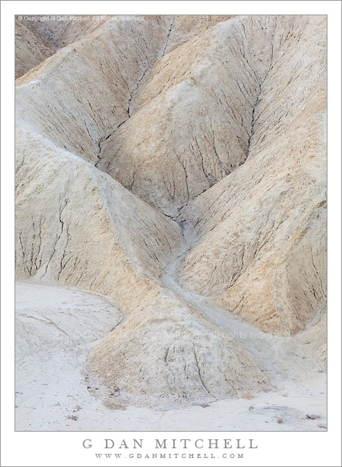
Edge of Gower Wash, Zabriskie Point

Edge of Gower Wash, Zabriskie Point

Edge of Gower Wash, Zabriskie Point. Death Valley National Park, California. April 30, 2010. © Copyright G Dan Mitchell – all rights reserved.

The folded hill and gully patterns along the edge of Gower Wash at Zabriskie Point, Death Valley National Park, California.

Having shot at Zabriskie Point often enough to feel less urgency about shooting the famous and iconic views… yet again… (unless conditions are truly exceptional), I’ve been looking for other elements in the scene. Last year I became interested in using very long lenses to isolate interesting small sections of the scene. I have to say that it is a lot more challenging and satisfying for me to look at the amazing number of potential subjects here that are not the justifiably famous images of Manley Beacon, the Panamints, and the panoramic view of Gower Wash. (I don’t want to get too full of myself here and make it sound like I’m “too good” to shoot the familiar views – in fact I still do point my camera in those directions when the light and other conditions are just right.)

This small section of cracked earth, small hills, and gullies sits right on the edge of the flatter and gravel-filled bottom of Gower Wash right below Zabriskie Point. I made this photograph early in the morning when the light of the sun was partially blocked by clouds to the east and I see a very subtle glow on the sides of these features that face east.

This photograph is not in the public domain and may not be used on websites, blogs, or in other media without advance permission from G Dan Mitchell.

G Dan Mitchell Photography | Twitter | Friendfeed | Facebook | Facebook Fan Page | Email

Technical Data:
Canon EOS 5D Mark II
Canon EF 100-400mm f/4.5-5.6 L IS USM at 190mm
ISO 200, f/11, 1/40 second

keywords: death, valley, national, park, california, usa, north america, spring, nature, zabriskie, point, morning, gower, wash, earth, dirt, gravel, sand, gully, hill, eroded, crack, landscape, scenic, travel, light, geology, stock

Eroded Formations, Zabriskie Point

Eroded Formations, Zabriskie Point

Eroded Formations, Zabriskie Point. Death Valley National Park, California. March 29, 2010. © Copyright G Dan Mitchell – all rights reserved.

A small dry wash runs past folded patterns of eroded hills in morning light at Zabriskie Point, Death Valley National Park, California.

This is another in my “up close and personal” sequence of photographs of details of the geology at Zabriskie Point. Zabriskie is undeniably an incredibly beautiful spot, but after photographing “the view” a number of times my attention was drawn to some of the smaller details of the surrounding terrain. While I’ll still shoot the famous view(s) from this location when conditions are special, I now spend more time using a long lens to pick out small elements of the scene – and there are a lot of them to work with!

On this morning the light was, at times, very special. When I made this photograph the typical sidelight from the early sun was diffused and filtered by some high clouds in the east, and this soft light is different than what I’ve seen here before – it seems to me to have a subtle glow.

This photograph is not in the public domain and may not be used on websites, blogs, or in other media without advance permission from G Dan Mitchell.

G Dan Mitchell Photography | Twitter | Friendfeed | Facebook | Facebook Fan Page | Email

Technical Data:
Canon EOS 5D Mark II
Canon EF 100-400mm f/4.5-5.6 L IS USM at 150mm
ISO 200, f/14, 1/40 second

keywords: zabriskie, point, gower, gulch, wash, folds, eroded, hills, formations, crack, earth, desert, barren, morning, light, sand, gravel, tan, brown, death valley, national, park, california, usa, north america, detail, landscape, nature, stock, geology, scenic, travel, dry, hill, gully