Tag Archives: cliff

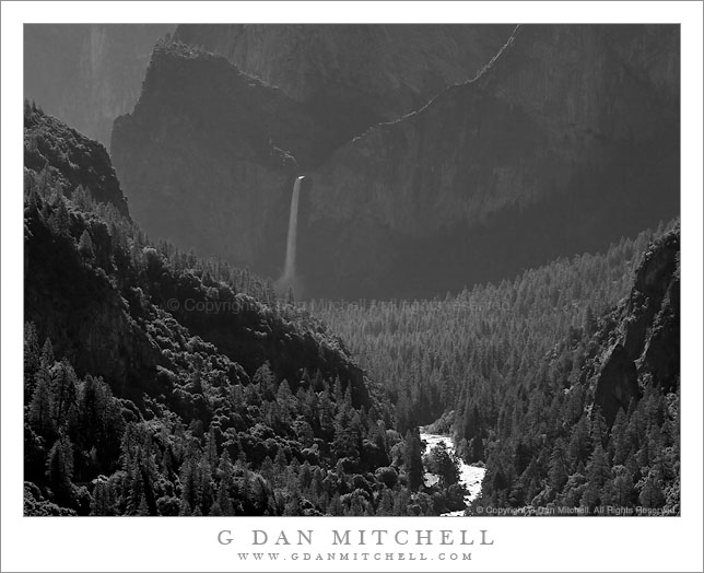
Bridalveil Fall and Merced River Canyon, Morning

Bridalveil Fall and Merced River Canyon, Morning

Bridalveil Fall and Merced River Canyon, Morning. Yosemite National Park, California. June 5, 2010. © Copyright G Dan Mitchell – all rights reserved.

Black and white photograph of Bridalveil Fall and the Merced River canyon in morning backlight – Yosemite Valley, California.

This is the classic view of Bridalveil Fall looking up the canyon of the Merced River as seen from highway 120 just below the longest tunnel on the road descending into the Valley. I can’t tell you how many times I’ve driven down this road into The Valley, but I seem unable to resist pulling over and at least having a look.

On this early June morning all of the waterfalls were in full flow and the Merced was only 24 hours away from cresting with spring melt-water. The Merced was full from bank to bank, and the sound of falling water was everywhere in the Valley. (Though I only stayed there a few hours before the crowds drove me to visit Tioga Pass instead.) I wasn’t certain quite how to photograph this as the backlit morning haze created a very low contrast effect in the atmosphere even though the areas where the sun hit the water (on the river and at the top of the fall) were very bright. I had a hunch that it might work best in black and white, and after working on it a bit in post that hunch seemed to be correct.

This photograph is not in the public domain and may not be used on websites, blogs, or in other media without advance permission from G Dan Mitchell.

G Dan Mitchell Photography | Twitter | Friendfeed | Facebook | Facebook Fan Page | Email

Technical Data:
Canon EOS 5D Mark II
Canon EF 100-400mm f/4.5-5.6 L IS USM at 360mm
ISO 200, f/4.9, 1/320 second

keywords: yosemite, national, park, sierra, nevada, mountain, spring, nature, bridalveil, fall, waterfall, merced, river, canyon, cliff, valley, black and white, monochrone, forest, morning, light, back, havze, atmosphere, recession, mist, slope, ridge, shadow, landscape, nature, travel, scenic, california, usa, north america, road, highway, 120, stock
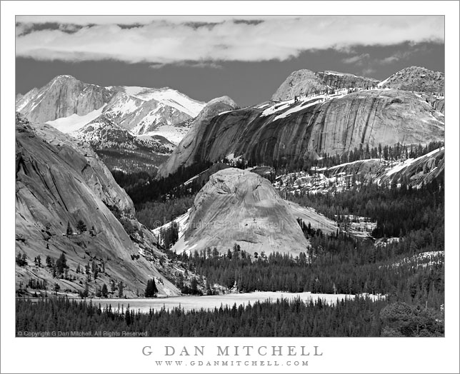
Early Season Ice on Tenaya Lake

Early Season Ice on Tenaya Lake

Early Season Ice on Tenaya Lake. Yosemite National Park, California. June 5, 2010. © Copyright G Dan Mitchell – all rights reserved.

Black and white photograph of early season ice on the surface of Tenaya Lake with high granite peaks and domes beyond, Yosemite National Park, California.

A long-lens version of the classic view of Tenaya Lake from Olmsted Point, made on the day that Tioga Pass Road opened for the season and while ice still covered almost all of the surface of the lake. Peaks and domes tower above the lake, including the heights of Mount Conness near the upper left. In a larger version of this photograph, many seasonal waterfalls are visible along the sides of the cliffs and domes.

This photograph is not in the public domain and may not be used on websites, blogs, or in other media without advance permission from G Dan Mitchell.

G Dan Mitchell Photography | Twitter | Friendfeed | Facebook | Facebook Fan Page | Email

Technical Data:
Canon EOS 5D Mark II
Canon EF 100-400mm f/4.5-5.6 L IS USM at 210mm
ISO 200, f/5.1, 1/400 second

keywords: yosemite, national, park, sierra, nevada, mountain, spring, nature, california, usa, north america, tenaya, lake, dome, conness, peak, ridge, snow, ice, field, forest, granite, cliff, june, olmsted, point, landscape, nature, cloud, sky, black and white, monochrome, tioga, pass, road, highway, 120, trans, scenic, travel, stock

Headlands Near Davenport

Headlands Near Davenport

Headlands Near Davenport. California Coast. May 15, 2010. © Copyright G Dan Mitchell – all rights reserved.

Foggy sky along the coastal headlands near Davenport, California.

I stopped along the edge of the bluff at a spot on the California Coast Highway (highway 1) where I know that I can photograph seabirds as they cruise just feet away from the top of the cliff. Although my attention was first on the birds, I was also aware of the expansive views of the coastline from this high spot on the road, and I thought that the glowing fog-filled sky to the southwest might be worth photographing. I decided to place the horizon very low in the frame and expose so that the thin line of coastal bluffs extending into the frame from the left would be much darker than the water or the sky.

While I had a pretty good idea that this would end up as a black and white photograph – the colors in the foggy and gray conditions were not that special – I wasn’t certain when I made the exposure of just what I would do with it in post. As soon as I opened the file though I had a pretty good idea of what I wanted to do. In the end, for an image that might seem so simple, this photograph required quite a bit of post-processing work.

This photograph is not in the public domain and may not be used on websites, blogs, or in other media without advance permission from G Dan Mitchell.

G Dan Mitchell Photography | Twitter | Friendfeed | Facebook | Facebook Fan Page | Email

Technical Data:
Canon EOS 5D Mark II
Canon EF 70-200mm f/4 L USM at 200mm
ISO 100, f/11, 1/120 second

keywords: davenport, california, usa, north america, headlands, bluff, coast, shore, surf, wave, horizon, fog, clouds, cliff, rocky, ocean, sea, shoreline, highway, one, black and white, monochrome, landscape, seascape, travel, scenic, nature, beach, shoal, minimal, sky, stock

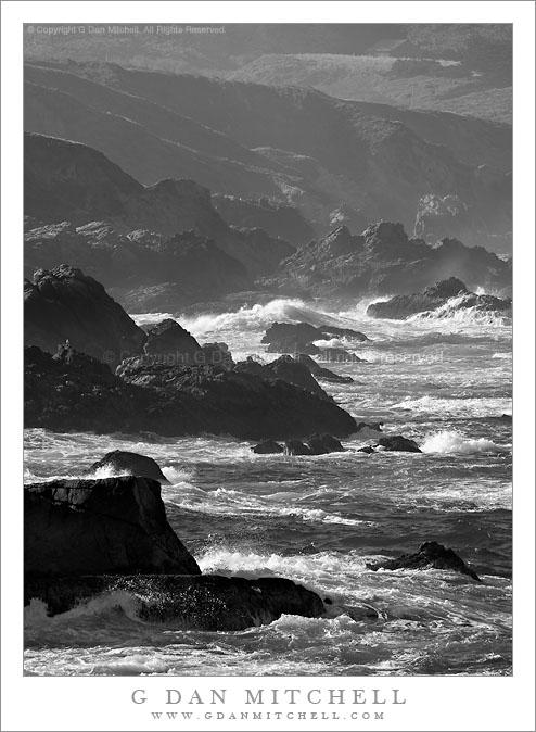
Big Sur Coastline Near Soberanes Canyon

Big Sur Coastline Near Soberanes Canyon

Big Sur Coastline Near Soberanes Canyon. Big Sur, California. May 1, 2010. © Copyright G Dan Mitchell – all rights reserved.

Black and white photograph of rugged Big Sur coastline rocks and surf near Soberanes Canyon, Garrapata State Park, California.

One more rugged shoreline photograph from my May 1 visit to the Big Sur coastline. This area is within the confines of Garrapata State Park, and very close to Soberanes Canyon. (Those who know the Soberanes Canyon trail may recognize the old barn seen faintly through the foggy haze near the upper right corner of the frame.)

I love to follow the ridgelines of these coastal mountains all the way down to the surf. Them begin high up on the steep but rounded slopes and gradually become sharper as they descend toward the ocean, being cut deeply by the streams in the bottoms of their canyons. Just above the ocean the canyons are often quite steep, though there can be a bluff right above the drop-off to the water, too. Then, at the very lowest ends of these ridges, the ocean has its effect and the softer dirt and gravel that gives them their folded forms higher up is stripped away, leaving the broken and rugged underlying rocks and they disappear into the surf.

This photograph is not in the public domain and may not be used on websites, blogs, or in other media without advance permission from G Dan Mitchell.

G Dan Mitchell Photography | Twitter | Friendfeed | Facebook | Facebook Fan Page | Email

Technical Data:
Canon EOS 5D Mark II
Canon EF 100-400mm f/4.5-5.6 L IS USM at 400mm
ISO 200, f/16, 1/160 second

keywords: big, sur, coast, coastline, soberanes, canyon, creek, black and white, monochrome, rugged, rough, rock, surf, wave, foam, garrapata, state, park, california, usa, north america, bird, gull, barn, highway, cliff, bluff, island, seascape, sea, ocean, pacific, shore, shoreline, landscape, nature, scenic, travel, monterey, carmel, stock