Tag Archives: mountains

Star Trails, The Manifold, Zabriskie Point

Star Trails, The Manifold, Zabriskie Point
The Manifold, Star Trails – Zabriskie Point

Star Trails, The Manifold, Zabriskie Point. Death Valley National Park, California. March 29, 2010. © Copyright G Dan Mitchell – all rights reserved.

Star trails above the Manifold, Zabriskie Point, Death Valley National Park, California.

One of my goals on my late-March trip to Death Valley was to do some night photography, in particular to take advantage of the nearly full moon near the end of my visit. Some of my plans did not quite work out – for example, on the night when I intended to do night photography of the moving rocks at the Racetrack Playa it was cloudy all night! However, on the final night of my visit the weather gods cooperated and I was able to make a few exposures from Zabriskie Point as the moon rose. As if to partially make up for messing up the intended Racetrack shots, the “cloud gods” were kind enough to provide me with a few high thin clouds at Zabriskie. This was one of those wonderful occasions when things actually did go as planned!

Anticipating the full moon at Zabriskie, I made a point of camping in the vicinity of Furnace Creek at the Texas Springs campground. (I expect that my habits mystified a few nearby campers. I drove in at about 2:00 p.m., grabbed a site and “marked” it by leaving a chair and a tarp, and almost immediately left – not returning until nearly 10:00 p.m. Then I was up and gone well before sunrise.) In any case, I headed down to the Badwater area in the late afternoon to photograph sunset light on the salt flats and evening clouds – following an impromptu “dinner” at the back of my car at the Badwater parking lot. It was getting fairly dark by the time I finished up at Badwater, so I headed straight up to Zabriskie. By the time I arrived the moon was just coming up over the mountain range to the east, with its light at times filtering through high clouds. During the hour I was there I made three exposures. With exposure times in the 8 to 12 minute range and followed by “dark frame exposures” of equal length, this was a slow and quiet process.

This photograph is not in the public domain and may not be used on websites, blogs, or in other media without advance permission from G Dan Mitchell.

G Dan Mitchell Photography | Twitter | Friendfeed | Facebook | Facebook Fan Page | Email

Technical Data:
Canon EOS 5D Mark II
Canon EF 24-105mm f/4 L IS USM
ISO 200, f/8, 787 seconds (not a typo!)

keywords:

Titus Canyon

Titus Canyon
Titus Canyon

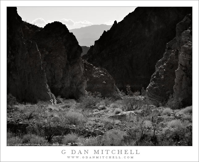
Titus Canyon. Death Valley National Park, California. April 3, 2008. © Copyright G Dan Mitchell – all rights reserved.

Black and white photograph of Titus Canyon, Death Valley National Park, California.

This photograph was made on a trip to Death Valley a couple of years ago – I pulled it up recently while working on a post about photographing Death Valley at my web site. Titus Canyon is known for the lower section which is a very narrow and deep slot canyon with a road through it. The road is a spectacular drive, starting east of Death Valley near Rhyolite and Beatty, crossing the mountain range along the east side of Death Valley, descending steep canyons on the west side, passing though the very deep and narrow lower section, and finally emerging into Death Valley. I regard the route as one of the most spectacular drives that I’ve seen – though it isn’t an easy drive. You’ll want a vehicle with good ground clearance, 4WD is advised, and those unnerved by steep and winding gravel roads that sometimes pass across very exposed areas might think twice about driving it. (As of this writing, Titus Canyon has been closed by flooding during the recent southern California storms.)

This photograph was made in the lower portion of the canyon, but above the slot canyon section near where the canyon emerges into Death Valley. The mountains seen in the distance are on the other side of Death Valley and far to the west.

This photograph is not in the public domain and may not be used on websites, blogs, or in other media without advance permission from G Dan Mitchell.

G Dan Mitchell Photography | Twitter | Friendfeed | Facebook | Facebook Fan Page | Email

keywords: titus, canyon, road, cliff, rocks, sky, clouds, trees, bushes, plants, desert, grapevine, mountains, landscape, scenic, travel, drive, california, usa, death valley, national park, stock, curve, rugged, desert, road

Sunset Surf, Big Sur Coastline

Sunset Surf, Big Sur Coastline

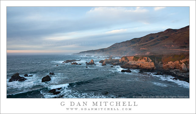
Sunset Surf, Big Sur Coastline. Pacific Coast, California. January 2, 2010. © Copyright G Dan Mitchell – all rights reserved.

Panoramic photograph of winter surf and rough winter seas along the Big Sur coastline at sunset, California.

This is actually a photograph that I posted previously, but this time presented in a panoramic orientation. The last bit of sunset light is shining through a gap in the otherwise cloudy sky. (I didn’t realize it when I posted the original version, but I managed to get a good case of poison oak by clambering out onto the edge of this bluff to make this photograph…)

This photograph is not in the public domain and may not be used on websites, blogs, or in other media without advance permission from G Dan Mitchell.

G Dan Mitchell Photography | Twitter | Friendfeed | Facebook | Facebook Fan Page | Email

keywords: big, sur, coast, coastline, winter, season, seascape, pacific, ocean, california, usa, sea, water, surf, wave, stock, sunset, dusk, spray, mist, fog, cloud, sky, blue, road, highway, one, sea stack, bluff, poles, beach, rocks, landscape, nature, scenic, travel, hills, mountains, ridge

Runoff Pool, Evening – Tuolumne Meadows

Runoff Pool, Evening - Tuolumne Meadows

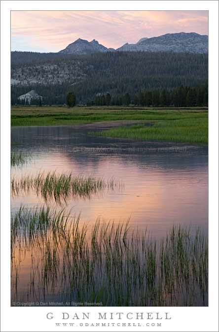
Runoff Pool, Evening – Tuolumne Meadows. Yosemite National Park, California. July 7, 2009. © Copyright G Dan Mitchell – all rights reserved.

Grass bordered early summer runoff pool in Toulumne Meadows reflects sunset clouds and the summit of Ragged Peak, Yosemite National Park, California.

I made this photograph on a very early-season visit to the Tuolumne Meadows area in early July of this year. Since this was a below-normal precipitation year, the road to the pass cleared a bit on the early side and by early July almost all of the snow was gone at road level – but there was still a good amount of run-off water in Tuolumne Meadows. (Though nothing like in the big precipitation years, when portions of the meadow become more lake than solid ground.) There were some interesting clouds this evening so I wandered out into one of my favorite areas in the lower end of the meadow as the day ended and photographed the new grasses and pools of water that reflected sky, clouds, and surrounding peaks. In the distance the summit of Ragged Peak marks the location of Young Lakes.

This photograph is not in the public domain and may not be used on websites, blogs, or in other media without advance permission from G Dan Mitchell.

G Dan Mitchell Photography | Twitter | Friendfeed | Facebook | Facebook Fan Page | Email

keywords: tuolumne, meadow, tioga, pass, road, sierra, nevada, mountains, range, yosemite, national, park, california, usa, reflection, runoff, pool, water, surface, grass, ripple, cloud, evening, sunset, dusk, summit, ragged, peak, ridge, forest, granite, blue, orange, green, nature, july, early, summer, nature, landscape, scenic, travel, stock