
Tag Archives: nature

Dunes, Cottonwood Mountains, and Dust Storm

Dunes, Cottonwood Mountains, and Dust Storm

Dunes, Cottonwood Mountains, and Dust Storm. Death Valley National Park, California. February 19, 2011. © Copyright G Dan Mitchell – all rights reserved.

Afternoon winds whip up a dust storm over Death Valley between sand dunes and the high ridges of the Cottonwood Mountains.

Following my typical routine of “get up ridiculously early and shoot until I can’t stand it any longer, hang out during the middle of the day, and then head out for late afternoon and evening shooting,” I had been watching some interesting clouds developing far to the north of Stovepipe Wells during the day and decided that I might head up that way in the evening if they continued to hold promise. After crossing the Valley to the Scotty’s Castle road junction I could see a curtain of virga falling from those clouds to the north, so I decided to head that way.

The wind had been picking up from the south during the afternoon as another weather front approached. As I headed up along the edge of the main valley I could see that this wind was starting to pick up dust and sand from the Mesquite Dunes area near Stovepipe and from areas just north of that. I’m more familiar with the dust being carried south by winds out of the north, so this was a bit of a different site as sand/dust were being picked up from the dunes rather than being deposited there.

The dunes at the bottom of this photograph are not the familiar “main” dunes near Stovepipe, but are instead smaller dunes running north/south up the Valley. While a larger version of the photograph shows some blowing dust on these foreground dunes, the main cloud is coming from further south down the Valley. Beyond the dust and across the Valley are the hills of the Cottonwood range ascending to a ridge that still holds a bit of snow from storms over the previous couple of days, with building clouds above that would bring another dusting on this evening.

G Dan Mitchell Photography | Flickr | Twitter | Facebook | Email
Text, photographs, and other media are © Copyright G Dan Mitchell (or others when indicated) and are not in the public domain and may not be used on websites, blogs, or in other media without advance permission from G Dan Mitchell.
Winter Evening Sky, Panamint Range, Death Valley

Winter Evening Sky, Panamint Range, Death Valley

Winter Evening Sky, Panamint Range, Death Valley. Death Valley National Park, California. February 18, 2011. © Copyright G Dan Mitchell – all rights reserved.

Winter clouds fill the evening sky above the eastern slopes of the Panamint Range in Death Valley National Park.

After the long drive from the San Francisco Bay Area I arrived at Stovepipe Wells in Death Valley and set up my camp in the mid afternoon and hung out a bit, thinking about the prospects of late afternoon and evening shooting. Because a weather front was coming in (the forecast called for a chance of rain in the Valley and pretty much certain light snow over the passes) the clouds were increasing, in many directions heading past the point of “picturesque” and more towards “socked in.” I was hoping for some evening light – or early rain? – but it seemed less promising as evening approached. In circumstances like these I may come up with a few possible shooting alternatives ahead of time, watch as conditions develop, and make a last-minute decision about where to go based on observations and hunches.

So, late in the afternoon I stopped near Death Valley Dunes and worked to line up some long shots that filled the background of the dunes with the rugged shapes of the Grapevine Mountains, and then headed towards the junction with the road to Scotty’s Castle to try to figure out if the light held more promise to the north or the south. It didn’t look totally promising in either direction, but I thought that I might be able to make something out of the haze to the south as the ridges on both sides of the Valley receded, especially if a bit of glow in the sky turned up right at sunset. So, south it was.

I drove just a little ways in that direction to a point where the road curves a bit towards the east to travel around the northernmost area of salt flats in what I think of as the lower valley – this is the area a bit south of the Salt Creek cutoff. From here there is a fairly open view all the way down to the end of the Valley, and it looked like the clouds were going to evolve in some interesting ways. It didn’t look like I would see a gaudy, brilliantly colorful sunset, but something more subtle and quiet looked like it might happen. As the light began to fade I made a series of photographs whose subject was largely the sky and the atmospheric recession along the Panamint Range (shown here) on the west side of the Valley and the mountains just beyond Furnace Creek.

G Dan Mitchell Photography | Flickr | Twitter | Facebook | Email
Text, photographs, and other media are © Copyright G Dan Mitchell (or others when indicated) and are not in the public domain and may not be used on websites, blogs, or in other media without advance permission from G Dan Mitchell.
Tioga Lake, Late Spring

Tioga Lake, Late Spring

Tioga Lake, Late Spring. Near Yosemite National Park, California. June 5, 2010. © Copyright G Dan Mitchell – all rights reserved.

Late spring at icebound Tioga Lake below Tioga Pass with Mammoth Peak and the Kuna Crest beyond in afternoon light.

I made and shared a slightly different photograph of this scene last summer, but when I did my annual end-of-year traverse of the year’s raw files I returned to the original set of images and wondered how I missed this one. In a lot of ways it is similar to the one I selected earlier, though the foreground light and shadow patterns are a bit different and, more importantly, I like the position of the clouds in this one more than what I had in the original. So, there are now two versions of this scene floating around…

After several fairly dry years in California, the winter of 2009-10 produced much more precipitation, as rain in the lowlands and as snowpack in the Sierra. Because of the heavier snow, Tioga Pass opened just a bit later than average, and when it opened there was still a lot of snow in the high country. Since this afforded a rare chance to cross the Yosemite Sierra in conditions not usually seen by drivers I made it a point to get up there as soon as the road opened.

On the drive there was snow along almost the entire length of Tioga Pass Road, and in many places it looked more like winter than like spring. At the same time, it was spring, and the melting of the snowpack was fully underway. While lakes like Tioga Lake, as seen in this photograph, were still ice-covered… the ice was thinning quickly, and everywhere the melting snow was creating creeks and cascades. The high country, especially at the elevation of the road, was filling with water – water in ponds, water in overflowing lakes, water in rivers, water in cascades and waterfalls. I was waterfalls along the road in places where I had not even suspected that there were creeks!

This photograph shows Tioga Lake, just east of and below Tioga Pass, the eastern entrance to Yosemite. The pass itself is in the low saddle just above the meadow ascending the hill at the end of the lake. Beyond, and inside the park, is massive Kuna Crest with white, snow-capped Mammoth Peak in full sun at the right end of the ridge.

G Dan Mitchell Photography | Flickr | Twitter | Facebook | Email
Text, photographs, and other media are © Copyright G Dan Mitchell (or others when indicated) and are not in the public domain and may not be used on websites, blogs, or in other media without advance permission from G Dan Mitchell.

Cascade, Reflected Sunlight

Cascade, Reflected Sunlight

Cascade, Reflected Sunlight. Yosemite National Park, California. June 28, 2010. © Copyright G Dan Mitchell – all rights reserved.

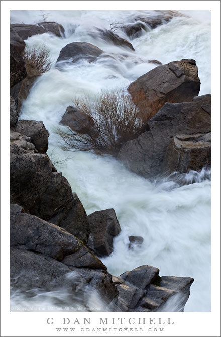
Sunlight reflects on granite ledges next to cascades on Tenaya Creek.

In this iteration of the “blurry-fast-moving-water-in-Sierra-creek” photograph, I was looking to cram a variety of elements into the frame – as you can see, the entire photograph is not filled with water. There is a transition from white water with flashes of sunlit light at the tops of the waves, through the water with smaller areas of foam, to water reflecting the golden late afternoon light from a cliff face on the other side of the creek, to some bits of streamside granite slabs along the lower right edge of the frame. To me, these areas of shallow water and wet rock reflecting more distant light almost have a molten quality.

One of the trickiest things about this photograph for me was dealing with the strong contrast between very blue tones in the shaded parts of the water and the very warm tones of the reflections. As every photographer knows, the light in shade can be very blue, especially when the subject is supposed to be white and is lit almost entirely by the blue sky, as is the case in parts of the turbulent water. Adjustments are necessary in order to make it look realistic and conform with the colors that our eyes tell are are there. (Our vision system is remarkable… but it is not objectively accurate!) But adjustments to the blue water, if applied to the warm tones of the reflecting granite, can end up looking bizarre and overdone in the opposite direction!

G Dan Mitchell Photography | Flickr | Twitter | Facebook | Email
Text, photographs, and other media are © Copyright G Dan Mitchell (or others when indicated) and are not in the public domain and may not be used on websites, blogs, or in other media without advance permission from G Dan Mitchell.