Tag Archives: ridge

Soberanes Canyon, Morning Light

Soberanes Canyon, Morning Light

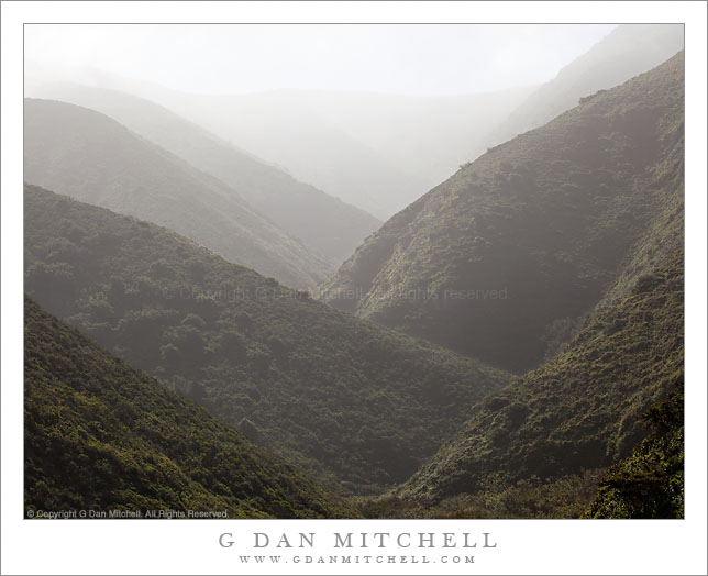
Soberanes Canyon, Morning Light. Garrapata State Park, Big Sur, California. May 1, 2010. © Copyright G Dan Mitchell – all rights reserved.

Morning light and morning fog fill the upper reaches of Soberanes Canyon, Big Sur, California.

I’ve driven past the trailhead for Soberanes Canyon many times. The trail starts at a curve in the Coast Highway above a popular portion of the rugged beach at Garrapata State Park. This time, as I came past heading south I noticed brilliant light in the steep canyon above the trailhead caused by light shining down from the tops of the peaks through the slightly foggy atmosphere. I didn’t stop right away – I had a different objective further down the coast in mind – but I made a mental note to take a look on my way back north, thinking that I’d probably be back within a half hour or so.

I did return shortly. I parked, loaded up the photo gear, and headed up the trail towards the canyon. I wanted to try to make a photograph that captures the intensity of the light-filled atmosphere created when a steep canyon like this is filled with slightly hazy air – the light is so bright that you almost cannot look at it, but when you do look the light seems almost palpable and the receding ridges of the canyon form interesting patterns before the furthest of them virtually disappear into the light. My first stop was at a small footbridge crossing a creek. This might have made a beautiful photograph – with lush green plants and wildflowers lining the small, rushing creek and the mountains beyond – but I couldn’t find a composition that would work, do so I continued on a bit. Soon I came to a more open area where the trail curved above the floor of the canyon near a cactus-covered slope, and from here the view into the upper reaches of the canyon was unobstructed.

As I framed up several compositions of the ridge patterns of the canyon the light continued to change – one moment it was smooth and undifferentiated, but the next a bit of fog would come through and brilliant clouds would sit on top of the ridge. In the end I wasn’t completely satisfied with the result – but I’m going to think of this as work in progress, and I’ll be back to try to photograph this canyon and these conditions again.

This photograph is not in the public domain and may not be used on websites, blogs, or in other media without advance permission from G Dan Mitchell.

G Dan Mitchell Photography | Twitter | Friendfeed | Facebook | Facebook Fan Page | Email

Technical Data:
Canon EOS 5D Mark II
Canon EF 70-200mm f/4 L USM at 84mm
ISO 125, f/11, 1/400 second

keywords: ridge, atmospheric, recession, distance, canyon, mountain, hill, steep, fog, mist, haze, morning, light, back light, upper, reaches, brush, chaparral, garrapata, state, park, california, usa, north america, big sur, coast, pacific, ocean, highway, trail, scenic, travel, landscape, nature, valley, stock

Rocky Creek Bridge, Big Sur

Rocky Creek Bridge, Big Sur

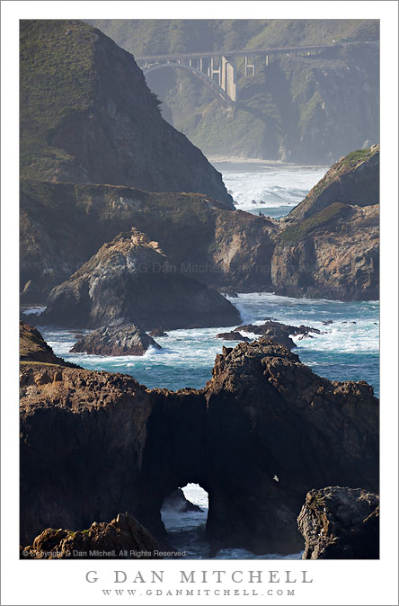
Rocky Creek Bridge, Big Sur. Garrapata State Park, California. May 1, 2010. © Copyright G Dan Mitchell – all rights reserved.

A natural bridge in front of manmade Rocky Creek Bridge along the Big Sur Coastline, California.

This scene is becoming a sort of personal icon in my photography of the California coastline. I have made a couple black and white photographs of the location that are among my very favorite photographs, but I’ve been meaning to work on a color photograph of this spot. There are at least three general conditions in which this spot gets what I regard as interesting light: fairly early morning when the light slants down toward the ocean from over the coastal Big Sur hills, late afternoon in warm light, and during various types of cloud and fog conditions. This version is from the first of these – photographed relatively early in the day when portions of the scene are backlit but some light hits parts of the scene directly after the sun rises above the tall mountains to the east.

Believe it or not, I still don’t think I’ve fully worked this scene – and I have several other ideas of how I would like to shoot it when the conditions are just right.

This photograph is not in the public domain and may not be used on websites, blogs, or in other media without advance permission from G Dan Mitchell.

G Dan Mitchell Photography | Twitter | Friendfeed | Facebook | Facebook Fan Page | Email

Technical Data:
Canon EOS 5D Mark II
Canon EF 100-400mm f/4.5-5.6 L IS USM at 360mm
ISO 200, f/11, 1/250 second

keywords: natural, manmade, bridge, rocky, creek, pacific, ocean, sea, shore, shoreline, coast, highway, 1, one, rock, island, surf, wave, arch, beach, spring, morning, light, bird, gull, cliff, hill, steep, ridge, monterey, carmel, landscape, seascape, nature, scenic, travel, road, drive, stock

Dusk Clouds, Badwater Basin Panorama

Dusk Clouds, Badwater Basin Panorama

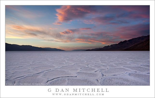
Dusk Clouds, Badwater Basin Panorama. Death Valley National Park, California. March 29, 2010. © Copyright G Dan Mitchell – all rights reserved.

Colorful dusk clouds against darkening sky above the salt flats of Badwater Basin and the distant ridges of the Amargosa and Panamint mountain ranges.

This was one of the final photographs I made in fading light on this evening. (I made another series a few minutes later when the sky and clouds and salt flats were all various stages of blue – I may ultimately post that image here as well.) The very last light was catching the clouds above Badwater and the central portions of Death Valley, and the color was already fading quickly in the darker area to the east over the Amargosa Range.

As I have mentioned before, the very wide dynamic range between the shaded surface of the salt flats and the bright bit of sunlit cloud and sky at the far left necessitated the use of two exposures which were then combined in post. (Even after this light finally faded I was not yet finished for the day. An hour or so later I was doing night photography under the light of the rising full moon at Zabriskie Point.)

This photograph is not in the public domain and may not be used on websites, blogs, or in other media without advance permission from G Dan Mitchell.

G Dan Mitchell Photography | Twitter | Friendfeed | Facebook | Facebook Fan Page | Email

Technical Data:
Canon EOS 5D Mark II
Canon EF 17-40mm f/4 L USM at 17mm
ISO 100, f/16, composite of two exposures in the 1/2 to 1/4 second range.

keywords: badwater, basin, salt, flat, polygon, pattern, white, texture, panorama, evening, sunset, twilight, dusk, dark, sky, color, orange, pink, blue, amargosa, panamint, mountain, range, ridge, horizon, death valley, national, park, california, usa, north america, landscape, travel, scenic, nature, stock

Badwater Basin Salt Flats, Dusk

Badwater Basin Salt Flats, Dusk

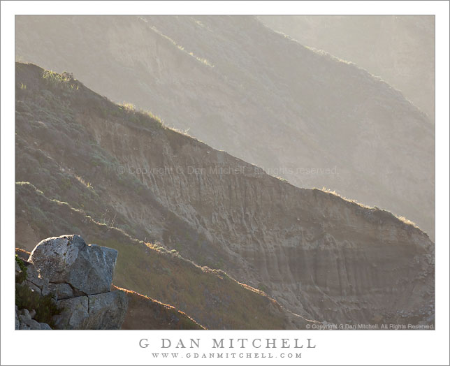
Badwater Basin Salt Flats, Dusk. Death Valley National Park, California. March 29, 2010. © Copyright G Dan Mitchell – all rights reserved.

Newly formed salt polygons extend to the horizon as evening clouds gather above the Badwater Basin salt flats, Death Valley National Park, California.

This is one more – and perhaps the last – in a series of photographs I shot on a late-March evening in the Badwater Basin of Death Valley National Park. The light goes through a long and interesting transitional process at this location. Because of the tall Panamint Mountain range to the west, the direct sun leaves the surface of the salt flats quite early, though the hills along the east side of the valley and the more distant mountains can still be sunlit for some time. Once the sun drops behind the Panamints, the “white” salt actually can end up being quite blue since it is illuminated entirely by the diffused light from the blue sky. As I have mentioned before this creates some interesting subjective questions for the photographer. Should the salt be white? Should it be as blue as it looks in the capture? Should it be somewhere in between? I’ve seen interesting and effective photographs that seemed to take each of these approaches.

In this case, because I shot a bit before actual sunset and while some clouds reflected less blue light onto the playa surface, the need to alter to color balance was diminished a bit – which is not to say that I didn’t do some work to balance the colors so that they looked more like what I remembered. A second issues is related, namely that the sky remains very bright while the salt flat surface, in deep shade, is very dark by comparison. On the scene, the eyes/brain compensate and the difference seems less than what the camera records. So, again, some adjustment in post is needed. In this case I made two exposures one stop apart. On just barely handled the brightest portions of the sky without blowing out, while the other did a better job of holding the details for the shadowed salt formations. I combined the two source images in post.

This photograph is not in the public domain and may not be used on websites, blogs, or in other media without advance permission from G Dan Mitchell.

G Dan Mitchell Photography | Twitter | Friendfeed | Facebook | Facebook Fan Page | Email

Technical Data:
Canon EOS 5D Mark II
Canon EF 17-40mm f/4 L USM at 17mm
ISO 100, f/16, composite of 1/13 second and 1/6 second exposures

keywords: badwater, basin, salt, flat, desert, polygon, water, playa, crust, pattern, sky, cloud, evening, dusk, sunset, blue, mountain, ridge, range, distant, death valley, national, park, california, usa, north america, landscape, nature, scenic, travel, geology, horizon, stock