Tag Archives: steep

Dawn Light, Base of the Cottonwood Mountains

Dawn Light, Base of the Cottonwood Mountains

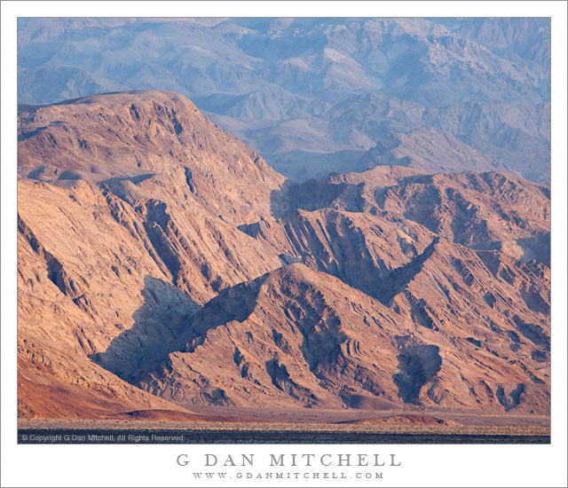
Dawn Light, Base of the Cottonwood Mountains. Death Valley National Park, California. March 29, 2011. © Copyright G Dan Mitchell – all rights reserved.

Dawn light on the based of the Cottonwood Mountains at the edge of Death Valley.

This is (yet another) one of those photographs that is the result of some odd combination of “planning” and serendipity. When I travel somewhere to do photography I often, though not always, have some ideas about certain types of subjects I would like to photograph or about ways I’d like to photograph them. On this visit to Death Valley I had a few such ideas in mind – one of them had to do with scenes that filled the frame with the rugged and forbidding and seemingly lifeless mountains and valleys and ridges of the place. Another had to do with photographing in the early light along the west side of the Valley, something I thought about but didn’t really try on my previous visit. This photograph and a few others like grew out of those ideas.

On the other hand, I wouldn’t have been in this spot at this moment if I had not had an electrical problem with my car! The night before I had returned to the campground from a bit of late shooting, parked the car, and went about my “camp business” before crawling into the tent and setting my alarm for an appropriate pre-dawn hour so that I could arrive at a particular location before the sun came up. The alarm went off at the appointed time, and a few minutes later I emerged from my tent and got into my car. It wouldn’t start. I soon realized that the car was electrically “dead” – no interior lights, etc. Since it was still completely dark, the idea of doing auto repair outside the tents and RVs of lots of other sleeping campers was out of the question, so I went back into my tent and speculated uncomfortably about the potential costs of towing and automobile repair in Death Valley.

Later, as the sky began to lighten, I heard other campers stirring. I got up – again – and opened the engine compartment to find that one of the battery cables had come off, perhaps as I drove a rather rough road the previous day! Relieved to find that this was something that I could fix, I reattached the cable, quickly got in the car, and figured I would see what I could salvage of the morning shoot. I headed west across the Valley toward Towne Pass, thinking about photographing some snow that was high on the ridge. As I drove I saw that the first light had still not quite reached the Valley floor along the base of the Cottonwood Range. I quickly found a slight rise along the road where the view wasn’t obstructed by desert plants, pulled over, put on the long lens, and made a few photographs as this beautiful light worked its way down the face of the range and began to work its way out across the giant wash along the edge of the Valley.

G Dan Mitchell Photography | Flickr | Twitter | Facebook | Email
Text, photographs, and other media are © Copyright G Dan Mitchell (or others when indicated) and are not in the public domain and may not be used on websites, blogs, or in other media without advance permission from G Dan Mitchell.

Red Rock Gully

Red Rock Gully
Red Rock Gully

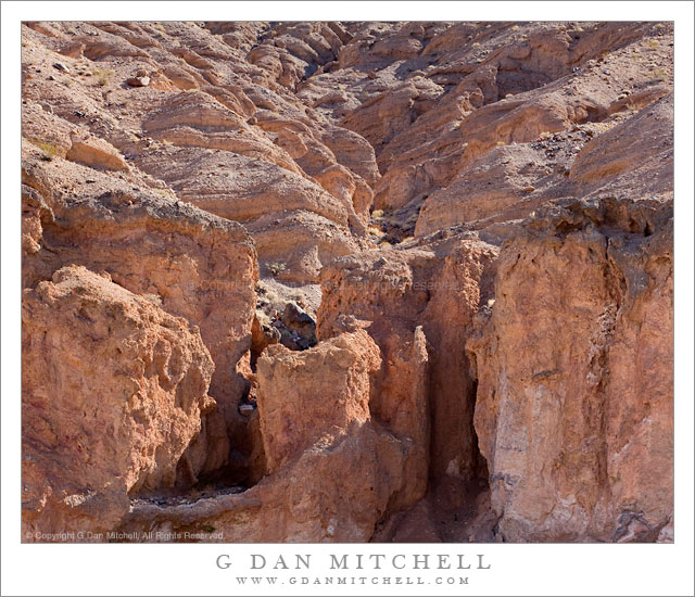
Red Rock Gully. Death Valley National Park, California. March 29, 2011. © Copyright G Dan Mitchell – all rights reserved.

A red rock gully and wash in the Panamint Range of Death Valley National Park.

I have driven past this area along the road from Death Valley up to Wildrose Canyon quite a few times, and as I do I always am impressed by the many convoluted little canyons and odd and interesting rock formations. Most often I have been on my way to some other place or the light wasn’t quite right, but I always take a look and make a mental list of little spots to keep an eye on. This particular little canyon is one you might not even notice unless you were looking carefully as you passed it. It is in a narrow section of the lower canyon where it is one of many such little landscapes. On this morning I was coming back down from shooting up higher in the Panamints and I was watching carefully as I drove, frequently pulling over to stop and check things out more carefully. At first I almost drove past this spot, but it looked like the light might be interesting this time so I quickly stopped and backed up and made a series of photographs including this one.

The question of how to frame this scene was an interesting one. As is often the case I cover more than one base and shoot the subject in several ways. Initially I worked with a vertical orientation that includes a bit more of the rough terrain a bit higher in the canyon. That image may still see the light of day! But as I shot the scene I also realized that I could use a horizontal orientation too, more tightly frame the entrance to the small canyon, and give up some of the upper canyon formations.

With many subjects I would prefer softer light, and I would probably try to shoot much earlier in the day or come back in the evening. But this canyon, I think, works well in the light of a bit later in the morning when the sun has topped the ridge and direct light hits the top of the rocks and reflects into the recesses a bit more.

G Dan Mitchell Photography | Flickr | Twitter | Facebook | Email
Text, photographs, and other media are © Copyright G Dan Mitchell (or others when indicated) and are not in the public domain and may not be used on websites, blogs, or in other media without advance permission from G Dan Mitchell.
Monterey Cypress Trees, Fog, Carmel Peninsula

Monterey Cypress Trees, Fog, Carmel Peninsula

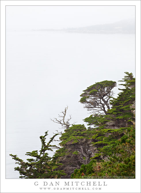
Monterey Cypress Trees, Fog, Carmel Peninsula. Point Lobos State Reserve, California. July 10, 2010. © Copyright G Dan Mitchell – all rights reserved.

Carmel Peninsula is barely visible though fog beyond Monterey Cypress trees along the north shore of Point Lobos State Reserve.

This was a typical summer day in coastal California – completely socked in by a thick, gray blanket of cold, wet fog! The light was somewhat dismal, so it wasn’t a day for typical “scenic” landscape or seascape photography, though the colors of the plants and trees were saturated by the soft light and the distant peninsula faded almost to monochrome though the fog across the bay.

These Monterey cypress trees grow along the tops of the rocky cliffs above this part of the Pacific Ocean, in some of the most exposed and precipitous locations imaginable. In some spots they are left exposed to the full force of the ocean winds and winter storms, and they grow close to the ground, following the contours of the rocky terrain in ways that remind me of trees growing in exposed locations near timberline in the Sierra. In other spots they are a bit more sheltered and they seem to be able to “stretch out” a bit, as these trees do along a section of the rocky cliffs that faces more into the bay than out to sea.

The bay holds the outlet of the Carmel River, and the peninsula visible across the water in the distance is the coastline of the town of Carmel. The foreground trees are within the boundaries of the Point Lobos State Reserve.

G Dan Mitchell Photography | Flickr | Twitter | Facebook | Email
Text, photographs, and other media are © Copyright G Dan Mitchell (or others when indicated) and are not in the public domain and may not be used on websites, blogs, or in other media without advance permission from G Dan Mitchell.
Rocky Knoll with Monterey Cypress Trees

Rocky Knoll with Monterey Cypress Trees

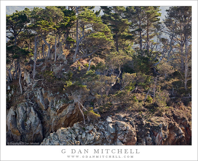
Rocky Knoll with Monterey Cypress Trees. Point Lobos State Reserve, California. January 8, 2011. © Copyright G Dan Mitchell – all rights reserved.

A grove of Monterey Cypress trees grows on top of a rocky ridge above the Pacific Ocean at Point Lobos State Reserve, California.

In my continuing attempt to mine every bit of ore possible from this scene… this is a closer study of the same tree-covered knoll that I posted recently. The rocky hill is near the end of a thin peninsula between Whalers Cove and Bluefish Cove at Point Lobos. It is covered with a wild confusion of plants, Monterey cypress trees, and rocks and the whole thing drops suddenly to the edge of the Pacific Ocean right below.

This is another in a group of photographs that I sort of think of as “how much dense detail can I cram into one frame” photographs. For this reason, I’m pretty certain that this will have a better chance of making sense in a decent sized photograph in which the detail can be enjoyed a bit more than it can be in this small jpg.

This photograph is not in the public domain and may not be used on websites, blogs, or in other media without advance permission from G Dan Mitchell.
G Dan Mitchell Photography
FlickrTwitter (follow me) | Facebook (“Like” my page) | LinkedInEmail

Text, photographs, and other media are © Copyright G Dan Mitchell (or others when indicated) and are not in the public domain and may not be used on websites, blogs, or in other media without advance permission from G Dan Mitchell.