Tag Archives: field

Lupine, Upper Sabrina Basin

Lupine, Upper Sabrina Basin
“Lupine, Upper Sabrina Basin” — A lush lupine-filled meadow along the outlet stream from Hungry Packer Lake near Picture Peak, high in the Sabrina Basin – John Muir Wilderness, Sierra Nevada, California.

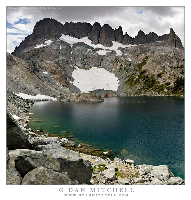
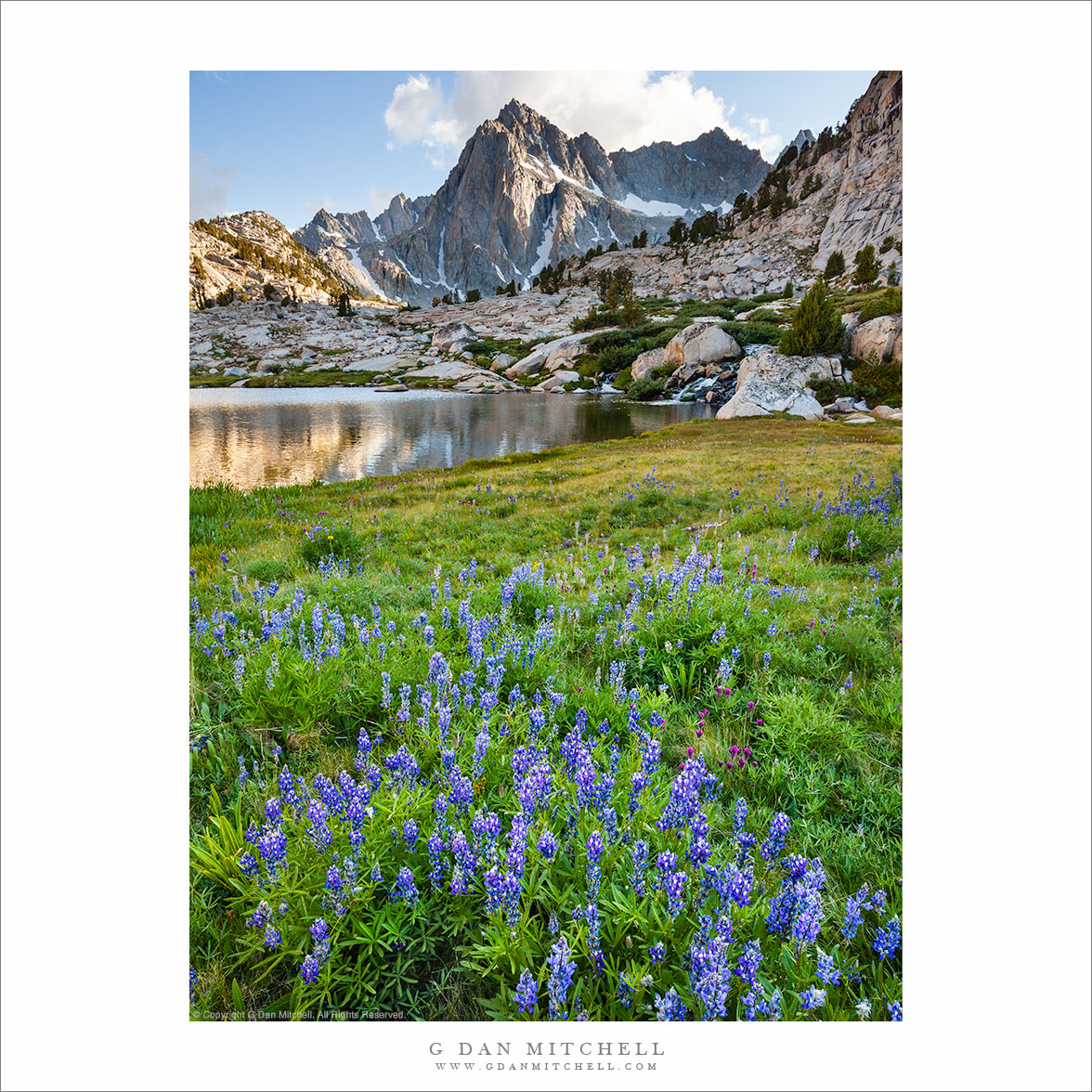
We had hiked up through this meadow filled with plants and wildflowers earlier in the day while walking a circuit that included Hungry Packer Lake (beyond the saddle seen in the distance and below Picture Peak), Moonlight Lake, and Sailor Lake. At that time the early afternoon light had been far too harsh for photography, so I made plans to be back here early in the evening. I had hoped for some “golden hour” light, but I have to admit that I could see that a ridge to the right was going to cast a shadow here too early for that. Fortunately, the light on the peak came from the side such that it wasn’t as much brighter as it might otherwise have been, and it seemed like it might be possible to capture the huge dynamic range of this scene.

That last point brings up a difficult technical issue with this photograph – that tremendously large dynamic range. Although my eyes/brain could take in the full scene while standing there, no camera that I’d be carrying on the trail can possibly deal with this in a single shot. In the foreground the meadow plants were in early evening/late afternoon shade while the cloud above the peak was brightly lit by the direct sun. In the film days the only real option would have been to use a graduated neutral density (GND) filter to reduce the light from the sky. However, with digital capture we have another alternative – capturing several exposures of the scene optimized for the bright and dark areas and then combining them in post-production. That is precisely what I determined to do here.

In this case I made a main exposure that handled the middle of the dynamic range of the scene. I also made two more; one optimized to barely contain the brightest levels in the cloud and the second optimized to capture all of the details in the darker foreground meadow. The three versions of the scene were combined in post-processing to recreate something much closer to what I actually saw. (Yes, this was a complex photograph to realize!) in addition to using three exposures, I was also able to carefully customize the boundaries between them issuing masks – both of which would be impossible with a GND filter.


Leave a comment or question using the form. (Click the title to see the full article and to comment if you are viewing it on the home page.)

G Dan Mitchell is a California photographer and visual opportunist. His book, “California’s Fall Color: A Photographer’s Guide to Autumn in the Sierra” (Heyday Books) is available directly from him. Blog | Bluesky | Mastodon | Substack Notes | Flickr | Email

All media © Copyright G Dan Mitchell and others.

Clearing Storm, Eastern Sierra Nevada

Clearing Storm, Eastern Sierra Nevada

Clearing Storm, Eastern Sierra Nevada. Near Mono Lake, California. June 7, 2009. © Copyright G Dan Mitchell – all rights reserved.

The clouds of a late-spring storm along the Sierra Nevada crest clear as evening light illuminates sage-covered high desert slopes near Mono Lake.

Another photograph in this brief series of black and white images, this one was made very close to Mono Lake. If you have been to the famous (at least among sunrise photographers!) South Tufa area at Mono, you may know the road that departs highway 395 and heads east to that wonderful photo location. Between highway 395 and where the road drops down to the lake shore, it crosses a low ridge with good views in every direction but directly south. It was from here that I made this photograph – and a few others that may turn up here eventually.

Shooting Mono Lake late in the day can be a bit tricky since the light disappears behind the Sierra crest earlier than one might think. If the conditions are right an evening shot from Mono can be fine, but often the light is less challenging in the morning. On this afternoon I had first headed out to South Tufa, but decided that it wasn’t looking right – so I headed back up towards the June Lake loop. Once there the clouds over the crest began to break up, so after shooting some images in that area I headed back towards Mono. As I topped this hill before the descent to South Tufa I saw this wonderful back-light on the sage-covered foreground hills so I stopped right at the top of this hill and photographed this scene.

This photograph is not in the public domain. It may not be used on websites, blogs, or in any other media without explicit advance permission from G Dan Mitchell.

keywords: sierra, nevada, range, mountains, eastern, slope, escarpment, crest, cirque, valley, snow, yosemite, mono, lake, south, tufa, recession, atmospheric, storm, clouds, flurry, field, sage, high, desert, hill, gully, valley, california, usa, scenic, travel, landscape, sky, evening, light, stock, black and white, clearing, spring, slope, forest

Iceberg Lake, Minarets

Iceberg Lake, Minarets

Iceberg Lake, Minarets. Sierra Nevada Mountains, California. July 27, 2007. © Copyright 2007  G Dan Mitchell – all rights reserved.

Submerged boulders along the rocky alpine shoreline of Iceberg Lake in front of the spires of the Minarets as afternoon thunderclouds begin to build.

This is an older photograph that I’ve been thinking of working on and posting for some time. Two summers ago in late July I was on a backpack trip into Ediza Lake and then on to Garnett and Thousand Island. We spent a few nights a beautiful Lake Ediza and on one of the layover mornings I decided to wander on up to Iceberg Lake. Iceberg Lake (along with Cecile Lake) is located along a high and almost cross-country route between Ediza and Minarets Lakes, and it passes very close beneath the east side of the imposing ridge of the Minarets. I made it as far as Iceberg when I noticed that that the thunderclouds were already building quickly at noon – so I stopped for a few photographs before high-tailing it back down to camp. (I almost made it back before the rain and hail started! :-)

My history with this lake goes back to some earlier trips as well. Many years ago I decided to do a sol0 backpack trip beneath the Minarets, comprising a loop up to Minaret Lake, then up into the rough country above the lake, across it, and down past Iceberg Lake to Ediza Lake. (I have been to the latter lake many times!) It was, as I recall, early in a season that was a reasonably snowy one. When I picked up my permit the range tried to warn me of the dangers of crossing while there was still a lot of snow in a few spots, but being younger than I am now and foolish in very different ways, I decided to ignore him. The climb above Minaret Lake went well, once I found a route through rocks that went up to the right. I had a small accident that left some scars that I still bear—I stepped into a hole between rocks and managed to bang up one leg a bit. I continued on and eventually found myself at the top of the saddle at the upper left corner of this photograph, looking down at a very steep slope that was covered with snow that dropped right into the lake. I was without any of the aids to mountain travelers that might have come in handy here such as trekking poles (didn’t use them back in those days), an ice ax, or crampons. I found a small piece of wood that I might use for an emergency self arrest—or so I imagined— and stepped gingerly down this slope.

G Dan Mitchell is a California photographer and visual opportunist whose subjects include the Pacific coast, redwood forests, central California oak/grasslands, the Sierra Nevada, California deserts, urban landscapes, night photography, and more.
Blog | About | Flickr | Twitter | FacebookGoogle+ | 500px.com | LinkedIn | Email

Text, photographs, and other media are © Copyright G Dan Mitchell (or others when indicated) and are not in the public domain and may not be used on websites, blogs, or in other media without advance permission from G Dan Mitchell.

First Light, Mount Gibbs

First Light, Mount Gibbs

First Light, Mount Gibbs. Yosemite National Park, California. July 11, 2009. © Copyright G Dan Mitchell – all rights reserved.

First morning light shines across the face of Mt. Gibbs above Tioga Pass, Yosemite National Park, California.

This photograph was made in the early morning alongside Tioga Meadow, the large meadow just below Tioga Pass inside the eastern boundary of Yosemite National Park, as the first sun crept over the Sierra crest and began to hit the upper slopes of Mt. Gibbs. This is one of my favorite locations along Tioga Pass Road, probably because it is the highest area right at the pass but also because of the extensive rolling meadows containing the skeletons of trees knocked down by avalanches and because of the proximity to much higher peaks, such as Mt. Dana.

This photograph is not in the public domain. It may not be used on websites, blogs, or in any other media without explicit advance permission from G Dan Mitchell.

keywords: mount, gibbs, morning, dawn, sun, light, mountain, snow, field, red, brown, clouds, sky, blue, forest, trees, meadow, rock, tioga, pass, road, tuolumne, meadows, yosemite, national park, california, usa, ridge, mountains, landscape, sierra nevada, range, scenic, travel, stock