Tag Archives: highway

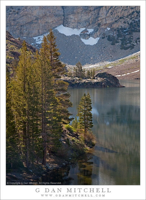
Morning, Ellery Lake

Morning, Ellery Lake

Morning, Ellery Lake. Eastern Sierra Nevada near Yosemite. June 29, 2010. © Copyright G Dan Mitchell – all rights reserved.

Morning light on Ellery Lake and surrounding mountains near Tioga Pass.

Yosemite National Park visitors who enter or leave the park via the Tioga Pass Road route are familiar with the sub-alpine lakes just east of the pass including Tioga Lake, Ellery Lake, and many smaller ponds. Ellery Lake – which is made a bit higher by a dam on its outlet stream – is the last lake before the drop-off into Lee Vining Canyon, and a place that people often stop during the summer months. Even during the very early and late season it is a popular place – in the early season right after the road opens you can often see back-country skiers on the steep slopes above the lake.

I rarely pass this particular cove near the upper end of the lake without stopping. However, I have also found it a tricky photographic subject! Very early light is blocked by the very tall ridge whose lower slopes are seen in the distance in this photograph. It is often quite windy. Late in the day the color of the light can be special, but it also tends to be almost directly behind the photographer and to leave some deep foreground shadows. There are other places like this – they seem like they should be photographic “slam dunks,” but they turn out to be more difficult than they appear. Or maybe it is just me! :-)

In any case, on this late June morning I had earlier finished photographing in the Mono Lake area and was heading back up towards Tuolumne Meadows. And, as always, as I drove around the curve above this cove I caught a view of the lake out of the corner of my eye and couldn’t resist stopping.

G Dan Mitchell Photography | Flickr | Twitter | Facebook | Email
Text, photographs, and other media are © Copyright G Dan Mitchell (or others when indicated) and are not in the public domain and may not be used on websites, blogs, or in other media without advance permission from G Dan Mitchell.

Purple Dawn, Mono Lake

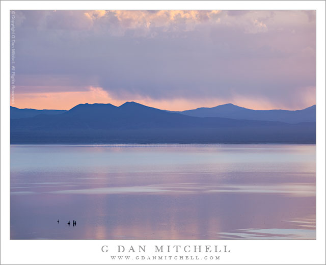
Purple Dawn, Mono Lake

Purple Dawn, Mono Lake. Eastern Sierra Nevada, California. June 29, 2010. © Copyright G Dan Mitchell – all rights reserved.

Pastel shades of purple and blue just before dawn at Mono Lake.

Back at the end of 2010 I wrote that I was going through all of my 2010 raw files to look for images that I had passed over, as I do near the end of every year. Things got busy, I got distracted, and I only got about half way through the year’s files. Recently I have returned to the 2010 photographs to try to complete the task, and this is one of the photographs that I rediscovered as I resumed the search with images taken near the end of June.

This was my first real photographic trip to the Sierra during the summer season of 2010. I had made a brief trip up there, visiting Yosemite Valley and then crossing Tioga Pass, back in early June right about the time that the pass opened. However, on this trip I was able to spend several days in the high country and kicking around near Mono Lake. This can be a great time of the year up there since conditions range from what seems like late winter in the high country to real summer in places like Owens Valley and around Mono Lake.

On this morning I decided that I’d head down to Mono Lake well before dawn and see what I could turn up. I did not go to the iconic South Tufa area on this morning, thinking instead that I’d try for some different and longer views of the lake. (Later in the morning I traveled a good distance south of the lake on the less-used section of highway 120.) There were, obviously, clouds in the morning and they blocked the sunrise. However, the light glowed through and over and under and around them, and even though there was not direct light in very early morning image, the colors were quite something. The group of tufa towers at the lower left are offshore not far from the South Tufa area.

G Dan Mitchell Photography | Flickr | Twitter | Facebook | Email
Text, photographs, and other media are © Copyright G Dan Mitchell (or others when indicated) and are not in the public domain and may not be used on websites, blogs, or in other media without advance permission from G Dan Mitchell.
Confluence of Cascade and Tamarack Creeks

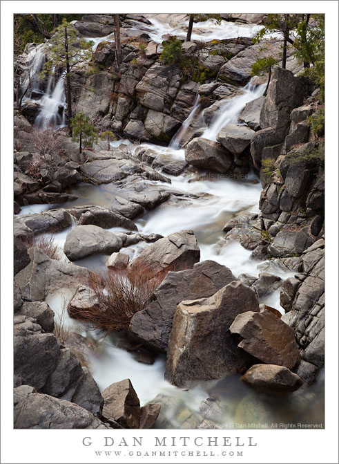
Confluence of Cascade and Tamarack Creeks

Confluence of Cascade and Tamarack Creeks. Yosemite National Park, California. January 16, 2011. © Copyright G Dan Mitchell – all rights reserved.

Long exposure in evening light of the boulder-strewn confluence of Cascade and Tamarack Creeks, Yosemite National Park.

Right below the bridge along the Crane Flat Road (often described as highway 120) route into Yosemite Valley, two wildly cascading creeks join together before their final descent to the bottom of the canyon where they join with the Merced River. Cascade Creek is probably the better known of the two since some spectacular sections of its descent are clearly visible right above the roadway. Tamarack Creek is easier to miss since you have to look carefully into the trees if you try to spot it from your car, or else get out of the car and look more closely. In the photograph, Cascade Creek flows away from the bottom of the frame, and Tamarack joins from the right in the upper portion of the frame.

I’ve always paid more attention to the section of Cascade Creek that is above the bridge. However, after recently having several opportunities to carefully (and admiringly) view Charlie Cramer’s stunning print of his “Cascade Creek, Spring, Yosemite”, I decided that I really needed to look off the other side of this bridge! (Charlie, I found your rocks. First, I’m even more impressed now that I realize how obscure and out of the way the subject of your photograph is. Second, how the heck did you position the camera over the side of the bridge to make that photograph!?) With that in mind, I visited this spot several times on this weekend trip to Yosemite and tried photographing it in different types of light.

This photograph is not in the public domain and may not be used on websites, blogs, or in other media without advance permission from G Dan Mitchell.
G Dan Mitchell Photography
FlickrTwitter (follow me) | Facebook (“Like” my page) | LinkedInEmail

Text, photographs, and other media are © Copyright G Dan Mitchell (or others when indicated) and are not in the public domain and may not be used on websites, blogs, or in other media without advance permission from G Dan Mitchell.

Big Sur Coast Near Bixby Creek, Winter

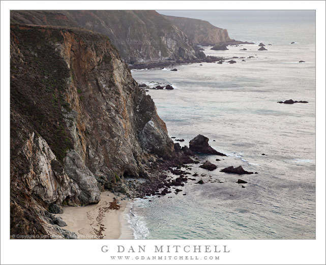
Big Sur Coast Near Bixby Creek, Winter

Big Sur Coast Near Bixby Creek, Winter. Pacific Ocean, California. January 1, 2011. © Copyright G Dan Mitchell – all rights reserved.

Light winter rain falls on the rugged Big Sur coastline near Bixby Creek.

This is one more – and perhaps the final – photograph from New Years Day 2011 along the Big Sur coast line. While this is perhaps not your chamber of commerce picture perfect day, it is my kind of Big Sur day. As I made the photograph the wind was absolutely howling – so strong that I couldn’t really use my tripod, so I instead hand held the camera and braced it and myself against a very large boulder. To make things even more “fun,” it was trying very hard to rain!

The location is precisely at the spot where many of the iconic photographs of Bixby Bridge are made, at the north end of the bridge. However, on this day I thought that the subdued tones of the winter ocean and cliffs were more interesting, so I framed my photographs to avoid including the bridge.

This photograph is not in the public domain and may not be used on websites, blogs, or in other media without advance permission from G Dan Mitchell.

G Dan Mitchell Photography
FlickrTwitter (follow me) | Facebook (“Like” my page) | LinkedInEmail

Text, photographs, and other media are © Copyright G Dan Mitchell (or others when indicated) and are not in the public domain and may not be used on websites, blogs, or in other media without advance permission from G Dan Mitchell.