Tag Archives: recession

Devils Cornfield, Morning

Devils Cornfield, Morning

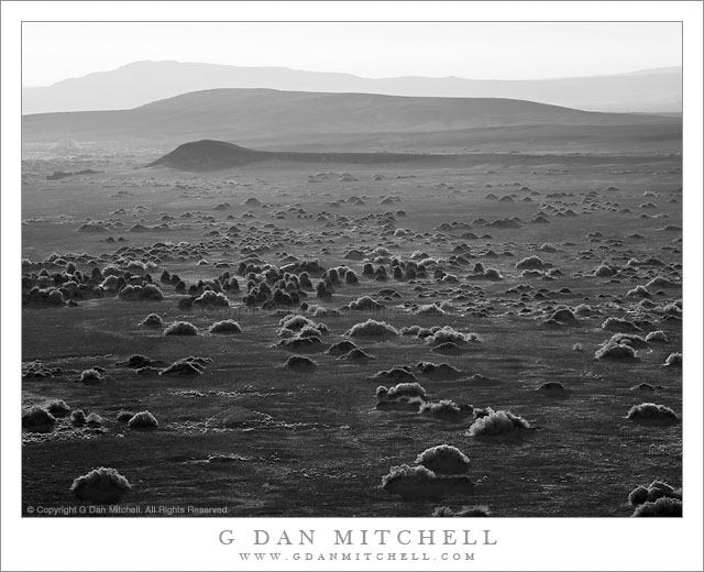
Devils Cornfield, Morning. Death Valley National Park, California. March 31, 2011. © Copyright G Dan Mitchell – all rights reserved.

Low angle morning light silhouettes receding hills and plants near Devils Cornfield, Death Valley National Park.

Taking advantage of the low angle light from the sun as it rose above the Funeral Mountains, I shot almost directly into the light with a long lens to photograph these backlit plants (“arrowweed” I believe) growing along the fringes of the Devils Cornfield area not far from Stovepipe Wells. Although the compressed perspective from the relatively long focal length disguises the fact, I was shooting from a hill that gave me some elevation above the flat surface of the Valley here, and provided a bit better view of the tops of the hills receding into the haze.

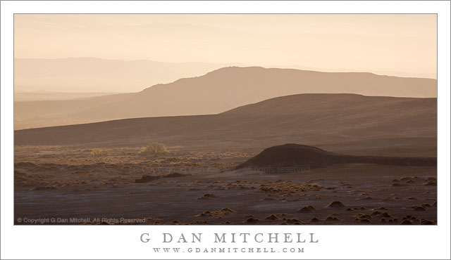
I made a variation on this photograph at the same time that I posted earlier – it is in color and used an even longer focal length to get a bit more detail of the mesquite tree that is barely visible in the upper right area of this shot. The color image has a much less start appearance than the black and white rendition with its contrast between the light on the tops of the plants and the surrounding dark soil.

G Dan Mitchell Photography | Flickr | Twitter | FacebookLinkedIn | Email
Text, photographs, and other media are © Copyright G Dan Mitchell (or others when indicated) and are not in the public domain and may not be used on websites, blogs, or in other media without advance permission from G Dan Mitchell.

Hills and Sunrise Haze, Death Valley

Hills and Sunrise Haze, Death Valley

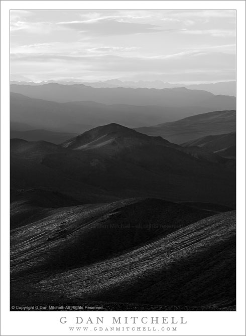
Hills and Sunrise Haze. Death Valley National Park, California. March 31, 2011. © Copyright G Dan Mitchell – all rights reserved.

Sunrise light shines through morning haze to silhouette low hills in central Death Valley.

On the last morning of my late-March Death Valley shoot, I was on top of a low hill in roughly the middle of the Valley, not far from the “Devils Cornfield” area, mainly to photograph the Mesquite Dunes and the nearby transverse dunes against the backdrop of the Cottonwood Mountains. But this spot gave me a 360 degree panoramic view of a huge section of the central Valley, so while I waited for “just right” light on my intended subjects I also had time to see and photograph other subjects.

These low hills, mostly bare but sprinkled here and there with a few small plants or even a creosote bush or possibly a mesquite tree, were in the morning haze that sometimes settles in the bottom of the Valley before the daytime winds clear it out. The sun had just come over the Funeral Mountains to the east and was shining at a very low angle through this haze, so I pointed the camera (with a 400mm focal length lens!) almost straight into the sun (shading the lens with my hand) and made a few shots of these hills receding into the hazy distance across the Valley

G Dan Mitchell Photography | Flickr | Twitter | Facebook | Email
Text, photographs, and other media are © Copyright G Dan Mitchell (or others when indicated) and are not in the public domain and may not be used on websites, blogs, or in other media without advance permission from G Dan Mitchell.
Dusk, Death Valley Ridges

Dusk, Death Valley Ridges

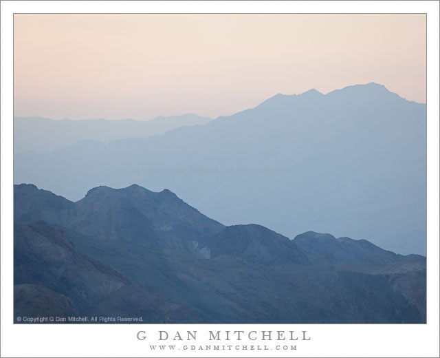
Dusk, Death Valley Ridges. Death Valley National Park, California. March 30, 2011. © Copyright G Dan Mitchell – all rights reserved.

Dusk light on ridges above Death Valley, California.

This photograph was made in the evening from Aguereberry Point, high in the Panamint Mountain Range along the west side of Death Valley. The point is a spectacular overlook with panoramic views in all directions. The number of visitors is relatively low since it is at the end of a gravel road and is a good long drive from most of the places where people tend to stay when they visit the park. It is also windy!

(Those who read the brief technical information about the photographs might wonder at my use of ISO 400 for a landscape photograph – but when shooting at 400mm in windy conditions, a lower ISO makes it darn near impossible to deal with camera vibrations.)

The range of lighting conditions and effects as the day comes to an end at Aguereberry Point is tremendous. To the west (roughly behind me and over my left shoulder as I shot this photograph) the sky is very bright as the sun drops towards the distant Sierra Nevada. Below the Valley and the canyons along the mountains on either side gradually dim and become hazy. As the sun drops and is blocked by intervening peaks and mountain ranges, even the higher peaks and ridges take on these subtle and pastel shadings. It probably isn’t too important to identify the specific ridges in this image, but they are to the northeast of the point. The nearer ridge is along the west side of the Valley (probably part of the Tucki Mountain complex) and the further ridges are a much greater distance to the northeast across the upper Valley.

G Dan Mitchell Photography | Flickr | Twitter | Facebook | Email
Text, photographs, and other media are © Copyright G Dan Mitchell (or others when indicated) and are not in the public domain and may not be used on websites, blogs, or in other media without advance permission from G Dan Mitchell.
From the Panamints to the Sierra, Evening

From the Panamints to the Sierra, Evening

From the Panamints to the Sierra, Evening. Death Valley National Park, California. March 30, 2011. © Copyright G Dan Mitchell – all rights reserved.

The Sierra Nevada in evening light as seen from Aguereberry Point in Death Valley National Park’s Panamint Range.

I made this photograph from Aguereberry Point shortly before sunset. Aguereberry Point is a lonely prominence over 6000′ above Death Valley, high in the Panamint Mountain range, a place of astonishing panoramic views – and often some significant winds. As I drove the gravel road to the point late in the afternoon I saw three or four other vehicles heading the other direction, but when I arrived at the point a bit more than an hour before sunset no one else was there.

Having photographed here a few times previously, I am becoming more familiar with the challenges and the opportunities of shooting here. One of the challenges – as is the case in many spots in Death Valley – is that certain subjects seem to be “photographable” at very specific times and only for short intervals. One of the most interesting views from Aguereberry is southeast down into Trail Canyon and on to the lower slopes of Wildrose Peak beyond. This is wild, rugged, austere terrain. However, because it lies on the east side of this range the light changes quickly from a washed out blast of daytime sun to sudden deep shadows as the sun drops behind the higher ridges of the Panamints. (Trail Canyon is not seen in this photograph.)

Another challenge is that, impressive and overwhelming as the scale of this grand scene is, it can be difficult to pull interesting compositions out of it. I tend to work with longer lenses here, both to isolate smaller areas out of the huge landscape and to compress distance. In this photograph, the silhouetted crest of the highest part of the Sierra Nevada range is on the horizon, with the intervening ridges of the Panamint Range and others probably including the Inyo Mountains and the ridge just west of Panamint Valley.

And, since I tend towards those large and long lenses… wind is an issue! And on top of Aguereberry Point there is nothing to stop the often strong winds of Death Valley. On this evening the winds were howling, so I found a spot below some rocks where it was a bit less windy and then spent a lot time waiting for momentary lulls in the wind when I could make photographs.

G Dan Mitchell Photography | Flickr | Twitter | Facebook | Email
Text, photographs, and other media are © Copyright G Dan Mitchell (or others when indicated) and are not in the public domain and may not be used on websites, blogs, or in other media without advance permission from G Dan Mitchell.