Tag Archives: cliff

Big Sur Coastline at Bixby Creek, Winter

Big Sur Coastline at Bixby Creek, Winter

Big Sur Coastline at Bixby Creek, Winter. Central California Coast. January 1, 2010. © Copyright G Dan Mitchell – all rights reserved.

A winter storm approaches the bluffs of the Big Sur coastline at Bixby Creek.

This is, as you may have noticed, the same scene as that in yesterday’s photograph – but this time in portrait mode and composed to focus on the receding edge of the land as it meets the winter sea off of the Big Sur coast. To recap, it was raining lightly and blowing hard enough to almost knock me over when I made this photograph. The wind was coming straight at my camera position out of the south. Since I figured my tripod would probably blow right over in one of the gusts, I decided to use a “natural tripod” and instead drape myself over a conveniently placed boulder and brace the camera on the top of the rock.

This is a wild section of the coastline that forces the coast highway to ascend well above the steep shoreline bluffs and cliffs. I am intrigued by the rock pile that has slid off the face of the tall cliff at the left and collected along the beach in front of and beyond the cave at the waterline. I was surprised to see a small number of footprints in the sand on this little beach!

G Dan Mitchell Photography
About | Flickr | Twitter | FacebookGoogle+ | 500px.com | LinkedIn | Email

Text, photographs, and other media are © Copyright G Dan Mitchell (or others when indicated) and are not in the public domain and may not be used on websites, blogs, or in other media without advance permission from G Dan Mitchell.

(Basic EXIF data may be available by “mousing over” large images in posts. Leave a comment if you want to know more.)

Titus Canyon Road

Titus Canyon Road
Titus Canyon Road

Titus Canyon Road. Death Valley National Park, California. March 28, 2010. © Copyright G Dan Mitchell – all rights reserved.

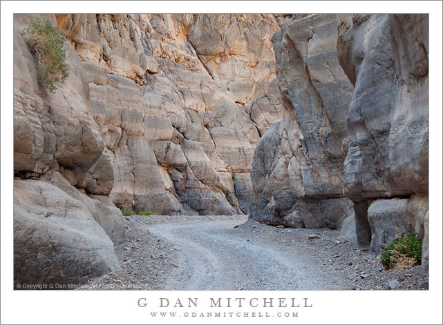
I made this photograph during midday hours after walking a ways up into the canyon from its mouth – the alternative to making the very long drive over the Grapevine Mountains from Amargosa Valley. (I have done the latter a few times, too.) While most Death Valley subjects tend to be appealing in the early morning or in the evening, many of the canyons can be at their best during the middle of the day, especially the very deep and narrow canyons like lower Titus Canyon. Here the canyon narrows down to the point that there is only room of a single gravel track, and twists and turns around rocky outcroppings. The light striking the upper canyon walls – out of the range of this photograph – reflects down into the canyon and produces soft, diffused illumination.

This photograph is not in the public domain and may not be used on websites, blogs, or in other media without advance permission from G Dan Mitchell.

G Dan Mitchell Photography
About | Flickr | Twitter | Facebook | Google+ | 500px.com | LinkedIn | Email

Text, photographs, and other media are © Copyright G Dan Mitchell (or others when indicated) and are not in the public domain and may not be used on websites, blogs, or in other media without advance permission from G Dan Mitchell.

(Basic EXIF data may be available by “mousing over” large images in posts. Leave a comment if you want to know more.)


Rugged Terrain, Lower Titus Canyon

Rugged Terrain, Lower Titus Canyon

Rugged Terrain, Lower Titus Canyon. Death Valley National Park, California. March 28, 2010. © Copyright G Dan Mitchell – all rights reserved.

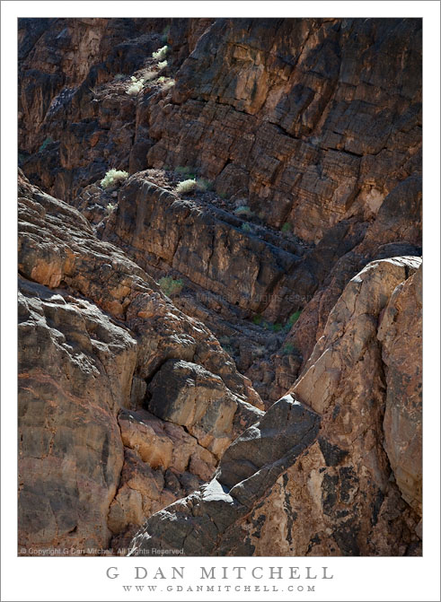
Details of the rugged cliffs and walls rising above lower Titus Canyon in Death Valley National Park.

Titus Canyon Road is one of the marvels of Death Valley National Park. It begins in high desert of Amargosa Valley near the town of Beatty and the ghost town of Rhyolite, winds over the summit of the Grapevine Mountains, drops precipitously into upper Titus Canyon, passes a number of historically interesting sites, passes through a very narrow and deep section in the lower canyon, and then suddenly emerges into the vastness of Death Valley.

In the lower section of the canyon, the wash becomes very narrow, passing through a twisty slot canyon and is, in places, barely wide enough for the one-lane gravel road. Here the walls of the canyon press tightly together and rise steeply for hundreds of feet. Some places are so deep that the sun rarely penetrates to the bottom.

Fortunately for the preservation of the canyon the road is horrible, at least if you are used to more civilized driving. It is a one-way road and the whole thing is gravel. Sections are in decent shape, but it other places the road passes over narrow and twisty sections next to precipitous drop-offs and then dives steeply into deep canyons. At times the route is closed after heavy rains or other conditions that make the route impassable.

Fortunately, the section that is perhaps the most impressive in many ways – the deep slot canyon near the bottom – is easily accessible by foot from Death Valley. After a short drive up to the canyon entrance on a gravel road to a parking area, you can enter the canyon on foot and walk up as far as you want. This photograph was made within the lower mile of the canyon during the late morning, when the light penetrates more deeply into the canyon and creates a glow on the canyon walls.

G Dan Mitchell Photography
About | Flickr | Twitter | Facebook | Google+ | 500px.com | LinkedIn | Email

Text, photographs, and other media are © Copyright G Dan Mitchell (or others when indicated) and are not in the public domain and may not be used on websites, blogs, or in other media without advance permission from G Dan Mitchell.

(Basic EXIF data may be available by “mousing over” large images in posts. Leave a comment if you want to know more.)

Winter Dusk, Carmel Highlands Near Yankee Point

Winter Dusk, Carmel Highlands Near Yankee Point

Winter Dusk, Carmel Highlands Near Yankee Point. Carmel Highlands, California. January 2, 2010. © Copyright G Dan Mitchell – all rights reserved.

Winter dusk light and clouds over the Pacific Ocean at Carmel Highlands near Yankee Point, Pacific Coast Highway, California.

This is the companion image to the black and white photograph I posted yesterday, Before I made the exposures that I used to create that black and white landscape-orientation image, I first made a quick series of bracketed exposures in portrait mode. As I photographed, I knew that the dynamic range was going to be too large for a singe exposure so I quickly made a series of four exposures, from which I selected two that have blended to produce this image.

This photograph is not in the public domain and may not be used on websites, blogs, or in other media without advance permission from G Dan Mitchell.

G Dan Mitchell Photography
Flickr | Twitter | Facebook Fan Page | Facebook | Friendfeed | Email