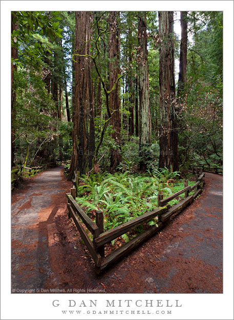
A bed of ferns grows at a trail junction under deep redwood forest cover at Muir Woods National Monument.
This photograph was made in the late winter of 2009, during that time of the year when the redwood forest is still very wet and cool, but when flowers are blooming and spring is clearly on the way. The location is along the very popular (and often quite busy) main trail along the creek through the central part of the park. No doubt I had to wait a bit for the combination of these beams of light and no other visitors on the trail!
(Basic EXIF data may be available by “mousing over” large images in posts when this page is viewed on the web. Leave a comment if you want to know more.)
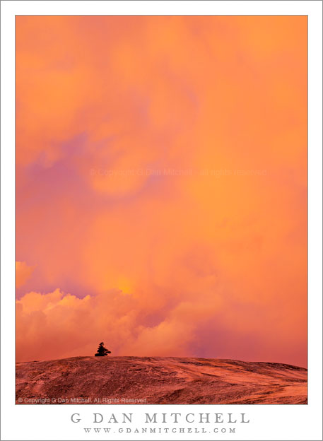
A tree and granite slab are lit by brilliant sunset light from a dissipating evening thunderstorm, Yosemite National Park.
This was another of those sometimes-surprising bursts of evening Sierra color that results in effects so gaudy that they almost seem unreal – but this is real. I was camped down in a valley among trees so I wasn’t initially expecting much in the way of spectacular sunset photography. Instead, I planned to take advantage of the early shadows in the valley and get some evening photographs under soft light without any direct sun at all. I first worked some moving water where the nearby river flowed across granite slabs, and then I contemplated photographing some small plants in deeply cracked and patterned granite. As a worked my way across this granite, I remembered a small tree on the other side of the bowl that had looked like an interested photo subject a few days ago, so I walked over to that area where the tree stands in a shallow granite bowl.
Earlier in the afternoon I could see huge thunderheads building up to my east, but they did not move far enough west to affect me with anything more than a bit of gray sky. However, as the clouds built up to higher elevations, their tops began to take on the familiar “anvil” shape and the upper portions of the “anvils” began to spread to the west and out over my position. This is a classic setup for potentially spectacular evening sky color. Near sunset the clouds can pick up intense red/orange coloration from the sun setting in the west. At the same time, the storms begin to dissipate, creating semi-transparent “curtains” of virga (falling rain that doesn’t reach the ground), unusual shapes along the bottoms of the clouds, clouds emerging out of the gray murk as the sunset light picks them up.
As I arrived at my little tree, I quickly lost interest in that subject as the cloud light show began. First the bottom of the thunderhead began to turn brilliantly orange and red. Then the lower reaches of the small storm began to produce very unusual cloud shapes including mammatus clouds. Virga produced a brightly colored by semi-transparent scrim. It quickly became so bright that the red/orange colors began to wash the granite bowl, and I turned my camera from the little tree to the uphill granite surfaces and the clouds above.
In this vertical format image the tip of a small tree extends above the top of a dome-like area above me, and the brilliant light from the clouds washes the dome with color. The colors here have not been “amped up” in post – in fact, I’ve actually toned some of them down a bit!
(Basic EXIF data may be available by “mousing over” large images in posts when this page is viewed on the web. Leave a comment if you want to know more.)
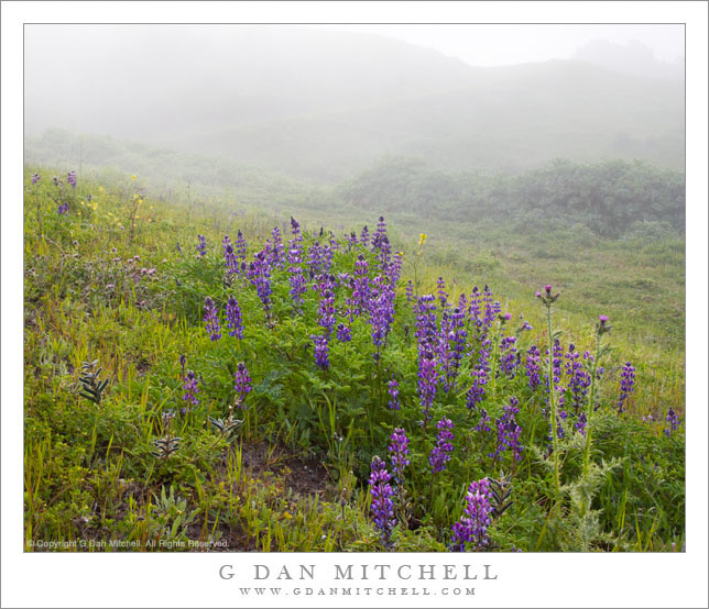
Spring lupine blossoms grow on fog-shrouded slopes of Mission Peak above Fremont, California.
While doing a major review of the past half-dozen years of raw files this week I have come across quite a few photographs that I had more or less forgotten. (I’ve also deleted a lot of old raw files, but that is a different story.) While I had forgotten this photograph, I remember the day I took it quite well and the memory of the photograph came back as soon as I found it.
Mission Peak is more than 2000′ feet above the Mission San Jose (part of Fremont) area of the San Francisco Bay Area, in the East Bay a bit north of San Jose. The peak is a very popular hiking location due to its proximity to urban areas, its quick access to near-wilderness, and the fact the summit provides a spectacular view of the southern parts of the San Francisco Bay, ranging from the South Bay and the Santa Cruz Mountains all the way up to San Francisco and, on clear days, beyond. On this day it was not clear, at least not at the start of the hike – it was extremely foggy, quite wet, and rather cold. But anyone who photographs flowers much knows that soft and diffused light can be your friend, and this fog certainly provided that light. The fog-obscured hills beyond are covered in the intense green (what I call the “impossible green”) of the California grasslands in spring.
By the way, I recall that as I continued on up the trail past these flowers and approached the summit of the peak I emerged above the fog bank to find hillsides carpeted with more lupine and with California golden poppy flowers.
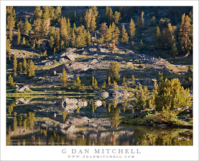
Early morning light on Greenstone Lake and surrounding trees and rocky terrain.
Greenstone is a relatively small lake just beyond the upper end of Saddlebag Lake, which is itself located just east of the Sierra crest and Yosemite National Park in an area dominated by Mount Conness and the tall ridge on which it stands. I had arrived before dawn at the Saddlebag Lake parking lot so that I could be on the trail before sunrise. Rather than giving in to the temptation to pay for a “water taxi” ride to the other end of the lake, I took the trail along the left shore, and arrived at Greenstone Lake just about the time that the first direct light was making its way down to this lake and the surrounding rocky hillside.
In this wet year with its late arrival of summer conditions, everything was still very wet around the lake and the meadow plants were still green and growing. (In dry years they start to finish up their growth spurt and begin turning brown by this time.)
I think this lake is a bit tricky to photograph in morning light. The light could be lovely at sunrise, but it would still be well up on the high ridges above the lake. It takes a long time for the sun to get high enough to rise above the ridge leading to Tioga Peak, and by that time most of the early morning warm light quality has given way to more typical daytime light. There were a few challenges in this photograph. They included trying to figure out how to find a workable composition in such a complex scene that was made even more complex by the reflections in the water. I think the triangle of rocky terrain in the upper half of the frame may help with this. The light posed several problems, mainly related to the very large dynamic range between the bright rocks and the shaded areas of forest at upper right. The light color was also tricky – because the shadows tend to be much bluer in a photograph than your eyes register when you are there, I had to mute the very blue quality of the shadows. This was done partly with an overall adjustment to color, but some additional work had to be done directly on the shadows.