Tag Archives: trees

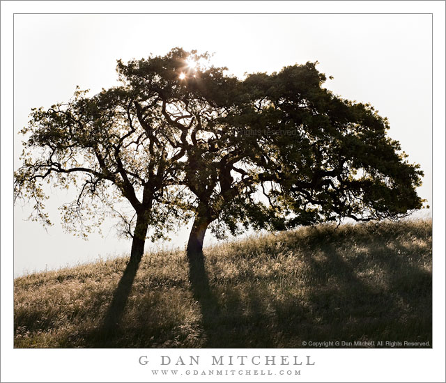
Two Oaks, Morning Sun

Two Oaks, Morning Sun

Two Oaks, Morning Sun. Calero Hills, California. April 30, 2011. © Copyright G Dan Mitchell – all rights reserved.

The springtime morning sun shines through a pair of oak trees in the Calero Hills south of San Jose, California.

On the final day of April and for the first time this season, I found to go for a hike at my favorite local park, a place where I have walked just about every available trail (and invented a few routes of my own) and photographed for a number of years. The park would not seem like anything all that special by comparison to some of the other places I visit, but it is close and I’ve gotten to know it in a way that makes it more special. The place is called the Calero County Park, part of the Santa Clara County Parks system.

The entrance to the park is in a broad valley that is largely occupied by stables. (Or, used to be – it looks like the stables must have closed since last season.) Rising from this valley are the typical grass-covered hills of central and northern California, with oaks and other trees scattered around and, in places, thicker trees and brush. At this time of year, the hills turn what I call “impossibly green” – and if you have seen them on a late-winter or early spring morning you know what I mean.

I started this hike a bit after dawn, so the golden hour light was more or less gone. I had a general idea of photographing some wildflowers (which didn’t happen – it was too windy) and some oak trees that grow alone or in small groups on the grass-covered hills. I passed a small lake – where a single egret often hangs out, but not on this morning – and topped a rise and descended into a small valley from which I have made quite a few photographs of oaks. It didn’t look too promising at first, but at the far end of this area I noticed that a pair of trees were still obscuring the sun and that I might be able to shoot straight into the sun with the trees blocking its disk, and get a photograph including the tree shadows on the hillside grasses.

This turned out to be another of those all-too-common ephemeral photographs in that the sun was starting to rise above the top branches of the tree and would soon be “out in the open,” making it much too bright for what I had in mind. So I worked quickly to set up tripod and camera and select a lens, then frame a composition, focus, and make a series of exposures that might be needed to deal with the huge dynamic range between direct sun and backlit tree trunks. By the time I had everything set up and was ready to shoot the sun had already risen above the upper branches, so I ended up looking for a slightly better shadow and putting the tripod down very low – and this gave me must enough time to make the series of exposures I figured I would need.

In the end, I got lucky. One single shot somehow managed to not blow the sun out too badly yet hold enough detail in the grass that a bit of work in post could bring it back. With all of the potential for lens flare – which I had to some extent in every shot – this one only had two small bits of it, and they were easily dealt with.

G Dan Mitchell Photography | Flickr | Twitter (follow me) | Facebook (“Like” my page) | LinkedIn | Email
Text, photographs, and other media are © Copyright G Dan Mitchell (or others when indicated) and are not in the public domain and may not be used on websites, blogs, or in other media without advance permission from G Dan Mitchell.

Osgood Place

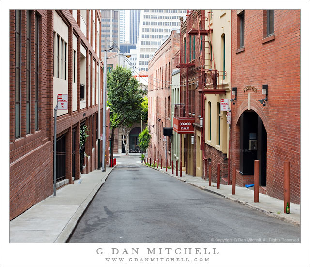
Osgood Place
Osgood Place

Osgood Place. San Francisco, California. July 12, 2010. © Copyright G Dan Mitchell – all rights reserved.

A steep street in downtown San Francisco with a sign for “Osgood Place.”

I came across this photograph from last summer while going over old raw files again this week. To be honest, I barely remember shooting this scene, and the only hints about the precise location are the “Osgood Place” sign (referring to one of the buildings) and the base of the Transamerica Pyramid beyond the end of the street.

When I saw it this week, something caught my attention about it. I like the vantage point that roughly as high as the third story of buildings near the bottom of the street – this does some slightly odd things to perspective lines. I also like the various types of red to brick-red coloration and the row of steel posts along the narrow sidewalk. The subtle green beer bottle against the first post at the right is a touch I like, too. ;-) It is surprising that I managed to take a photograph of this area of San Francisco that includes no people.

(Update: Thanks to some folks who saw this photograph elsewhere, I have learned that the street is also called Osgood Place.)

G Dan Mitchell Photography | Flickr | Twitter (follow me) | Facebook (“Like” my page) | LinkedIn | Email
Text, photographs, and other media are © Copyright G Dan Mitchell (or others when indicated) and are not in the public domain and may not be used on websites, blogs, or in other media without advance permission from G Dan Mitchell.
Whalers Knoll, Point Lobos

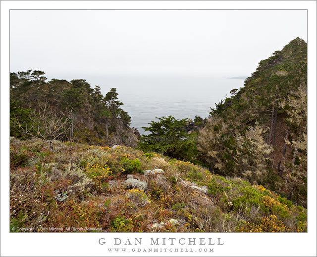
Whalers Knoll, Point Lobos

Whalers Knoll, Point Lobos. Point Lobos State Reserve, California. July 10, 2010© Copyright G Dan Mitchell – all rights reserved.

View of foggy Pacific Ocean from Whalers Knoll, Point Lobos State Reserve, California.

Whalers Knoll is yet another feature of Point Lobos named after “whalers” – Whalers Cove is another. Sometimes when I hike the trails along the north shore of the park I detour up a trail to the top of the knoll, from which there is a view of a larger expanse of landscape and seascape. But still, given the rough and rugged landscape of Point Lobos, there is no clear and unobstructed view – instead you can see the ocean between ridges and peaks and then only by looking for a spot where the Monterey Cypress trees are not as thick.

Although Point Lobos is a very popular park, it is usually possible to find some solitude by walking away from the most popular shoreline areas and hiking a bit. Since this trail is a bit out of the way and involves a climb, it isn’t unusual to be alone on at this lookout, especially on a foggy day when many visitors find the view from their cars to be sufficient!

G Dan Mitchell Photography | Flickr | Twitter | Facebook | Email
Text, photographs, and other media are © Copyright G Dan Mitchell (or others when indicated) and are not in the public domain and may not be used on websites, blogs, or in other media without advance permission from G Dan Mitchell.
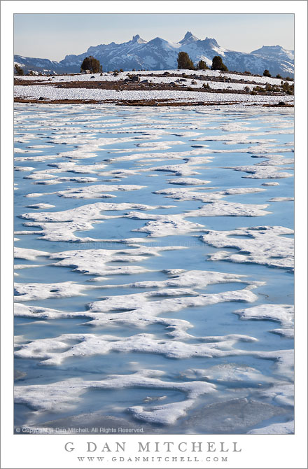
Melting Ice, Gaylor Lake and the Cathedral Range

Melting Ice, Gaylor Lake and the Cathedral Range

Melting Ice, Gaylor Lake and the Cathedral Range. Yosemite National Park, California. June 29, 2010. © Copyright G Dan Mitchell – all rights reserved.

The distant Cathedral Range rises above the melting ice of Gaylor Lake, Yosemite National Park.

Near the end of June last summer I hiked up here late in the day with my friends Mike and Karl. This was a somewhat unusual season in the Yosemite Sierra, in that there had been a lot of snow during the winter season and it had continued right on into spring. Consequently, the high passes opened up later than usual, and on a very late June day when things would typically be a bit more summer-ish, it looked more like late winter up here when we arrived.

I’ve visited this place quite a few times, but had never seen quite this scene before. More typically, the snow and ice are completely gone by the time I manage to get up there, and a typical visit usually entails arriving late on a warm afternoon and then hanging out in the sun while waiting for the evening light to come on. This time we were in snow before we crossed the ridge before the lake, and we had to think a bit about just how to head down toward the lake since the usual path was covered in snow. The lake itself was (obviously, judging from the photo!) still covered in ice, though melting was underway and the surface was a jigsaw puzzle of alternating blue pools and white ice.

We found a location near clumps of trees on rocky talus slopes above the lake to do our photography. In this photograph I shot down the length of the lake to mostly fill the frame with the melting ice. Beyond a small rocky rise at the end of the lake, the terrain drops off towards the meadows of the Tuolumne region, and beyond rise the peaks of the Cathedral range in early evening light.

G Dan Mitchell Photography | Flickr | Twitter | Facebook | Email
Text, photographs, and other media are © Copyright G Dan Mitchell (or others when indicated) and are not in the public domain and may not be used on websites, blogs, or in other media without advance permission from G Dan Mitchell.