Tag Archives: cliff

Red Rock Gully

Red Rock Gully
Red Rock Gully

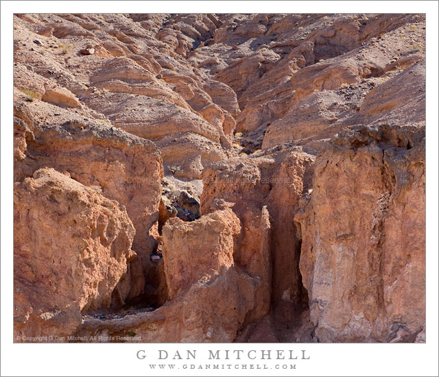
Red Rock Gully. Death Valley National Park, California. March 29, 2011. © Copyright G Dan Mitchell – all rights reserved.

A red rock gully and wash in the Panamint Range of Death Valley National Park.

I have driven past this area along the road from Death Valley up to Wildrose Canyon quite a few times, and as I do I always am impressed by the many convoluted little canyons and odd and interesting rock formations. Most often I have been on my way to some other place or the light wasn’t quite right, but I always take a look and make a mental list of little spots to keep an eye on. This particular little canyon is one you might not even notice unless you were looking carefully as you passed it. It is in a narrow section of the lower canyon where it is one of many such little landscapes. On this morning I was coming back down from shooting up higher in the Panamints and I was watching carefully as I drove, frequently pulling over to stop and check things out more carefully. At first I almost drove past this spot, but it looked like the light might be interesting this time so I quickly stopped and backed up and made a series of photographs including this one.

The question of how to frame this scene was an interesting one. As is often the case I cover more than one base and shoot the subject in several ways. Initially I worked with a vertical orientation that includes a bit more of the rough terrain a bit higher in the canyon. That image may still see the light of day! But as I shot the scene I also realized that I could use a horizontal orientation too, more tightly frame the entrance to the small canyon, and give up some of the upper canyon formations.

With many subjects I would prefer softer light, and I would probably try to shoot much earlier in the day or come back in the evening. But this canyon, I think, works well in the light of a bit later in the morning when the sun has topped the ridge and direct light hits the top of the rocks and reflects into the recesses a bit more.

G Dan Mitchell Photography | Flickr | Twitter | Facebook | Email
Text, photographs, and other media are © Copyright G Dan Mitchell (or others when indicated) and are not in the public domain and may not be used on websites, blogs, or in other media without advance permission from G Dan Mitchell.

Monterey Pines, Fog

Monterey Pines, Fog
Monterey Pines, Fog

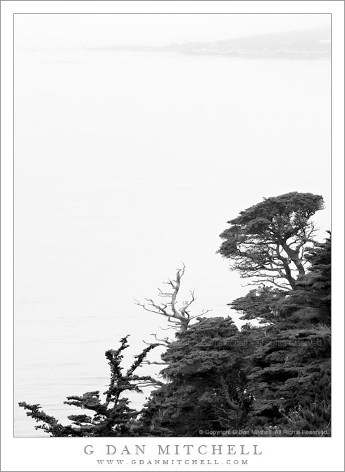
Monterey Pines, Fog. Point Lobos State Reserve, California. July 10, 2010. © Copyright G Dan Mitchell – all rights reserved.

Monterey Pines growing along cliff tops on the north shore of Point Lobos State Reserve with Carmel coastline visible in the distance.

These beautiful and tough Monterey Cypress trees grow at the edges of cliffs above the Pacific Ocean along the north shore of Point Lobos, and on this foggy morning the outline of the Carmel shoreline was just barely visible beyond them. The light was difficult, but I think it ended up helping produce a very moody image that, for me, evokes that feeling of walking though this area on such a morning.

I’m one of those strange people who is usually a bit disappointed when the weather here is clear! In fact, I’ll change my mind and decide not to go photograph at Point Lobos if I hear it is going to be a beautiful blue sky day. My ideal is a day with fog or clouds or rain, and especially so if there is a chance that a bit of light might try to break through clearing (or arriving) clouds.

G Dan Mitchell Photography | Flickr | Twitter | Facebook | Email
Text, photographs, and other media are © Copyright G Dan Mitchell (or others when indicated) and are not in the public domain and may not be used on websites, blogs, or in other media without advance permission from G Dan Mitchell.
Monterey Cypress Trees, Fog, Carmel Peninsula

Monterey Cypress Trees, Fog, Carmel Peninsula

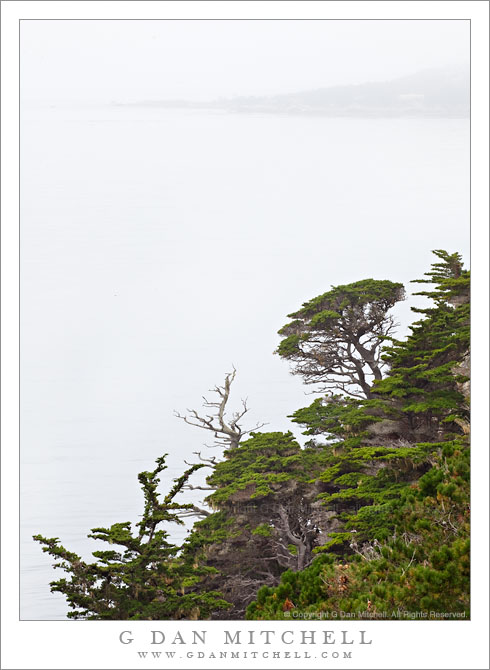
Monterey Cypress Trees, Fog, Carmel Peninsula. Point Lobos State Reserve, California. July 10, 2010. © Copyright G Dan Mitchell – all rights reserved.

Carmel Peninsula is barely visible though fog beyond Monterey Cypress trees along the north shore of Point Lobos State Reserve.

This was a typical summer day in coastal California – completely socked in by a thick, gray blanket of cold, wet fog! The light was somewhat dismal, so it wasn’t a day for typical “scenic” landscape or seascape photography, though the colors of the plants and trees were saturated by the soft light and the distant peninsula faded almost to monochrome though the fog across the bay.

These Monterey cypress trees grow along the tops of the rocky cliffs above this part of the Pacific Ocean, in some of the most exposed and precipitous locations imaginable. In some spots they are left exposed to the full force of the ocean winds and winter storms, and they grow close to the ground, following the contours of the rocky terrain in ways that remind me of trees growing in exposed locations near timberline in the Sierra. In other spots they are a bit more sheltered and they seem to be able to “stretch out” a bit, as these trees do along a section of the rocky cliffs that faces more into the bay than out to sea.

The bay holds the outlet of the Carmel River, and the peninsula visible across the water in the distance is the coastline of the town of Carmel. The foreground trees are within the boundaries of the Point Lobos State Reserve.

G Dan Mitchell Photography | Flickr | Twitter | Facebook | Email
Text, photographs, and other media are © Copyright G Dan Mitchell (or others when indicated) and are not in the public domain and may not be used on websites, blogs, or in other media without advance permission from G Dan Mitchell.
Ellery Lake

Ellery Lake
Ellery Lake

Ellery Lake. Sierra Nevada near Yosemite, California. June 29, 2010. © Copyright G Dan Mitchell – all rights reserved.

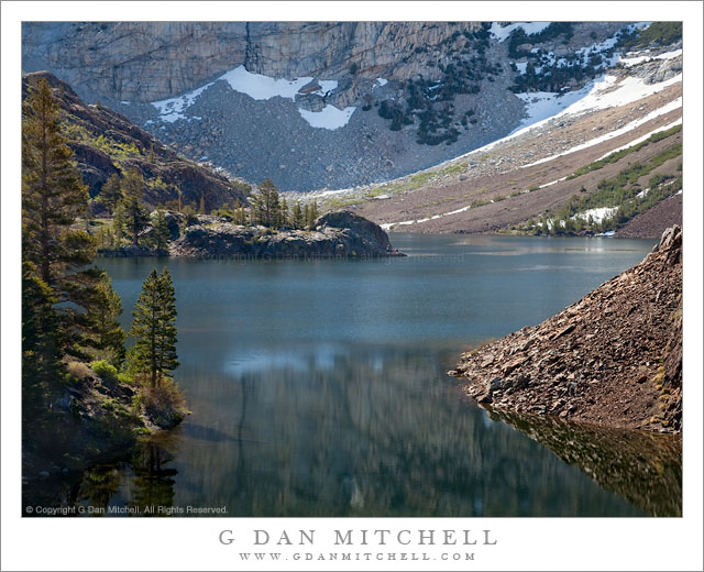
Early season morning light on Ellery Lake near Tioga Pass.

I made this photograph on the same early-season morning on which I made the vertical format photograph of the same scene that I recently posted. Ellery Lake is alongside highway 120, the “Tioga Pass Road,” just beyond the eastern boundary of the park and the Sierra crest. To be completely forthcoming, I made this photograph from the side of the road! (The many individuals who know this area well, and who have probably stopped to look at the same scene, already knew that…)

To briefly recap, the road here curves around the upper end of the lake above this small bay. Looking across the bay, the rocky edges of the lake are visible along with the steep talus slopes ascending to the peaks around Mt. Dana beyond. The spot has a natural beauty in terms of the forms of the landscape, but I think it is difficult to photograph as a whole – the light is the tricky thing. The earliest morning light is block by high peaks to the east and the late afternoon light goes quickly from sun to shade as the sun drops below ridges behind the camera position, and this light can be fairly flat since it comes from directly behind. This photograph was made in the morning, but not close to sunrise at all – it was two or three hours later. Even here the scene isn’t without technical challenges, especially from the dynamic range that spans from the shadows behind backlit rocks and trees to the very bright snow fields at upper right.

G Dan Mitchell Photography | Flickr | Twitter | Facebook | Email
Text, photographs, and other media are © Copyright G Dan Mitchell (or others when indicated) and are not in the public domain and may not be used on websites, blogs, or in other media without advance permission from G Dan Mitchell.