
Tag Archives: shore

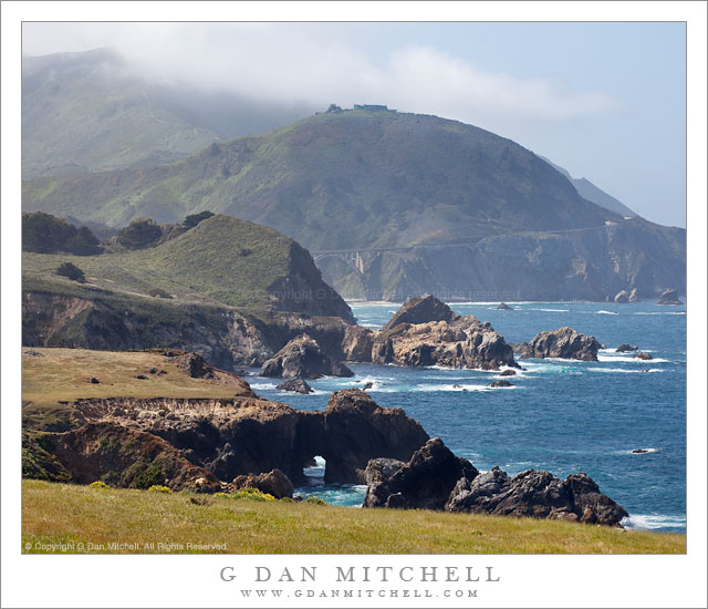
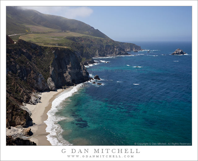
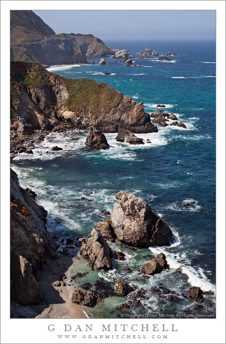
Sea Stacks, Big Sur Coastline

Sea Stacks, Big Sur Coastline

Sea Stacks, Big Sur Coastline. Pacific Coast Highway, California. May 13, 2011. © Copyright G Dan Mitchell – all rights reserved.

Sea stacks line the rugged California Big Sur coastline below the Pacific Coast Highway.

I had some free time on Friday morning, so I decided to head over to the coast below Monterey. I had some discussions with someone earlier this week about photographs featuring coastal fog and hills, and I think that may be what planted the idea in my mind, though it turned out that conditions were not quite ideal for that particular sort of thing. However, it was a beautiful spring morning along the Big Sur coast, with the bright sun somewhat modulated by some atmospheric haze and a bit of fog here and there along ridge tops.

For those who may not have heard, driving this section of the Coast Highway is a bit tricky right now due to washouts and closures. I had to wait for a pilot vehicle to lead scores of us through one large section, and in another spot the road was reduced to a single lane by a large landslide. I understand that further south the road is actually closed completely, necessitating an inland detour.

The unusual traffic situation did create one advantage for me, however. Usually there is enough traffic on this famous route that driving along at very slow speeds annoys other drivers – so I sometimes have to keep going right past places I might otherwise want to stop and investigate. However, yesterday I quickly figured out that with 20-30 minutes between waves of traffic as the road opened and closed, all I had to do was pull over after passing one of the blockages, wait for the other cars to pass, and then drive in a more leisurely way with plenty of opportunities to stop.

So as I drove past this area that I had not really looked at closely in the past – it is between a couple of other spots that I know well – I was able to drive slowly, pull over to look more carefully, backtrack, and generally get to see it more than in the past. I first pulled off near this spot simply to turn around to go back and check a spot I had just passed. As I did so I noticed a painter packing up his gear. I did my “turn around,” looked at the spot I had passed, decided it wasn’t promising after all… and came right back to the spot where I had seen the painter. A short trail led down to the edge of the bluff and provided this view along the coast to the south.

G Dan Mitchell Photography | Flickr | Twitter (follow me) | Facebook (“Like” my page) | LinkedIn | Email
Text, photographs, and other media are © Copyright G Dan Mitchell (or others when indicated) and are not in the public domain and may not be used on websites, blogs, or in other media without advance permission from G Dan Mitchell.
Eroded Sandstone, Point Lobos

Eroded Sandstone, Point Lobos

Eroded Sandstone, Point Lobos. Point Lobos State Reserve, California. July 20, 2010. © Copyright G Dan Mitchell – all rights reserved.

Patterns in eroded shoreline sandstone rocks at the Point Lobos State Reserve, California.

The rugged Point Lobos shoreline in places exposes some very interesting rocks, including sections like this one where layers of different colored sand stone are gradually worn away, revealing underlying layers of different colors and textures and sometimes exposing surprising color contrasts. On days when the light is very soft (or very boring!) I may seek out some of these rocks and photograph them since the softer light lets details appear that might easily be washed out in harsher light.

G Dan Mitchell Photography | Flickr | Twitter | Facebook | Email
Text, photographs, and other media are © Copyright G Dan Mitchell (or others when indicated) and are not in the public domain and may not be used on websites, blogs, or in other media without advance permission from G Dan Mitchell.

Monterey Cypress Trees, Fog, Carmel Peninsula

Monterey Cypress Trees, Fog, Carmel Peninsula

Monterey Cypress Trees, Fog, Carmel Peninsula. Point Lobos State Reserve, California. July 10, 2010. © Copyright G Dan Mitchell – all rights reserved.

Carmel Peninsula is barely visible though fog beyond Monterey Cypress trees along the north shore of Point Lobos State Reserve.

This was a typical summer day in coastal California – completely socked in by a thick, gray blanket of cold, wet fog! The light was somewhat dismal, so it wasn’t a day for typical “scenic” landscape or seascape photography, though the colors of the plants and trees were saturated by the soft light and the distant peninsula faded almost to monochrome though the fog across the bay.

These Monterey cypress trees grow along the tops of the rocky cliffs above this part of the Pacific Ocean, in some of the most exposed and precipitous locations imaginable. In some spots they are left exposed to the full force of the ocean winds and winter storms, and they grow close to the ground, following the contours of the rocky terrain in ways that remind me of trees growing in exposed locations near timberline in the Sierra. In other spots they are a bit more sheltered and they seem to be able to “stretch out” a bit, as these trees do along a section of the rocky cliffs that faces more into the bay than out to sea.

The bay holds the outlet of the Carmel River, and the peninsula visible across the water in the distance is the coastline of the town of Carmel. The foreground trees are within the boundaries of the Point Lobos State Reserve.

G Dan Mitchell Photography | Flickr | Twitter | Facebook | Email
Text, photographs, and other media are © Copyright G Dan Mitchell (or others when indicated) and are not in the public domain and may not be used on websites, blogs, or in other media without advance permission from G Dan Mitchell.

Ellery Lake

Ellery Lake
Ellery Lake

Ellery Lake. Sierra Nevada near Yosemite, California. June 29, 2010. © Copyright G Dan Mitchell – all rights reserved.

Early season morning light on Ellery Lake near Tioga Pass.

I made this photograph on the same early-season morning on which I made the vertical format photograph of the same scene that I recently posted. Ellery Lake is alongside highway 120, the “Tioga Pass Road,” just beyond the eastern boundary of the park and the Sierra crest. To be completely forthcoming, I made this photograph from the side of the road! (The many individuals who know this area well, and who have probably stopped to look at the same scene, already knew that…)

To briefly recap, the road here curves around the upper end of the lake above this small bay. Looking across the bay, the rocky edges of the lake are visible along with the steep talus slopes ascending to the peaks around Mt. Dana beyond. The spot has a natural beauty in terms of the forms of the landscape, but I think it is difficult to photograph as a whole – the light is the tricky thing. The earliest morning light is block by high peaks to the east and the late afternoon light goes quickly from sun to shade as the sun drops below ridges behind the camera position, and this light can be fairly flat since it comes from directly behind. This photograph was made in the morning, but not close to sunrise at all – it was two or three hours later. Even here the scene isn’t without technical challenges, especially from the dynamic range that spans from the shadows behind backlit rocks and trees to the very bright snow fields at upper right.

G Dan Mitchell Photography | Flickr | Twitter | Facebook | Email
Text, photographs, and other media are © Copyright G Dan Mitchell (or others when indicated) and are not in the public domain and may not be used on websites, blogs, or in other media without advance permission from G Dan Mitchell.